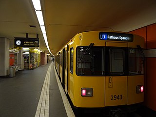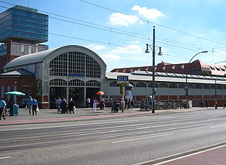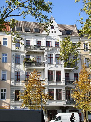
The Berlin U-Bahn is a rapid transit system in Berlin, the capital and largest city of Germany, and a major part of the city's public transport system. Together with the S-Bahn, a network of suburban train lines, and a tram network that operates mostly in the eastern parts of the city, it serves as the main means of transport in the capital.

U1 is a line on the Berlin U-Bahn, which is 8.8 kilometres (5.5 mi) long and has 13 stations. Its traditional line designation was BII. It runs east–west and its eastern terminus is Warschauer Straße S-Bahn station where it connects to the Schlesische Bahn. From there it runs through Kreuzberg via Gleisdreieck and Wittenbergplatz on to the Kurfürstendamm.

U2 is a line of the Berlin U-Bahn. The U2 line starts at Pankow S-Bahn station, runs through the eastern city centre (Alexanderplatz) to Potsdamer Platz, the western city centre and finally to the Ruhleben terminal station.

U5 is a line on the Berlin U-Bahn. It runs from Hauptbahnhof in Mitte eastwards through Alexanderplatz, Friedrichshain, Lichtenberg and Friedrichsfelde, surfaces in Biesdorf-Süd to pass Kaulsdorf and Hellersdorf above ground and finally reaches city limits at Hönow.

U6 is a 19.9 km (12.4 mi) long rapid transit line on the Berlin U-Bahn with 29 stations. It runs in a north-south direction from the Berlin locality of Tegel in the north via Friedrichstraße to Mariendorf, a locality in the southern part of the city. It is one of the five large profile ("Großprofil") lines.

The U7 is a rail line on the Berlin U-Bahn. It runs completely underground for a length of 31.8 kilometres (19.8 mi) through 40 stations and connects Spandau, via Neukölln, to Gropiusstadt and Rudow. The U7 was originally the south-eastern branch of the Nord-Süd-Bahn (U6) that ran between the branching point at Belle-Alliance-Straße (Mehringdamm) and Grenzallee; however, in the 1960s, this stretch was separated from the rest of the line and extended at each end to form a new line.

Schlesisches Tor is a Berlin U-Bahn station on lines U1 and U3. Many Berliners use the affectionate term Schlesi.

Kottbusser Tor is a Berlin U-Bahn station located on lines U1, U3, and U8. Many Berliners use the affectionate term Kotti.

The Oberbaum Bridge is a double-deck bridge crossing Berlin, Germany's River Spree, considered one of the city's landmarks. It links Friedrichshain and Kreuzberg, former boroughs that were divided by the Berlin Wall, and has become an important symbol of Berlin's unity.

Weberwiese is a Berlin U-Bahn station located on the U5 line, which currently runs from Berlin Central Station to Hönow. The station is located under Karl-Marx-Allee directly east of Straße der Pariser Kommune. Although the next station on the line is called Frankfurter Tor, the historical city gate Frankfurter Tor actually stood at the location of the Weberwiese station. Several of the stations on this line have been recently redeveloped and are now colour-coded. In 2003, Weberwiese station was renovated and now has a very different appearance, with yellow tiles in contrast to its former white ones.

The Frankfurter Tor is a large square in the inner-city Friedrichshain locality of Berlin. It is situated in the centre of the district, at the intersection of Karl-Marx-Allee and Frankfurter Allee with the Warschauer Straße and Petersburger Straße ring road. The Frankfurter Tor station, on the city's U-Bahn line U5, is located under the square.

Samariterstraße is a Berlin U-Bahn station located on the U5. It is located underneath Frankfurter Allee, at the intersection with Samariterstraße in the district of Friedrichshain. It was opened as part of the then-Line E of the Berlin U-Bahn on 21 December 1930. As the station remains almost in its original condition, it is now protected as a historic building.

Warschauer Straße is the eastern terminus station of lines U1 and U3 of the Berlin U-Bahn.

Stralauer Tor was a Berlin U-Bahn station in Berlin-Friedrichshain. It operated between Warschauer Straße and Schlesisches Tor stations on today's U1. Following its destruction in World War II it was never rebuilt and is one of three Berlin U-Bahn stations to have been abandoned after having previously been in service.

Warschauer Straße is a major thoroughfare in the Friedrichshain-Kreuzberg district of central Berlin, the capital of Germany. The street begins at Frankfurter Tor to the north and spans 1.6km south to the intersection of the Oberbaumbrücke, Mühlenstraße and Stralauer Allee. The street acts as a section of Bundesstraße 96a and the Berlin Inner Ring Road. The street is named after Warsaw, the capital of Poland.

The U12 is an inactive Berlin U-Bahn line. It existed between 1993 and June 2003, as a peak-time and night line between Ruhleben and Warschauer Straße stations. The route remains available for temporary use when it is not possible to run a full U1 or U2 service for reasons such as maintenance.

The North–South S-Bahn Tunnel is the central section of the North–South transversal Berlin S-Bahn connection crossing the city centre. It is not to be confused with the Tunnel Nord-Süd-Fernbahn, the central tunnel part of the North–South main line used by intercity and regional trains. The S-Bahn North–South line encompasses the route from Bornholmer Straße and Gesundbrunnen via Friedrichstraße and Anhalter Bahnhof to Papestraße and Schöneberg.

The Frankfurter Allee is one of the oldest roads of Berlin, the capital city of Germany. It extends the Karl-Marx-Allee from Frankfurter Tor in the direction of the city of Frankfurt (Oder). It is part of Bundesstraße 1 and has a length of 3.6 kilometres (2.2 mi).

The Berlin Customs Wall was a ring wall around the historic city of Berlin, between 1737 and 1860; the wall itself had no defence function but was used to facilitate the levying of taxes on the import and export of goods (tariffs) which was the primary income of many cities at the time.

The Berlin U-Bahn originated in 1880 with Werner Siemens' idea to build an urban railway in Berlin. During the nine years after the German Empire was founded, the city's population grew by over one-third and traffic problems increased. In 1896, Siemens & Halske began to construct the first stretch of overhead railway. On 1 April 1897, the company began construction of an electric underground railway. The Berliner Verkehrs Aktiengesellschaft (BVG) was formed in 1928, and took over further construction and operation of the network. In 1938, the company was renamed Berlin Transport Company; the original acronym, however, remained. Since 1994, the BVG has been a public company.


