Franklin Township, Lenawee County, Michigan

Last updated

Franklin Township, Michigan
Franklin Township Hall (Lenawee County) Michigan (2020).JPG
Franklin Township Hall along M-50
Franklin Township (Lenawee), MI location.png
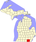
Location within Lenawee County
USA Michigan location map.svg
Red pog.svg
Franklin Township
Location within the state of Michigan
Usa edcp location map.svg
Red pog.svg
Franklin Township
Franklin Township (the United States)
Coordinates: 42°01′53″N84°04′28″W / 42.03139°N 84.07444°W / 42.03139; -84.07444
Country United States
State Michigan
County Lenawee
Government
  SupervisorGordon Whelan
   Clerk Susan Whitehead
Area
  Total
39.3 sq mi (101.8 km2)
  Land38.5 sq mi (99.7 km2)
  Water0.8 sq mi (2.2 km2)
Elevation
[1]
958 ft (292 m)
Population
 (2020)
  Total
3,063
  Density78/sq mi (30/km2)
Time zone UTC-5 (Eastern (EST))
  Summer (DST) UTC-4 (EDT)
ZIP code(s)
49221 (Adrian)
49236 (Clinton)
49265 (Onsted)
49286 (Tecumseh)
49287 (Tipton)
FIPS code 26-30320 [2]
GNIS feature ID1626308 [1]
Website www.franklintownship.net

Franklin Township is a civil township of Lenawee County in the U.S. state of Michigan. The population was 3,063 at the 2020 census. [3]

Contents

Communities

Geography

According to the United States Census Bureau, the township has a total area of 39.3 square miles (101.8 km2), of which 38.5 square miles (99.7 km2) is land and 0.8 square mile (2.1 km2) (2.11%) is water.

Demographics

As of the census [2] of 2000, there were 2,939 people, 1,071 households, and 846 families residing in the township. The population density was 76.4 inhabitants per square mile (29.5/km2). There were 1,275 housing units at an average density of 33.1 per square mile (12.8/km2). The racial makeup of the township was 98.03% White, 0.07% African American, 0.10% Native American, 0.31% Asian, 0.48% from other races, and 1.02% from two or more races. Hispanic or Latino of any race were 1.09% of the population.

There were 1,071 households, out of which 36.4% had children under the age of 18 living with them, 68.3% were married couples living together, 7.1% had a female householder with no husband present, and 21.0% were non-families. 17.1% of all households were made up of individuals, and 5.5% had someone living alone who was 65 years of age or older. The average household size was 2.74 and the average family size was 3.08.

In the township the population was spread out, with 27.2% under the age of 18, 6.2% from 18 to 24, 30.4% from 25 to 44, 26.9% from 45 to 64, and 9.4% who were 65 years of age or older. The median age was 38 years. For every 100 females, there were 102.0 males. For every 100 females age 18 and over, there were 102.5 males.

The median income for a household in the township was $56,296, and the median income for a family was $61,979. Males had a median income of $47,083 versus $25,691 for females. The per capita income for the township was $24,300. About 1.6% of families and 2.7% of the population were below the poverty line, including 1.7% of those under age 18 and 3.0% of those age 65 or over.

Notable person

See also

References

  1. 1 2 U.S. Geological Survey Geographic Names Information System: Franklin Township, Lenawee County, Michigan
  2. 1 2 "U.S. Census website". United States Census Bureau . Retrieved January 31, 2008.
  3. "Explore Census Data". data.census.gov. Retrieved April 27, 2024.
  4. Romig, Michigan Place Names, p. 188
  5. U.S. Geological Survey Geographic Names Information System: Tipton, Michigan
  6. Romig, Walter (1986) [1973]. Michigan Place Names. Detroit, Michigan: Wayne State University Press. ISBN   0-8143-1838-X.
  7. U.S. Geological Survey Geographic Names Information System: Tipton Post Office
  8. 49287 5-Digit ZCTA, 492 3-Digit ZCTA - Reference Map - American FactFinder [ permanent dead link ], U.S. Census Bureau, 2000 census
  9. 49221 5-Digit ZCTA, 492 3-Digit ZCTA - Reference Map - American FactFinder [ permanent dead link ], U.S. Census Bureau, 2000 census
  10. 49236 5-Digit ZCTA, 492 3-Digit ZCTA - Reference Map - American FactFinder [ permanent dead link ], U.S. Census Bureau, 2000 census
  11. 49265 5-Digit ZCTA, 492 3-Digit ZCTA - Reference Map - American FactFinder [ permanent dead link ], U.S. Census Bureau, 2000 census
  12. 49286 5-Digit ZCTA, 492 3-Digit ZCTA - Reference Map - American FactFinder [ permanent dead link ], U.S. Census Bureau, 2000 census
  13. Newsroom, Michigan Public (March 30, 2024). "Walberg on Gaza: "It should be like Nagasaki and Hiroshima. Get it over quick."". Michigan Public. Retrieved September 13, 2025.{{cite web}}: |last= has generic name (help)