
Coorong is a locality in the Australian state of South Australia which is associated with the lagoon known as the Coorong in the south-east of the state and which overlooks the continental coastline from the mouth of the Murray River about 80 kilometres south-east of the state capital of Adelaide to the immediate north of the town of Kingston SE extending for a distance of at least 140 kilometres (87 mi).
Balgowan is a small coastal town on the west coast of South Australia's Yorke Peninsula. It is located approximately 20 kilometres west of Maitland. Like other towns on popular with tourists on Yorke Peninsula, it has a large number of shacks, holiday houses, caravan facilities and a boat ramp. The population generally increases during peak holiday periods.

Island Beach is a locality in the Australian state of South Australia overlooking Eastern Cove in Nepean Bay on the north-west coast of the Dudley Peninsula on Kangaroo Island about 121 kilometres from the state capital of Adelaide and about 21 kilometres from Penneshaw.

Baudin Beach is a locality in the Australian state of South Australia located on Dudley Peninsula on the north coast of Kangaroo Island about 115 kilometres south of the capital city of Adelaide and about 12 kilometres west of Penneshaw. It is named in 2002 after the French navigator Nicolas Baudin in honor of his exploration of Kangaroo Island in 1802.

Torrens Island is a locality in the Australian state of South Australia located in the Adelaide metropolitan area within the estuary of the Port River about 16 kilometres north-west of the Adelaide city centre.
Warburto is a locality in South Australia located on the west coast of Yorke Peninsula, consisting of the rural areas south of the town of Wallaroo around the headland of Warburto Point. It immediately adjoins Spencer Gulf, and is located about 140 kilometres north-west of the Adelaide city centre.
Gosse is a locality in the Australian state of South Australia located on Kangaroo Island about 175 kilometres south-west of the state capital of Adelaide city centre.
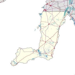
Blanche Harbor is a locality in South Australia located on the east coast of the Eyre Peninsula overlooking Spencer Gulf about 260 kilometres north north-west of the Adelaide city centre and about 20 kilometres south of the centre of Port Augusta.

Sleaford is a locality in the Australian state of South Australia located at the southern tip of the Eyre Peninsula overlooking the Great Australian Bight about 260 kilometres west of the state capital of Adelaide and about 17 kilometres west of the municipal seat of Port Lincoln.

Lincoln National Park is a locality located on the Jussieu Peninsula at the southern tip of the Eyre Peninsula in the Australian state of South Australia about 250 kilometres west of the state capital of Adelaide and about 13 kilometres south of the city of Port Lincoln.
De Mole River is a locality in the Australian state of South Australia located on the north coast of Kangaroo Island overlooking Investigator Strait about 175 kilometres south-west of the state capital of Adelaide.
Nalyappa is a locality in the Australian state of South Australia located on the west coast of Yorke Peninsula immediately adjoining Spencer Gulf about 128 kilometres north-west of the state capital of Adelaide.

Cleland is a suburb in South Australia located in the Adelaide metropolitan area about 10 kilometres south-east of the Adelaide city centre. Its boundaries were created in October 2001, with additional land being added in 2010 from the adjoining suburb of Crafers. Its name is derived from the Cleland Conservation Park. The principal land use within the locality is conservation with the majority of its land area being occupied by the Cleland Conservation Park. Places within its extent include the summit of Mount Lofty. Cleland is located within the federal Division of Mayo, the state electoral district of Bragg and the local government areas of the Adelaide Hills Council and the City of Burnside.
Brown Beach is a locality in the Australian state of South Australia located on the north coast of Dudley Peninsula on Kangaroo Island overlooking Nepean Bay about 119 kilometres south-west of the state capital of Adelaide. Its boundaries were created in March 2002. The name is derived from a nearby beach of the same name. As of 2015, Brown Beach consists of a strip of land located between the coastline with Nepean Bay and the Hog Bay Road. The locality is zoned for conservation purposes with the view of providing limited built development intended principally for tourism uses, which has a minimal impact and where provided, complements the environment of the locality. Brown Beach is located within the federal division of Mayo, the state electoral district of Mawson and the local government area of the Kangaroo Island Council.
Kangaroo Head is a locality in the Australian state of South Australia located on the north coast of Dudley Peninsula on Kangaroo Island overlooking both Backstairs Passage and Nepean Bay about 110 kilometres south of the state capital of Adelaide.
Ward Hill is a locality in the Australian state of South Australia located on the west coast of Yorke Peninsula immediately adjoining Spencer Gulf about 157 kilometres north-west of the Adelaide city centre.

Garden Island is an island in the Australian state of South Australia located about 14 kilometres (8.7 mi) north-west of the capital city of Adelaide in an estuary system within the Adelaide metropolitan area which drains into Gulf St Vincent. It is notable as being a site for a mangrove forest, a landfill, a part of the site for the Multifunction Polis, a ship graveyard and a venue for recreational boating activities. It has enjoyed varying degrees of protected area status since 1973.
Goolwa Beach is a locality in the Australian state of South Australia located about 67 kilometres south of the Adelaide city centre located on land overlooking Encounter Bay on the southern continental coastline.
Farm Beach is a locality in the Australian state of South Australia located on the Eyre Peninsula in the state’s west overlooking the body of water known as Coffin Bay about 297 kilometres (185 mi) west of the state capital of Adelaide and about 40 kilometres (25 mi) south-west of the municipal seat of Cummins.

East Arm is a suburb in the Northern Territory of Australia located in Darwin about 8 kilometres (5.0 mi) east of Darwin City overlooking a part of Darwin Harbour known as the East Arm.

