Gemmell | |
|---|---|
 Gemmell  Gemmell | |
| Coordinates: 47°58′24″N94°07′26″W / 47.97333°N 94.12389°W | |
| Country | United States |
| State | Minnesota |
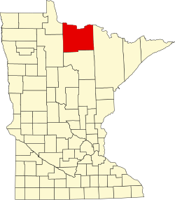
| County | Koochiching |
| Elevation | 1,348 ft (411 m) |
| Time zone | UTC-6 (Central (CST)) |
| • Summer (DST) | UTC-5 (CDT) |
| ZIP code | 56660 |
| Area code | 218 |
| GNIS feature ID | 656363 [1] |
Gemmell is an unincorporated community in Koochiching County, Minnesota, United States; located near Mizpah and Northome.
Contents
The community is located between Northome and Big Falls at the junction of County Roads 12 and 25; and U.S. Highway 71.
Gemmell is located within ZIP code 56660 based in Mizpah.
Clear Lake and Dark Lake are in the vicinity. Gemmell is located within the Pine Island State Forest.