Gemmell | |
---|---|
Coordinates: 47°58′24″N94°07′26″W / 47.97333°N 94.12389°W Coordinates: 47°58′24″N94°07′26″W / 47.97333°N 94.12389°W | |
Country | United States |
State | Minnesota |
County | Koochiching |
Elevation | 1,348 ft (411 m) |
Time zone | UTC-6 (Central (CST)) |
• Summer (DST) | UTC-5 (CDT) |
ZIP code | 56660 |
Area code(s) | 218 |
GNIS feature ID | 656363 [1] |
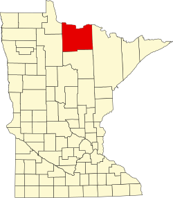
Gemmell is an unincorporated community in Koochiching County, Minnesota, United States; located near Mizpah and Northome.
The community is located between Northome and Big Falls at the junction of County Roads 12 and 25; and U.S. Highway 71.
Gemmell is located within ZIP code 56660 based in Mizpah.
Clear Lake and Dark Lake are in the vicinity. Gemmell is located within the Pine Island State Forest.
Gemmell is located within Northome Unorganized Territory. Nearby places include Mizpah, Northome, Kelliher, and Margie.
Gemmell is located 10 miles northeast of Northome; and 21 miles southwest of Big Falls. Gemmell is 52 miles northeast of Bemidji; and 60 miles southwest of International Falls.
A post office called Gemmell was established in 1905, and remained in operation until 1974. [2] The community was named for W. H. Gemmell, a railroad official. [3]
Koochiching County is a county in the U.S. state of Minnesota. As of the 2010 census, the population was 13,311. Its county seat is International Falls. A portion of the Bois Forte Indian Reservation is in the county. A small part of Voyageurs National Park extends into its boundary, with Lake of the Woods County to its northwest.
Island View is an unincorporated community in Koochiching County, Minnesota, United States.
Pelland is an unincorporated community in Koochiching County, Minnesota, United States, located along the Rainy River.
Loman is an unincorporated community in Koochiching County, Minnesota, United States.
Craigville is an unincorporated community in Koochiching County, Minnesota, United States; located within the Koochiching State Forest.
Ray is an unincorporated community in Koochiching County, Minnesota, United States.
Margie is an unincorporated community in Koochiching County, Minnesota, United States; located near Big Falls.
Bergville is an unincorporated community in Ardenhurst Township, Itasca County, Minnesota, United States; located within the Chippewa National Forest.
Ericsburg is an unincorporated community in Koochiching County, Minnesota, United States.
Lindford is an unincorporated community in Koochiching County, Minnesota, United States.
Rauch is an unincorporated community in Koochiching County, Minnesota, United States.
Grand Falls is an unincorporated community in Koochiching County, Minnesota, United States.
Wildwood is an unincorporated community in Koochiching County, Minnesota, United States; located within the Pine Island State Forest.
Pinetop is an unincorporated community in Koochiching County, Minnesota, United States; located within the Pine Island State Forest. The community is located east of Mizpah; and south of Gemmell; along Koochiching County Road 6.
Forest Grove is an unincorporated community in Koochiching County, Minnesota, United States; located within the Pine Island State Forest. The community is located north of Mizpah and west of Gemmell, along Koochiching County Road 17.
Bramble is an unincorporated community in Koochiching County, Minnesota, United States; located in the southeast corner of the county.
Grattan is an unincorporated community in Grattan Township, Itasca County, Minnesota, United States.
Houpt is an unincorporated community in Nore Township, Itasca County, Minnesota, United States, located in the northwest corner of the county.
Orth is an unincorporated community in Nore Township, Itasca County, Minnesota, United States, located in the northwestern corner of the county.
Pomroy is an unincorporated community in Pomroy Township, Itasca County, Minnesota, United States.
This article about a location in Koochiching County, Minnesota is a stub. You can help Wikipedia by expanding it. |