Related Research Articles

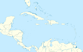
The Bahamas, known officially as the Commonwealth of The Bahamas, is a sovereign country within the Lucayan Archipelago of the West Indies in the Atlantic. It takes up 97% of the Lucayan Archipelago's land area and is home to 88% of the archipelago's population. The archipelagic state consists of more than 700 islands, cays, and islets in the Atlantic Ocean, and is located north of Cuba and northwest of the island of Hispaniola and the Turks and Caicos Islands, southeast of the American state of Florida, and east of the Florida Keys. The capital is Nassau on the island of New Providence. The Royal Bahamas Defence Force describes The Bahamas' territory as encompassing 470,000 km2 (180,000 sq mi) of ocean space.

The Bahamas are a group of about 700 islands and cays in the western Atlantic Ocean, of which only between 30 and 40 are inhabited. The largest of the islands is Andros Island, located north of Cuba and 200 kilometres southeast of Florida. The Bimini islands are to its northwest. To the North is the island of Grand Bahama, home to the second-largest city in the country, Freeport. The island of Great Abaco is to its east. In the far south is the island of Great Inagua, the second-largest island in the country. Other notable islands include Eleuthera, Cat Island, San Salvador Island, Acklins, Crooked Island, and Mayaguana. Nassau is the capital and largest city, located on New Providence. The islands have a tropical savannah climate, moderated by the Gulf Stream. The total size is 13,878 km2 (5,358 sq mi). Due to the many widespread islands it has the 41st largest Exclusive Economic Zone of 654,715 km2 (252,787 sq mi).

Bimini is the westernmost district of the Bahamas and comprises a chain of islands located about 80 kilometres (50 mi) due east of Miami. Bimini is the closest point in the Bahamas to the mainland United States and approximately 210 km (130 mi) west-northwest of Nassau. The population is 1,988 as of the 2010 census.

Andros Island is an archipelago within the Bahamas, the largest of the Bahamian Islands. Politically considered a single island, Andros in total has an area greater than all the other 700 Bahamian islands combined. The land area of Andros consists of hundreds of small islets and cays connected by mangrove estuaries and tidal swamplands, together with three major islands: North Andros, Mangrove Cay, and South Andros. The three main islands are separated by "bights", estuaries that trifurcate the island, connecting the island's east and west coasts. It is 167 kilometres (104 mi) long by 64 km (40 mi) wide at the widest point.

A cay, also spelled caye or key, is a small, low-elevation, sandy island on the surface of a coral reef. Cays occur in tropical environments throughout the Pacific, Atlantic, and Indian Oceans, including in the Caribbean and on the Great Barrier Reef and Belize Barrier Reef.

San Salvador Island is an island and district of the Bahamas. It is widely believed that during Christopher Columbus's first expedition to the New World, this island was the first land he sighted and visited on 12 October 1492. He named it San Salvador after Christ the Saviour. Columbus's records indicate that the native Lucayan inhabitants of the territory, who called their island Guanahani, were "sweet and gentle".

Eleuthera refers both to a single island in the archipelagic state of The Commonwealth of the Bahamas and to its associated group of smaller islands. Eleuthera forms a part of the Great Bahama Bank. The island of Eleuthera incorporates the smaller Harbour Island. "Eleuthera" derives from the feminine form of the Greek adjective ἐλεύθερος (eleútheros), meaning "free". Known in the 17th century as Cigateo, it lies 80 km east of Nassau. It is long and thin—180 km long and in places little more than 1.6 km wide. Its eastern side faces the Atlantic Ocean, and its western side faces the Great Bahama Bank. The topography of the island varies from wide rolling pink sand beaches to large outcrops of ancient coral reefs, and its population is approximately 11,000. The principal economy of the island is tourism.
The Bimini Road, sometimes called the Bimini Wall, is an underwater rock formation near North Bimini island in the Bahamas. The Road consists of a 0.8 km (0.50 mi)-long northeast-southwest linear feature composed of roughly rectangular to subrectangular limestone blocks. Various claims have been made for this feature being either a wall, road, pier, breakwater, or other man-made structure. However, credible evidence or arguments are lacking for such an origin.

The Lucayan Archipelago, also known as the Bahama Archipelago, is an island group comprising the Commonwealth of The Bahamas and the British Overseas Territory of the Turks and Caicos Islands. The archipelago is in the western North Atlantic Ocean, north of Cuba and the other Antilles, and east and southeast of Florida.

A blue hole is a large marine cavern or sinkhole, which is open to the surface and has developed in a bank or island composed of a carbonate bedrock. Their existence was first discovered in the late 20th century by fishermen and recreational divers. Blue holes typically contain tidally influenced water of fresh, marine, or mixed chemistry. They extend below sea level for most of their depth and may provide access to submerged cave passages. Well-known examples are the Dragon Hole and, in the Caribbean, the Great Blue Hole and Dean's Blue Hole.

The Bahama Banks are the submerged carbonate platforms that make up much of the Bahama Archipelago. The term is usually applied in referring to either the Great Bahama Bank around Andros Island, or the Little Bahama Bank of Grand Bahama Island and Great Abaco, which are the largest of the platforms, and the Cay Sal Bank north of Cuba. The islands of these banks are politically part of the Bahamas. Other banks are the three banks of the Turks and Caicos Islands, namely the Caicos Bank of the Caicos Islands, the bank of the Turks Islands, and wholly submerged Mouchoir Bank. Farther southeast are the equally wholly submerged Silver Bank and Navidad Bank north of the Dominican Republic.
Mouchoir Bank, in Spanish also called Banco de Pañuelo Blanco, is a submerged bank disputed by the Turks and Caicos Islands and the Dominican Republic, claimed by both as part of their EEZ.

The West Indies are a subregion of North America, surrounded by the North Atlantic Ocean and the Caribbean Sea that includes 13 independent island countries and 18 dependencies and other territories in three major archipelagos: the Greater Antilles, the Lesser Antilles, and the Lucayan Archipelago.
Stephanie Jutta Schwabe is a geomicrobiologist. She completed a Ph.D. in the biogeochemical investigation of caves within the Bahamian carbonate platforms, commonly referred to as blue holes. She is an expert geologic diver mostly in Bahamian blues holes, though her experience extends to expeditions in U.S. waters. Diver International named her one of the top 40 divers in the world. She earned a degree in law with a focus on international environmental law.
A chevron is a wedge-shaped sediment deposit observed on coastlines and continental interiors around the world. The term chevron was originally used independently by Maxwell and Haynes and Hearty and others for large, V-shaped, sub-linear to parabolic landforms in southwestern Egypt and on islands in the eastern, windward Bahamas.
Rugby union in the Bahamas is a minor, but relatively successful sport. They are currently ranked 86th in the International Rugby Board's world rankings. There are fewer than one thousand registered athletes in the country and only seven official IRB sanctioned teams.

Eolianite or aeolianite is any rock formed by the lithification of sediment deposited by aeolian processes; that is, the wind. In common use, however, the term refers specifically to the most common form of eolianite: coastal limestone consisting of carbonate sediment of shallow marine biogenic origin, formed into coastal dunes by the wind, and subsequently lithified. It is also known as kurkar in the Middle East, miliolite in India and Arabia, and grès dunaire in the eastern Mediterranean.
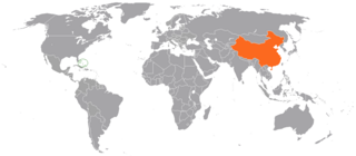
Bilateral relations exist between the People's Republic of China and the Bahamas. Diplomatic relations were established on May 23, 1997. Less than two months later, the Chinese government opened up an embassy in Nassau, on the island of New Providence. The government of The Bahamas has not established an embassy in Beijing, although in 1999 Dr. Arthur Foulkes was appointed the first non-resident ambassador. Prime Minister Hubert Ingraham became the first Bahamian head of government to visit China in 1997.
The Great Bahama Canyon is a V-shaped submarine canyon system in the Bahamas that cuts between the Abaco Islands to the north and Eleuthera island to the south. It separates the Bahama Banks and forms one of the deepest underwater canyon systems known. There are three branches: the Tongue of the Ocean running south between Andros and New Providence, and the northeast and northwest Providence Channel. The canyon walls reach heights of 5 kilometres (3 mi), taller than any canyon walls on land. This canyon system has remained open through a process of submarine erosion.
References
- ↑ Vacher, Leonard H.L; Quinn, Terrence M. (1997-12-19). Geology and hydrogeology of carbonate islands. ISBN 9780080532479.
- ↑ Hearty, Paul J.; Kindler, Pascal (1997). "The Stratigraphy and Surficial Geology of New Providence and Surrounding Islands, Bahamas". Journal of Coastal Research. 13 (3): 798–812. JSTOR 4298673.
| | This Bahamas-related article is a stub. You can help Wikipedia by expanding it. |
| | This article about a regional geological feature is a stub. You can help Wikipedia by expanding it. |