Related Research Articles

The Maracaibo Basin, also known as Lake Maracaibo natural region, Lake Maracaibo depression or Lake Maracaibo Lowlands, is a foreland basin and one of the eight natural regions of Venezuela, found in the northwestern corner of Venezuela in South America. Covering over 36,657 square km, it is a hydrocarbon-rich region that has produced over 30 billion bbl of oil with an estimated 44 billion bbl yet to be recovered. The basin is characterized by a large shallow tidal estuary, Lake Maracaibo, located near its center. The Maracaibo basin has a complex tectonic history that dates back to the Jurassic period with multiple evolution stages. Despite its complexity, these major tectonic stages are well preserved within its stratigraphy. This makes The Maracaibo basin one of the most valuable basins for reconstructing South America's early tectonic history.
The Sierra de Chuacús is situated in the central highlands of Guatemala, and runs southeast from El Quiché to Baja Verapaz. Its northwestern border is marked by the Chixoy River basin in Uspantán, which separates it from the Sierra de los Cuchumatanes. Its eastern border is marked by the Salamá River which separates it from the Sierra de las Minas. Its southeastern border is defined by the Motagua River valley.

The Andean orogeny is an ongoing process of orogeny that began in the Early Jurassic and is responsible for the rise of the Andes mountains. The orogeny is driven by a reactivation of a long-lived subduction system along the western margin of South America. On a continental scale the Cretaceous and Oligocene were periods of re-arrangements in the orogeny. The details of the orogeny vary depending on the segment and the geological period considered.
The Geology of Jamaica is formed of rocks of Cretaceous to Neogene age. The basement consists of Cretaceous island arc and back-arc basin sequences that formed above a subduction zone. The cover is of mainly Eocene to Miocene shallow water limestones, that have been uplifted due to the presence of a restraining bend along the major strike-slip faults that bound the southern edge of the Gonâve Microplate to the north of the island.

The Middle Magdalena Valley, Middle Magdalena Basin or Middle Magdalena Valley Basin is an intermontane basin, located in north-central Colombia between the Central and Eastern Ranges of the Andes. The basin, covering an area of 34,000 square kilometres (13,000 sq mi), is situated in the departments of Santander, Boyacá, Cundinamarca and Tolima.

The Arauco Basin is a sediment-filled depression –a sedimentary basin– in south-central Chile. In the context of plate tectonics it is classified as a forearc basin. The basin has an approximate area of 8,000 square kilometres (3,100 sq mi) and at its deeper parts the surface of its sedimentary fill reaches 200 metres (660 ft) below sea-level. The basin is interpreted as being part of an uplifted part of the continental shelf. To the west it bounds an active accretionary prism that lies next to the Chile trench and to the east it bounds metamorphic basement representing a fossil Paleozoic accretionary complex that has been intruded by the Coastal Batholith of central Chile.

The Bolivar Coastal Fields (BCF), also known as the Bolivar Coastal Complex, is located on the eastern margin of Lake Maracaibo, Venezuela. Bolivar Coastal Field is the largest oil field in South America with its 6,000-7,000 wells and forest of related derricks, stretches thirty-five miles along the north-east coast of Lake Maracaibo. They form the largest oil field outside of the Middle East and contain mostly heavy oil with a gravity less than 22 degrees API. Also known as the Eastern Coast Fields, Bolivar Coastal Oil Field consists of Tía Juana, Lagunillas, Bachaquero, Ceuta, Motatán, Barua and Ambrosio. The Bolivar Coast field lies in the Maracaibo dry forests ecoregion, which has been severely damaged by farming and ranching as well as oil exploitation. The oil field still plays an important role in production from the nation with approximately 2.6 million barrels of oil a day. It is important to note that the oil and gas industry refers to the Bolivar Coastal Complex as a single oilfield, in spite of the fact that the oilfield consists of many sub-fields as stated above.
The Romeral Fault System is a megaregional system of major parallel and anastomosing faults in the Central Ranges of the Colombian Andes and the Cauca, Amagá, and Sinú-San Jacinto Basins. The system spans across ten departments of Colombia, from northeast to south Bolívar, Sucre, Córdoba, Antioquia, Caldas, Risaralda, Quindío, Valle del Cauca, Cauca and Nariño. The fault zone extends into Ecuador where it is known as the Peltetec Fault System. The in detail described part of the Romeral Fault System south of Córdoba has a total length of 697.4 kilometres (433.3 mi) with a cumulative length of 1,787.9 kilometres (1,110.9 mi) and runs along an average north to south strike of 017.6 ± 16, cross-cutting the central-western portion of Colombia.
The Mutatá Fault is a strike-slip fault in the department of Antioquia in northern Colombia. The fault has a total length of 44.7 kilometres (27.8 mi) and runs along an average northwest to southeast strike of 326.4 ± 11 in the Urabá Basin. The fault is active and produced the 2016 Mutatá earthquake with a moment magnitude of 6.0.

The Bogotá Fault is a major inactive slightly dextral oblique thrust fault in the department of Cundinamarca in central Colombia. The fault has a total length of 79.3 kilometres (49.3 mi), while other authors designate a length of 107 kilometres (66 mi), and runs along an average north-northeast to south-southwest strike of 013.5 ± 7 across the Altiplano Cundiboyacense, central part of the Eastern Ranges of the Colombian Andes.

The geology of Kyrgyzstan began to form during the Proterozoic. The country has experienced long-running uplift events, forming the Tian Shan mountains and large, sediment filled basins.

The geology of Slovakia is structurally complex, with a highly varied array of mountain ranges and belts largely formed during the Alpine orogeny in Mesozoic and Cenozoic eras and with relicts of older Variscan structures of Paleozoic age. The internal zones of the West Carpathian orogen collapsed during Paleogene forming the Central Carpathian Paleogne Basin and later in Miocene the Pannonian Basin and Carpathian volcanic chain were formed.
The geology of Trinidad and Tobago includes two different islands with different geological histories.
The geology of El Salvador is underlain by rocks dating to the Paleozoic. Prior to the Pennsylvanian, sediments deposited and were intensely deformed, intruded by granite rocks and metamorphosed. Northern Central America took shape during uplift in the Triassic, large than its current area and extending east to the Nicaragua Rise. The Cayman Ridge and Bartlet Trough formed from longitudinal faults at the crest of the uplift. Deformation in the Cretaceous brought granite intrusions, particularly in what is now Nicaragua. Much of the terrain and coastline of the country is defined by volcanoes and volcanic deposits produced from the subduction of the Cocos Plate.
The geology of Nicaragua includes Paleozoic crystalline basement rocks, Mesozoic intrusive igneous rocks and sedimentary rocks spanning the Cretaceous to the Pleistocene. Volcanoes erupted in the Paleogene and within the last 2.5 million years of the Quaternary, due to the subduction of the Cocos Plate, which drives melting and magma creation. Many of these volcanoes are in the Nicaraguan Depression paralleled by the northwest-trending Middle America Trench which marks the Caribbean-Cocos plate boundary. Almost all the rocks in Nicaragua originated as dominantly felsic continental crust, unlike other areas in the region which include stranded sections of mafic oceanic crust. Structural geologists have grouped all the rock units as the Chortis Block.
The geology of Costa Rica is part of the Panama Microplate, which is slowly moving north relative to the stable Caribbean Plate.
The geology of Guatemala encompasses rocks divided into two tectonic blocks. The Maya Block in the north has igneous and metamorphic North American Craton basement rocks, overlain by late Paleozoic metasedimentary rocks, which experienced deformation during the Devonian. Red beds, evaporites and marine limestone from the Mesozoic overlie these rocks. A karst landscape formed in the thick limestone units across the north of the country. During a collisional orogeny, these Paleozoic and Mesozoic rocks were uplifted, thrust and folded as the Central Guatemalan Cordillera. Paleogene rocks from the early Cenozoic include volcanic and marine clastic rocks, associated with high rates of erosion.
The geology of Cuba differs significantly from that of other Caribbean islands because of ancient 900 million year old Precambrian Proterozoic metamorphic rocks in the Santa Clara province and extensive Jurassic and Cretaceous outcrops.
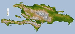
The geology of the Dominican Republic is part of the broader geology of Hispaniola with rocks formed from multiple island arcs, colliding with North America.

The Caribbean Terrane is one of the geological provinces (terranes) of Colombia. The terrane, dating to the Late Cretaceous, is situated on the North Andes Plate and borders the La Guajira, Chibcha and underlying Tahamí Terrane along the regional Bucaramanga-Santa Marta Fault. The terrane overlies the Tahamí, Arquía and Quebradagrande Terranes along the Romeral Fault System.
References
- ↑ "Strike-slip faulting and basin formation at the Guayape Fault--Valle de Catacamas intersection, Honduras, Central America". repositories.lib.utexas.edu. Retrieved 2018-11-10.
- ↑ "Paleomagnetic results from Cretaceous sediments in Honduras: Tectonic implications | Geology". GeoScienceWorld. Retrieved 2018-11-10.
- ↑ Heiken, Grant; Ramos, Napoleon; Duffield, Wendell; Musgrave, John; Wohletz, Kenneth; Priest, Sue; Aldrich, James; Flores, Wilmer; Ritchie, Alexander; Goff, Fraser; Eppler, Dean; Escobar, Carlos (1991). "Geology of the platanares geothermal area, Departamento de Copán, Honduras". Journal of Volcanology and Geothermal Research. 45 (1): 41. Bibcode:1991JVGR...45...41H. doi:10.1016/0377-0273(91)90021-Q.
- ↑ "Geology of the El Rosario Quadrangle, Honduras, Central America". repositories.lib.utexas.edu. Retrieved 2018-11-10.
- ↑ "Geology of the San Pedro Zacapa quadrangle, Honduras, Central America". repositories.lib.utexas.edu. Retrieved 2018-11-10.
- ↑ "Map showing Geology, Oil and Gas Fields, and Geologic Provinces of the Caribbean Region" (PDF). 2004-07-30. Archived from the original (PDF) on 2017-03-09. Retrieved 2018-11-10.