Getzville, New York

Last updated
Getzville, New York
NY 270 through Getzville.jpg
NY 270 through the hamlet of Getzville
Coordinates: 43°01′27″N78°46′04″W / 43.02417°N 78.76778°W / 43.02417; -78.76778 Coordinates: 43°01′27″N78°46′04″W / 43.02417°N 78.76778°W / 43.02417; -78.76778
CountryUnited States
State New York
CountyErie
Town Amherst
Elevation
584 ft (178 m)
Time zone UTC-5 (EST)
  Summer (DST) UTC-4 (EDT)
ZIP code
14068
Area code(s) 716

Getzville is a hamlet in the town of Amherst in Erie County, New York, United States. [1] Getzville's ZIP code is 14068, and its post office is located on Millersport Highway (NY 263).

Contents

Geography

Getzville is located in western New York and is northeast of Buffalo.

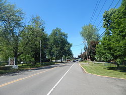
Getzville is located centrally within the town of Amherst, the hamlet center being at the intersection of Campbell Boulevard (NY 270) and Dodge Road (CR 45).

History

Getzville received its name from Joseph Goetz, who was a postmaster and owner of a copper shop and mill. [2] The settlement grew to have a predominantly German population. By the mid 1860s many of the large farms around town were owned by German immigrants, as well as several of the shops in town. In these early days most of the residents were farmers, so the few shops in town catered to agricultural needs. In town, there was a stave factory and a cooperage, important because barrels were needed to store most foodstuffs and beverages such as cider and beer. There was also a creamery, a cider mill, a surgeon, and lumber shop. [3]

The hamlet consisted of one main road running north–south and a center area bounded by a cross street on the north and the railroad on the south. The businesses were clustered in the center of town, with farms surrounding. New Home Road became what is today Campbell Boulevard, and Lintz Street is now Dodge Road. [3]

Getzville station in May 2015 Getzville Station - May 2015.jpg
Getzville station in May 2015

In 1855, the single track of the new Canandaigua and Niagara Falls Railroad opened with a station at Getzville. This railroad became known locally as the "Peanut Line" because of its small size and relative insignificance. It was later operated by the New York Central until it was discontinued in the late 1950s. [2]

Schools

The Getzville area is served by the Williamsville Central School District. Schools in Getzville that students attend include: Heim Elementary School, Heim Middle School and Williamsville North High School.

Fire and police services

Fire protection for the Getzville area is provided by the Getzville Fire Company which operates two stations. Station One, the larger of the two, is located on the corner of Campbell Boulevard (NY 270) and Dodge Road. Station Two is located on the corner of North Forest and Heim Roads. [4]

Since Getzville resides within the town of Amherst, it is served by the Amherst Police Department.

Related Research Articles

Erie County, New York County in New York

Erie County is a highly populated county located along the shore of Lake Erie in western New York State. As of the 2010 census, the population was 919,040. The county seat is Buffalo, which makes up about 28% of the county's population. Both the county and Lake Erie were named for the regional Iroquoian language-speaking Erie tribe of Native Americans, who lived in the area before 1654. They were later pushed out by the more powerful Iroquoian nations tribes.

Amherst, New York Town in New York, United States

Amherst is a town in Erie County, New York, United States. Amherst is the most populated town in New York state outside of the New York City Metropolitan area, and an inner ring suburb of Buffalo. As of 2019, the town had a total population of 126,082. This represents an increase of 3.0% from the 2010 census.

Williamsville, New York Village in New York, United States

Williamsville is a village in Erie County, New York, United States. The population was 5,300 at the 2010 census. The village is named after Jonas Williams, an early settler. It is part of the Buffalo–Niagara Falls Metropolitan Statistical Area.

Jericho, New York Hamlet and census-designated place in New York, United States

Jericho is a hamlet and census-designated place (CDP) in Nassau County, New York, United States, on the North Shore of Long Island, approximately 29 miles (47 km) east of Midtown Manhattan. Its population was 13,567 as of the U.S. 2010 Census.

Pendleton, New York Town in New York, United States

Pendleton is a town on the southern edge of Niagara County, New York, United States. It is east of the city of Niagara Falls and southwest of the city of Lockport. The population was 6,397 at the 2010 census.

Cheektowaga (town), New York Town in New York, United States

Cheektowaga is a town in Erie County, New York, United States. As of the 2010 census, it had a population of 88,226. The town is in the north-central part of the county, and is an inner ring suburb of Buffalo. It is the second-largest Buffalo suburb, after the town of Amherst.

Lancaster, New York Town in New York, United States

Lancaster is a town in Erie County, New York, United States, centered 14 miles east of downtown Buffalo. Lancaster is an outer ring suburb of Buffalo. As of the 2010 census, the town population was 41,604.

Interstate 990 (I-990) is an auxiliary Interstate Highway located entirely within the town of Amherst in Erie County, New York, in the United States. It runs in a roughly north–south direction for 6.43 miles (10.35 km) through the southwestern and central parts of Amherst from an interchange with I-290 north of Buffalo to an intersection with New York State Route 263 south of Lockport. The highway serves as a connection between Buffalo, the University at Buffalo, and Lockport. Like I-590 in nearby Rochester, I-990 does not physically meet I-90, its parent Interstate Highway; instead, the highway makes the connection by way of a "sibling" highway (I-290). I-990 is the highest numbered Interstate Highway in the United States.

East Amherst, New York Hamlet in New York, United States

East Amherst is a suburban hamlet 16 miles (26 km) northeast of downtown Buffalo, Erie County, New York, United States. It straddles the towns of Amherst and Clarence, and comprises the majority of ZIP code 14051.

New York State Route 263 (NY 263) is a state highway located entirely within the town of Amherst in Erie County, New York, in the United States. It extends from just north of the northeast corner of the city of Buffalo in a roughly northeast direction almost straight to just south of the north county line. The road is named Millersport Highway north of Eggert Road in Amherst for the community at its northern terminus. The section between its southern terminus at U.S. Route 62 (US 62) and the Eggert Road intersection is named Grover Cleveland Highway.

New York State Route 78 (NY 78) is a 73.49-mile-long (118.27 km) state highway in western New York in the United States. While it is signed north–south, the southern portion runs in an east–west direction across Wyoming and Erie counties, from its beginning at a junction with NY 19 north of the village of Gainesville to the village of East Aurora. The part of the route north of East Aurora follows a generally north–south alignment to an intersection with NY 18 in the Niagara County town of Newfane, just south of the Lake Ontario shoreline. The route is most closely identified in the region with Transit Road, a major north–south trunk road through the center of Erie and Niagara counties; however, NY 78 does not follow Transit Road for its entire length, nor does Transit Road comprise more than half its length. The highway joins Transit Road north of East Aurora and stays with the road until nearly its end in the city of Lockport.

New York State Route 277 (NY 277) is a state highway in New York in the United States. This highway is also called Union Road, along with other names. NY 277 is a major north–south road east of Buffalo, New York, through the middle of Erie County. The section of NY 277 north of Orchard Park used to be New York State Route 18B until the portion of NY 18 south of Niagara Falls was deleted on January 1, 1962.

New York State Route 270 (NY 270) is a north–south state highway in western New York in the United States. It runs through rural and wooded areas of the town of Amherst in Erie County and the town of Pendleton in Niagara County. The southern terminus of the route is at an intersection with NY 263 south of the hamlet of Getzville. Its northern terminus is at a junction with NY 31 and NY 93 west of the city of Lockport. The entirety of NY 270 is known as Campbell Boulevard, named after New York State Senator William W. Campbell of the Niagara–Orleans district.

Snyder, New York hamlet in New York, United States

Snyder is a hamlet within the town of Amherst in Erie County, New York, United States that is part of the Buffalo – Niagara Falls metropolitan area. The hamlet was established in 1837. It was named for Michael Snyder, its first postmaster, who also operated a store at the corner of Harlem Road, which is also known as New York State Route 240, and Main Street, which is also known as New York State Route 5. The hamlet blossomed due to retail activity demand created along the Main Street transportation route between Buffalo and points to the east in the 19th and early 20th century.

New York State Route 110 (NY 110) is a major north–south state highway along the western border of Suffolk County, New York. It runs between the village of Amityville in the town of Babylon and Halesite in the town of Huntington. NY 110 comes close to the Nassau County line several times in the town of Babylon, which is only surpassed by NY 108 in distance to the county line for a state highway.

Williamsville Central School District is a public school district in New York that serves the village of Williamsville, as well as the towns of Amherst, Cheektowaga, and Clarence. The district enrollment is approximately 10,600 students throughout 13 schools in the district. The district superintendent is Dr. Darren Brown-Hall. It is headquartered near Casey Middle School and North High School at 105 Casey Rd, East Amherst, NY 14051. The district also has an active technology distribution drive which provides all middle schoolers with Chromebooks.

New York State Route 356 (NY 356) was an east–west state highway in Erie County, New York, in United States. The final western terminus of the route was at an intersection with U.S. Route 62 (US 62) on the Tonawanda–Amherst town line. Its eastern terminus was at a junction with NY 270 in the Amherst hamlet of Getzville. When NY 356 was first assigned in the 1930 renumbering of state highways in New York, it began at NY 384 in the city of Tonawanda. It was truncated to US 62 in 1980 and removed entirely on January 7, 1988. The former routing of NY 356 east of the Tonawanda city limits is now maintained by Erie County.

Entranceway at Main Street at Roycroft Boulevard United States historic place

Entranceway at Main Street at Roycroft Boulevard is a suburban residential subdivision entranceway built in 1918. It is on Main Street in the hamlet of Snyder, New York, in the town of Amherst within Erie County. The entranceway is a marker that represents the American suburbanization of rural areas, suburbanization that occurred through transportation-related land development on the edges of urban areas. It consists of a variety of half-height wall formations, featuring a semicircular wall on the Roycroft Boulevard median's intersection with Main Street. The entranceway was added to the National Register of Historic Places on December 7, 2005.

Eggertsville, New York Census-designated place in New York, United States

Eggertsville is a hamlet and census-designated place (CDP) within the town of Amherst in Erie County, New York, United States. The population of the CDP was 15,019 at the 2010 census.

Wendelville, New York is a hamlet in the town of Pendleton in Niagara County, New York, United States.

References

  1. U.S. Geological Survey Geographic Names Information System: Getzville, New York
  2. 1 2 "History of the Town of Amherst, NY". Amherst Museum. 1997. Archived from the original on September 2, 2009. Retrieved August 28, 2009.
  3. 1 2 Young, Sue Miller (1965). A History of the Town of Amherst, New York, 1818-1965. Town Board of Amherst. pp. 81, 88–89.
  4. "Fire Stations". Getzville Fire Company. 2009. Archived from the original on July 5, 2009. Retrieved August 28, 2009.