Related Research Articles

West Sand Lake is a hamlet and census-designated place in Rensselaer County, New York, United States. The population was 2,616 people in 2020. The community is located in the northwestern corner of the town of Sand Lake.
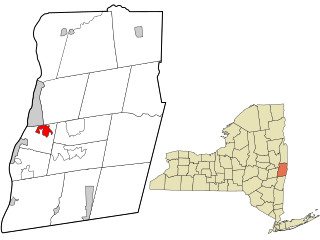
Wynantskill is a census-designated place (CDP) in Rensselaer County, New York, United States. The population was 4,050 at the 2020 census. Wynantskill is located at the northern town line and the northeastern corner of the town of North Greenbush. The community is a suburb of Troy. state route 66 is the main route through the community. Wynantskill has a major grocery store, several banks and restaurants, a craft beverage store, convenience stores, a post office, and a bowling alley, with almost all houses located on side streets off Main Ave. Other major roads are Whiteview Road, a primarily residential road that leads to US 4; and West Sand Lake Road.

New Paris is a borough in Bedford County, Pennsylvania, United States. The population was 192 at the 2020 census.
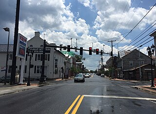
New Market is a town in Shenandoah County, Virginia, United States. Founded as a small crossroads trading town in the Shenandoah Valley, it has a population of 2,155 as of the most recent 2020 U.S. census. The north–south U.S. 11 and the east–west U.S. 211 pass near it and cross Massanutten Mountain at the town's titular gap.

Cross Plains is a village in Dane County, Wisconsin, United States. The population was 4,104 at the 2020 census. The village is located partially within the Town of Cross Plains. It is part of the Madison Metropolitan Statistical Area.

Glencoe is an unincorporated community in Calaveras County, California. It lies at an elevation of 2,749 feet and is located at 38°21′15″N120°35′06″W. The community's ZIP code is 95232. Glencoe has a population of 145 people. Glencoe was named after Glencoe, Scotland, the site of the Massacre of Glencoe in 1692.
Beriain is a town and municipality located in the province and autonomous community of Navarre, northern Spain.

Garínoain is a town and municipality located in the province and autonomous community of Navarre, northern Spain.
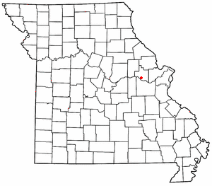
Treloar is an unincorporated community in southern Warren County, Missouri, United States. It is located on the north edge of the Missouri River floodplain and Kochs Creek enters the floodplain just west of the community. Route 94 passes just south of the community and Warrenton is twelve miles to the north.
Claxton is an unincorporated community in McMinn County, Tennessee, United States. Claxton used to have a community school but it closed in the 1970s, however it does have a local volunteer fire department and a Dollar General.

Great Wass Island lies in the Atlantic Ocean off the coast of the State of Maine, United States. On the mainland is Jonesport in Washington County. The island is 5 mi (8 km) long, 1.5 mi (2.5 km) wide and it is the biggest island in the Great Wass Archipelago, which contains over 43 islands extending off the coast from Jonesport. Great Wass Island is connected with a bridge to Beals Island, which is then connected to the mainland. Head Harbor Island and Steels Harbor Island lie close to the east. The 1,450-acre (5.9 km2) Great Wass Island Preserve is in the island. The interior of Great Wass Island supports coastal Maine's largest stand of jack pine, other typical plants are bakeapple, deer-hair sedge, and dragon's mouth orchid. The island is part of the Town of Beals, in Washington County.
Miley Memorial Field, formerly known as Big Piney-Marbleton Airport, is a public airport located three miles (5 km) north of Big Piney and two miles (3 km) north of Marbleton, both towns in Sublette County, Wyoming, United States. It is owned by the Big Piney-Marbleton Airport Board.

The Castlestrange stone is located in the grounds of "Castlestrange House" near Athleague in County Roscommon, Ireland. It is a granite boulder decorated with flowing spirals in the La Tène style, dating from the Iron Age period between 300 BC and 100 AD.
Sabana Larga is a town in the San José de Ocoa province of the Dominican Republic.
The Monterrey Open is a professional women's tennis tournament played on outdoor hard courts. From 2009 to 2013, the tournament was held in the Sierra Madre Tennis Club and since 2014 the tournament is currently held at the Club Sonoma.
Eubanks is a former community in Pushmataha County, Oklahoma, United States. It is 13 miles north of Antlers.
Katrine is an unincorporated community in Buckingham County, in the U.S. state of Virginia.
Bladen Community College is a public community college in Dublin, North Carolina. It is part of the North Carolina Community College System and serves Bladen County.
The Grand Blanc Metal Center, also known as the Fisher Body Tank Plant, was a General Motors automotive body metal fabricating facility in Grand Blanc, Michigan. It was built to produce tanks, which it did in large numbers during World War II and the Cold War.

Comiskey is a ghost town in Morris County, Kansas, United States. It was located approximately 6 miles (9.7 km) east of Council Grove, next to the county line.
References
- ↑ "Footes". Geographic Names Information System . United States Geological Survey, United States Department of the Interior . Retrieved August 18, 2016.
42°35′06″N78°38′40″W / 42.58500°N 78.64444°W

| | This article about a location in Erie County, New York is a stub. You can help Wikipedia by expanding it. |