History
The area was first settled in 1809. [2]
The town of North Collins was founded in 1852 as the "Town of Shirley" from the northern part of the town of Collins. In 1853 the town assumed its current name.
In 1911, the community of North Collins set itself off from the town by incorporating as a village.
The Gamel Hexadecagon Barn was listed on the National Register of Historic Places in 1984. [3]
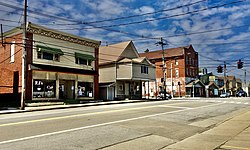
Geography
According to the United States Census Bureau, the town of North Collins has a total area of 43.0 square miles (111.4 km2), of which 42.9 square miles (111.0 km2) is land and 0.15 square miles (0.4 km2), or 0.40%, is water. [4]
NY 75, NY 249, and US 62 pass through the town.
Demographics
Historical population| Census | Pop. | Note | %± |
|---|
| 1860 | 1,948 | | — |
|---|
| 1870 | 1,617 | | −17.0% |
|---|
| 1880 | 1,856 | | 14.8% |
|---|
| 1890 | 2,016 | | 8.6% |
|---|
| 1900 | 2,362 | | 17.2% |
|---|
| 1910 | 2,424 | | 2.6% |
|---|
| 1920 | 2,271 | | −6.3% |
|---|
| 1930 | 2,522 | | 11.1% |
|---|
| 1940 | 2,550 | | 1.1% |
|---|
| 1950 | 2,943 | | 15.4% |
|---|
| 1960 | 3,805 | | 29.3% |
|---|
| 1970 | 4,090 | | 7.5% |
|---|
| 1980 | 3,791 | | −7.3% |
|---|
| 1990 | 3,502 | | −7.6% |
|---|
| 2000 | 3,376 | | −3.6% |
|---|
| 2010 | 3,523 | | 4.4% |
|---|
| 2020 | 3,504 | | −0.5% |
|---|
|
As of the census [6] of 2000, there were 3,376 people, 1,254 households, and 915 families residing in the town. The population density was 78.8 inhabitants per square mile (30.4/km2). There were 1,403 housing units at an average density of 32.7 per square mile (12.6/km2). The racial makeup of the town was 95.26% White, 0.44% Black or African American, 1.51% Native American, 0.71% Asian, 0.44% from other races, and 1.63% from two or more races. Hispanic or Latino of any race were 2.37% of the population.
There were 1,254 households, out of which 32.1% had children under the age of 18 living with them, 59.6% were married couples living together, 8.9% had a female householder with no husband present, and 27.0% were non-families. 22.1% of all households were made up of individuals, and 11.1% had someone living alone who was 65 years of age or older. The average household size was 2.68 and the average family size was 3.16.
In the town, the population was spread out, with 26.2% under the age of 18, 6.6% from 18 to 24, 29.9% from 25 to 44, 23.7% from 45 to 64, and 13.7% who were 65 years of age or older. The median age was 38 years. For every 100 females, there were 98.8 males. For every 100 females age 18 and over, there were 98.6 males.
The median income for a household in the town was $43,781, and the median income for a family was $50,781. Males had a median income of $36,087 versus $26,667 for females. The per capita income for the town was $19,253. About 5.4% of families and 7.7% of the population were below the poverty line, including 12.7% of those under age 18 and 2.4% of those age 65 or over.
This page is based on this
Wikipedia article Text is available under the
CC BY-SA 4.0 license; additional terms may apply.
Images, videos and audio are available under their respective licenses.