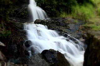
Gillies | |
---|---|
View from the Eastern side of the Gillies Range | |
Geography | |
Country | Australia |
State | Queensland |
Region | Far North Queensland |
Range coordinates | 17°9.1′S145°42.1′E / 17.1517°S 145.7017°E Coordinates: 17°9.1′S145°42.1′E / 17.1517°S 145.7017°E |
The Gillies Range is a mountain range in Queensland, Australia. It is a chain of summits south of Cairns that separate the Far North Queensland coastal plain from the interior Atherton Tableland. At the foot of the range is the town of Gordonvale.
Queensland is the second-largest and third-most populous state in the Commonwealth of Australia. Situated in the north-east of the country, it is bordered by the Northern Territory, South Australia and New South Wales to the west, south-west and south respectively. To the east, Queensland is bordered by the Coral Sea and Pacific Ocean. To its north is the Torres Strait, with Papua New Guinea located less than 200 km across it from the mainland. The state is the world's sixth-largest sub-national entity, with an area of 1,852,642 square kilometres (715,309 sq mi).
Far North Queensland is the northernmost part of the state of Queensland, Australia. Centered on the city of Cairns, the region stretches north to the Torres Strait, and west to the Gulf Country. The region has Australia's only international border, with the independent nation of Papua New Guinea.
The Atherton Tableland is a fertile plateau which is part of the Great Dividing Range in Queensland, Australia. The Atherton Tablelands is a diverse region, covering an area of 64,768 square kilometres and home to 45,243 people. The main population centres on the Atherton Tablelands are Mareeba and Atherton. Smaller towns include Tolga, Malanda, Herberton, Kuranda, Ravenshoe, Millaa Millaa, Chillagoe, Dimbulah, Mt Garnet, Mt Molloy, Tinaroo and Yungaburra.
The Gillies Highway permits road access from the Goldsborough Valley near Gordonvale, to Atherton on the Atherton Tableland via the Gillies Range (famous for its 263 corners, and 800 m elevation change in only 19 km of road). [1] The Gillies Highway and range were named after William N Gillies, [2] a former Premier of Queensland.
The Gillies Highway is a road that runs from Gordonvale in the Cairns Region through the Gillies Range to Atherton in the Tablelands Region, both in Queensland, Australia. It is also known as the Gillies Range Road and was originally known as the Cairns Range Road.
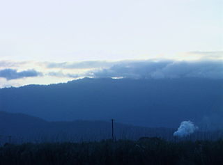
Gordonvale is a small sugar-growing town and locality situated on the southern side of Cairns in the Cairns Region, Queensland, Australia. In the 2016 census, Gordonvale had a population of 6,671 people.
Atherton is a rural town and locality on the Atherton Tablelands within the Tablelands Region, Far North Queensland, Australia. At the 2011 census, Atherton had a population of 7,287.
The Great Dividing Range, or the Eastern Highlands, is Australia's most substantial mountain range and the third longest land-based range in the world. It stretches more than 3,500 kilometres (2,175 mi) from Dauan Island off the northeastern tip of Queensland, running the entire length of the eastern coastline through New South Wales, then into Victoria and turning west, before finally fading into the central plain at the Grampians in western Victoria. The width of the range varies from about 160 km (100 mi) to over 300 km (190 mi). The Greater Blue Mountains Area, Gondwana Rainforests, and Wet Tropics of Queensland World Heritage Areas are located in the range.
Cairns is a city in the Cairns Region, Queensland, Australia. It is on the east coast of Far North Queensland. The city is the 5th-most-populous in Queensland and ranks 14th overall in Australia.
Yungaburra is a town located on the Atherton Tableland in Far North Queensland, Australia, not far from Cairns. In the 2011 census, Yungaburra had a population of 1,116 people.
Curtain Fig Tree is a heritage-listed tree at Curtain Fig Tree Road, Yungaburra, Tablelands Region, Queensland, Australia. It is one of the largest trees in Tropical North Queensland, Australia, and one of the best known attractions on the Atherton Tableland. It was added to the Queensland Heritage Register on 3 December 2009.
The Kuranda Range road is an informally named section of the Kennedy Highway in Queensland, Australia. The road traverses the Macalister Range near Cairns. The 11.5 kilometres (7.1 mi) section of road connects Smithfield, a suburb of Cairns in the Cairns Region with Kuranda, a town in the Shire of Mareeba on the Atherton Tableland, at an altitude of about 360 metres (1,180 ft). Traffic is primarily limited to one lane each way, with overtaking lanes at various points. The Kuranda Skyrail cableway crosses the road twice. Henry Ross Lookout is located near the road's highest point, at an altitude of 430 metres (1,410 ft), and is named after the foreman in charge of building the road to cross the range in 1939.
Irvinebank is a town and locality in the western foothills of the Atherton Tablelands of Far North Queensland, Australia. It is within the local government area of Shire of Mareeba.
The Mulgrave River, incorporating the East Mulgrave River and the West Mulgrave River, is a river system located in Far North Queensland, Australia. The 70-kilometre (43 mi)-long river flows towards the Coral Sea and is located approximately 50 kilometres (31 mi) south of Cairns.
Watsonville is a town and locality in North Queensland, Australia. It is within the local government area of Shire of Mareeba. At the 2011 census the town recorded a population of 344.
Innot Hot Springs is a small town and locality in the Tablelands Region, Queensland, Australia. In the 2011 census, Innot Hot Springs had a population of 321 people.
Bank of New South Wales is a heritage-listed former bank building at 27 Atherton Road, Yungaburra, Tablelands Region, Queensland, Australia. It was built c. 1914. It was added to the Queensland Heritage Register on 21 October 1992.
The Great Inland Way is an Australian road route from Sydney, New South Wales to Cairns in Queensland. It has been designated by the Queensland Government as a State Strategic Touring Route.
Little Mulgrave is a locality in the Cairns Region, Queensland, Australia. In the 2016 census, Little Mulgrave had a population of 249.
Lake Barrine is a rural locality in the Tablelands Region, Queensland, Australia. In the 2016 census, Lake Barrine had a population of 152 people.
Lamb Range is a locality in the Cairns Region, Queensland, Australia. In the 2016 census, Lamb Range had a population of 0.
Goldsborough is a locality in the Cairns Region, Queensland, Australia. In the 2016 census, Goldsborough had a population of 929 people.
Macalister Range is a coastal locality in the Cairns Region, Queensland, Australia. In the 2016 census, Maclister Range had no population.
This Far North Queensland geography article is a stub. You can help Wikipedia by expanding it. |