This article has multiple issues. Please help improve it or discuss these issues on the talk page . (Learn how and when to remove these template messages)
|
Golia | |
---|---|
Rural area | |
Country | India |
State | Odisha |
District | Ganjam |
Elevation | 13 m (43 ft) |
Population | |
• Total | 4,688(as per 2,001 Census) |
Time zone | UTC+05:30 (IST) |
Telephone code | 06818 |
ISO 3166 code | IN-OR |
Vehicle registration | OR-07/OD-07 |
Nearest city | Brahmapur, Buguda |
Literacy | 74.04% |
Official languages | Oriya |
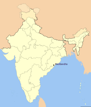
Golia is a village located in the Ganjam District of the Indian state of Odisha. It is governed by a panchayat, which also governs several nearby villages, and is famous for the large number of turtles in Nelia Pond beside the temple of Shiva. Golia is 76 kilometres (47 mi) away from the city of Brahampur and 159 kilometres (99 mi) away from the state capital, Bhubaneswar.
Golia has a tropical wet and dry climate. The summer seasons (March–July) are often close to 35 °C (95 °F), and maximum temperatures often exceed 40 °C (104 °F) between April and June. However, winter lows are around 10 °C (50 °F).
According to the 2001 Census of India, the population of Golia was 4688, consisting of 2312 males and 2376 females. The literacy rate of Golia is 74.45%, which is slightly higher than the National average of 74.04%. As of 2011, the total number of voters in the village was 3121.[ citation needed ] Golia is 70 kilometres (43 mi) away from the Brahampur, and 30 kilometres (19 mi) away from the town of Asika, which is famous for its sugar factory. It is surrounded by Polasara Tehsil to the south, Jagantha Prasad Tehsil to the north, Bellaguntha Tehsil to the west, and Bhanjanager Tehsil to the east. Its neighboring villages are Chirikipada, Kusapali, DahaniPali, Saturusola, Mareyapali, Mala, Lembhu Bagicha, and Badua. The village is very dependent on towns such as Buguda, Polasara, Aska, Chatrapura, Berhampur, Purusotampur, and Jaganath Prasad.
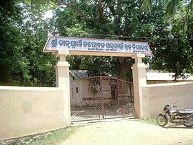
Golia is an education hub for nearby villages, which stretch from Mareyepoli and Kusapali to Kuanala. Multiple students from neighboring villages attend schools in the village to learn and improve their future prospects. Several educational organizations are present in the village:
Golia's Anganwadi Kendra childcare center plays a major role in raising awareness of the value of children's education in the village. Parents are encouraged to allow their children to participate in extra-curricular activities. Thus, some children move to nearby towns like Buguda, Polasara, and Asika for a better education and to study English.
There are no industries currently in this area, and most families are farmers. Golia is known for its fertile soil and agricultural productivity. Most people in the village depend greatly on their land and gardens. Farmers are dependent on rain-fed agriculture and climate sensitive variables. Varieties of crops such as rice, dal, sugar cane, oil seed, mung, and biri are cultivated by farmers. People who want to make more money often leave the village for better opportunities. Industrial cities like Surat (known as "The Diamond City"), which is known for implementing child labour to process rough Conflict Diamonds from Africa,[ citation needed ] and Mumbai (known as "The Dream City") are two common destinations for the people of Golia.
Local and state government workers are also present in the village, including teachers, civil servants (such as police officers and people employed in the army, air force, or navy), doctors, nurses, and pharmacists.[ citation needed ]
Ganjam district is a district in the Indian state of Odisha. Ganjam's total area is 8,206 km² (3,168 mi²). The district headquarters is Chhatrapur. Ganjam is divided into three sub-divisions Chhatrapur, Berhampur, and Bhanjanagar. The Imperial Gazetteer of India 1908 lists Ganjam, along with the Thanjavur and South Canara districts, as the three districts of the Madras Presidency where Brahmins were most numerous. As of 2011 it is the most populous district of Odisha.
Asika or Aska is a town and a Notified Area Council in Ganjam district in the state of Odisha, India. Fondly known as the Sugar city of Odisha. Asika is a major commercial and transportation hub of Ganjam district.
Bhanjanagar is a town and an urban region. It is a Notified Area Council in the Ganjam District in the state of Odisha, India. The town, earlier named as Russellkonda after George Russell, President of then board of Revenue, was renamed later after Kavi Samrat Upendra Bhanja. Bhanjanagar is a planned community situated in the confluence of rivers Loharakhandi and Badanadi.
Buguda is a town in the Ghumusara area of Ganjam district in the state of Odisha, India. Buguda is approximately 70 kilometres from Berhampur, a major city in Odisha.
Surada is a town and a Notified Area Council in Ganjam district in the Indian state of Odisha.
Upper Bagh Devi Temple is an ancient shrine at Kulada, Ganjam District in the state of Odisha in India. The temple is about 8 km from Bhanjanagar, 102 km from Chhatrapur and 140 km from Bhubaneswar. The nearest railway station is at Berhampur, 88 km away.
Berhampur University is a Public teaching-cum-affiliating university in Brahmapur, Odisha, India.
Umerkote, also known as Umarkot and Amarkot, is a town of Nabarangpur district, Odisha, in eastern India. Umerkote is an urban area and the name of a Municipality declared on 3 March 2014 and a Subdivision declared by State Cabinet on 3 November 2015. The town is a prominent business place of the Nabarangpur District.
Bijaya Dhanurjaya Pur Sasan is a Census town near Bellaguntha of Ganjam district in Odisha, India. It is located 108 km towards North from District Headquarters Chhatrapur. 149 km from State capital Bhubaneswar .It is named by King Dhananjay Bhanja.
Kukudakhandi popularly known as KKD is one of the significant villages in the Kukudakhandi Tehsil of Ganjam district in the Indian State of Odisha. The village is 31.2 km from its district main sub-division Chatrapur and is 149 km from its State capital Bhubaneswar. KKD is more often considered as a part of the city Berhampur
Shashi Bhusana Charitam is a Sanskrit book which is about the biography of the social reformer Sashi Bhusan Rath, who was born in Surada and about the Royal family of Surada. It has a short hand representation of various freedom fighters of Odisha and about the scenic beauty of Ganjam district. It consists of nine chapters. It was written by Pandit Sri Bhagabat Prasad Dash Sharma, a well known Sanskrit teacher in Surada area. It was edited with SUBODHINI Sanskrit Commentaries and also with the Odia translation.
Amrutulu is a village and also a gram panchayat in the Surada block of Ganjam district in Odisha, India. Amrutulu Panchayat consists of four villages, Amrutulu, Balighai, Buguda and Pankalabadi.
Chadiapada is a small village in Ganjam district of Odisha, India.
Makarajhola is a village and a Gram panchayat in Ganjam district in the Indian state of Odisha.
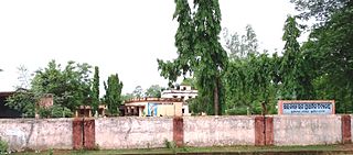
Mujagada is a large village located near Bhanjanagar of Ganjam district in Orissa. It is located 89 kilometres (55 mi) north of district headquarters, Chhatrapur, and 159 kilometres (99 mi) from the state capital Bhubaneswar. Asika, Hinjilicut, Phulabani, and Berhampur are nearby. Oriya is the local language here. The main occupation of this village is agriculture.
Ramesh Chandra Bhanja was a writer, teacher, educationist, linguist, historian, editor and dramatist from Odisha. He has written many short-stories & poetry collections for children of all age groups. For his book Gapa Ganthili, he received the Odisha Sahitya Academy Award.
Kulada is a small village located near Bhanjanagar of Ganjam district in Odisha. It is located 108 km towards North from District Headquarters Chhatrapur. 159 km from State capital Bhubaneswar. Asika, Hinjilicut, Phulabani, Berhampur are the nearby Cities to Kulada. Odia is the native Language here.
Baunsalundi is a small village in Gram Panchayat Baunsalundi located near Bhanjanagar of Ganjam district in Odisha. It is located 91 km towards North from District Headquarters Chhatrapur. 162 km from State capital Bhubaneswar.. Odia is the Language here.
Dihapadhal is a Village located near Bhanjanagar of Ganjam district in Orissa. It is located 104 km towards North from District Headquarters Chhatrapur. 170 km from State capital Bhubaneswar. Bhanjanagar, Lalsingi, Jilundi, Baunsalundi, Inginathi, Sanakodanda are the nearby Villages to Dihapadhal. Odia is the Local Language here.
Serango is a village in Gumma tehsil, Gajapati district, Odisha state, India. It is located 36 kilometres (22 mi) south of its district headquarters at Paralakhemundi, 8.3 kilometres (5.2 mi) from Gumma, and 309 kilometres (192 mi) from the state capital at Bhubaneswar. It is close to Mahendragiri, one of the highest mountain peaks in the state.
Coordinates: 19°45′32″N84°49′41″E / 19.759°N 84.828°E