Clarke County is a county located in the southwestern part of the U.S. state of Alabama. As of the 2020 census, the population was 23,087. The county seat is Grove Hill. The county's largest city is Jackson. The county was created by the legislature of the Mississippi Territory in 1812. It is named in honor of General John Clarke of Georgia, who was later elected governor of that state.

Union County is a county located in the U.S. state of North Carolina. As of the 2020 census, the population was 238,267, making it the 8th-most populous county in North Carolina. Its county seat is Monroe. Union County is included in the Charlotte-Concord-Gastonia, NC-SC Metropolitan Statistical Area.

Monroe County is a county on the northeast border of the U.S. state of Mississippi next to Alabama. As of the 2020 census, the population was 34,180. Its county seat is Aberdeen.

Minter City is an unincorporated community in Leflore County and Tallahatchie County, Mississippi. It is part of the Greenwood, Mississippi micropolitan area, and is within the Mississippi Delta.

The Natchez Trace Parkway is a national parkway in the Southeastern United States that commemorates the historic Natchez Trace and preserves sections of that original trail. Its central feature is a two-lane road that extends 444 miles (715 km) from Natchez, Mississippi, to Nashville, Tennessee. Access to the parkway is limited, with more than 50 access points in Mississippi, Alabama, and Tennessee. The southern end of the route is in Natchez at its intersection with Liberty Road, and the northern end is northeast of Fairview, Tennessee, in the suburban community of Pasquo, at an intersection with Tennessee State Route 100. In addition to Natchez and Nashville, larger cities along the route include Jackson and Tupelo, Mississippi, and Florence, Alabama.
Hamilton is a census-designated place and unincorporated community in Monroe County, Mississippi, United States. As of the 2020 census, it had a population of 404.
Blount Springs is an unincorporated community in Blount County, Alabama United States.
Becker is an unincorporated community in Monroe County, Mississippi.
Gibson is an unincorporated community in Monroe County, Mississippi. Gibson is located west of Aberdeen on Mississippi Highway 8.
Bigbee is an unincorporated community in Monroe County, Mississippi. Bigbee is located northwest of Amory on Mississippi Highway 6 (close to its intersection with Mississippi Highway 371.
Lackey, is an unincorporated community in Monroe County, Mississippi. Lackey is located between Aberdeen and Hamilton on U.S. Route 45.
Splunge,, is an unincorporated community in Monroe County, Mississippi.
Wren,, is an unincorporated community in Monroe County, Mississippi.
Darracott is an unincorporated community in Monroe County, Mississippi. Darracott is located south of Aberdeen.
Muldon, also known as Aberdeen Junction, Loohattan, Loohatten and Louhatten, is an unincorporated community in Monroe County, Mississippi. Muldon is located southwest of Aberdeen on Mississippi Highway 25.
Mormon Springs is an unincorporated community in Monroe County, Mississippi. Mormon Springs is located southwest of Gattman.

Lauderdale is an unincorporated community and census-designated place (CDP) in Lauderdale County, Mississippi, United States. The population of Lauderdale was 395 at the 2020 census. It is located along U.S. Highway 45, 16 miles (26 km) northeast of Meridian.

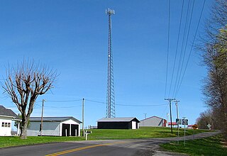
Mud Lick is a rural unincorporated community in Monroe County, Kentucky, United States. It is concentrated around the intersection of Kentucky Route 63 and Kentucky Route 870, northwest of Tompkinsville.

Seminole Hot Springs is an unincorporated community in Los Angeles County, California, United States. Seminole Hot Springs is located in the Santa Monica Mountains near Cornell, 3.6 miles (5.8 km) south-southeast of Agoura Hills at an elevation of 932 feet (284 m).

Toomsuba is a census-designated place (CDP) and unincorporated community in Lauderdale County, Mississippi, United States. Its population was 778 as of the 2020 census. Its ZIP code is 39364.


