Gregory Range

Last updated

Gregory
Australia Queensland relief location map.jpg
Red triangle with thick white border.svg
Location of the Gregory Range in Queensland
Highest point
Peakunnamed peak,in the Blackbraes National Park
Elevation 1,043 m (3,422 ft) [1]
AHD
Dimensions
Length400 km (250 mi)east–west
Naming
Etymology In honour of Sir Augustus Gregory
Geography
CountryAustralia
State Queensland
Region Far North Queensland
Rivers Norman, Carron, Clara and Yappar
Range coordinates 19°00′S143°12′E / 19.000°S 143.200°E / -19.000; 143.200 Coordinates: 19°00′S143°12′E / 19.000°S 143.200°E / -19.000; 143.200
Parent range Great Dividing Range
Geology
Age of rock
Type of rock

The Gregory Range is a mountain range located in Far North Queensland, Australia.

Contents

Location and features

Part of the Great Dividing Range, [2] the Gregory Range lies southeast of Croydon and southwest of Georgetown. [3] [4] [5]

The range is located in an area of ephemeral watercourses and stony sandstone ridges lightly vegetated with Eucalyptus miniata, acacia and spinifex on the ridge tops. Further down the ridges areas of paperbark are found. [6] The range extends approximately 400 kilometres (250 mi) in an east–west direction. [2] The southern portion forms an undulating sandstone and basalt plateau. The sandstone is of the Jurassic age (180-160 million years) while the basalt and granite dates from the Mesoproterozoic age (1.6 - 1.0 billion years). This portion is covered in open forest of Bloodwood, wattle, eucalypts and spear grass. The Stawall River flows south from the range and is a tributary of the Flinders River. [1]

The Norman River and three of its tributaries the Carron, Clara and Yappar Rivers, also have their headwaters in the range. The flow from these rivers is westward into the Gulf of Carpentaria [7] The Gilbert and Robertson Rivers also have there headwaters in the range but flow northward. [6] The highest point is in the southern half of the range with an elevation of 1,043 metres (3,422 ft) and is found within the Blackbraes National Park. [1]

The first European to travel through the area was the explorer Augustus Charles Gregory in 1855 or 1856 [1] as part of his expedition from Port Essington to Brisbane. The range was named by the explorer John McKinlay in 1862 while on an expedition from Adelaide, which he left from in 1861, in search of the lost Burke and Wills expedition. [8]

See also

Related Research Articles

Barron River (Queensland)

The Barron River is located on the Atherton Tablelands inland from Cairns in northern Queensland, Australia. With its headwaters below Mount Hypipamee, the 165-kilometre (103 mi)-long river with a catchment area of approximately 2,138 square kilometres (825 sq mi) forms through run off from the Mount Hypipamee National Park, flows through Lake Tinaroo, and eventually empties into the Coral Sea near Smithfield.

Mackenzie River (Queensland)

The Mackenzie River is a river located in Central Queensland, Australia. The Mackenzie River is a major tributary of the Fitzroy River, part of the largest river catchment flowing to the eastern coast of Australia.

Normanby River

The Normanby River, comprising the East Normanby River, the West Normanby River, the East Normanby River North Branch, the East Normanby River South Branch and the Granite Normanby River, is a river system located in Far North Queensland, Australia.

Jardine River

The Jardine River is the largest river of the Cape York Peninsula in Far North Queensland, Australia.

Archer River

The Archer River is a river located on the Cape York Peninsula, Far North Queensland, Australia.

Belyando River

The Belyando River, including the Belyando River , is a river system located in Central Queensland, Australia. At 1,054 kilometres (655 mi) in length and with a catchment area of 35,000 square kilometres (14,000 sq mi), the Belyando River system is one of the longest rivers in Queensland.

The Suttor River is a river in Central Queensland, Australia. The Belyando River is its main tributary. The river has its origins in the Leichhardt Range, north west of Glenden. It flows into Lake Dalrymple, becoming a tributary of the Burdekin River.

Johnstone River river in Queensland, Australia

The Johnstone River, comprising the North Johnstone River and the South Johnstone River, is a river system located in Far North and North Queensland, Australia.

Comet River

The Comet River is a river located in Central Queensland, Australia.

Mulgrave River

The Mulgrave River, incorporating the East Mulgrave River and the West Mulgrave River, is a river system located in Far North Queensland, Australia. The 70-kilometre (43 mi)-long river flows towards the Coral Sea and is located approximately 50 kilometres (31 mi) south of Cairns.

Cloncurry River

The Cloncurry River is situated in the Gulf Country of north west Queensland, Australia.

Yappar River

The Yappar River is a river located in the Gulf Country region of Far North Queensland, Australia.

Clara River

The Clara River is a river located in the Gulf Country of northwest Queensland, Australia.

Carron River (Queensland)

The Carron River is a river located in Far North Queensland, Australia.

Lynd River River in Australia

The Lynd River is a river located on the Cape York Peninsula in Far North Queensland, Australia.

Holroyd River

The Holroyd River is a river located on the Cape York Peninsula in Far North Queensland, Australia.

Isaac River

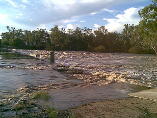
The Isaac River is a river and anabranch located in Central Queensland, Australia.

Langlo River

The Langlo River, a river that is part of the Murray-Darling basin, is located in South West Queensland, Australia.

Tate River

The Tate River is a river located in Far North Queensland, Australia.

Connors River

The Connors River is a river and anabranch located in Central Queensland, Australia.

References

  1. 1 2 3 4 "20°S 144°E Maiden Springs – Queensland by Degrees". Royal Geographical Society of Queensland. 2012. Retrieved 12 October 2014.
  2. 1 2 "Queensland". Centre for the Government of Queensland. 2014. Retrieved 17 October 2014.
  3. "Map of Gregory Range (1), QLD". Bonzle Digital Atlas of Australia. Retrieved 8 December 2015.
  4. "Map of Gregory Range (2), QLD". Bonzle Digital Atlas of Australia. Retrieved 8 December 2015.
  5. "Map of Gregory Range (3), QLD". Bonzle Digital Atlas of Australia. Retrieved 8 December 2015.
  6. 1 2 "19°S 143°E Gregory Range – Queensland by Degrees". Royal Geographical Society of Queensland. 2012. Archived from the original on 17 October 2014. Retrieved 12 October 2014.
  7. "Gulf Country, Queensland". Centre for the Government of Queensland. 2011. Retrieved 17 October 2014.
  8. Jack, Robert Logan (1 June 2013). "Northmost Australia, Volume I". Project Gutenberg of Australia. Retrieved 18 October 2014.