
Wellington City Council is a territorial authority in New Zealand, governing the country's capital city, and de facto second-largest city. It consists of the central historic town and certain additional areas within the Wellington metropolitan area, extending as far north as Linden and covering rural areas such as Mākara and Ohariu. The city adjoins Porirua in the north and Hutt City in the north-east. It is one of nine territorial authorities in the Wellington Region.

Summer Hill is a suburb of Sydney, in the state of New South Wales, Australia. Summer Hill is located 7 kilometres west of the Sydney central business district, in the local government area of the Inner West Council.

Kelburn is a central suburb of Wellington, the capital city of New Zealand, situated within 1 kilometre (0.62 mi) of the central business district.

Tawa is the northernmost suburb within the Wellington city boundary, located roughly 15 km north of Wellington's CBD between Churton Park and Porirua in the North Island of New Zealand. It takes its name from the broadleaf tree, which was once prolific throughout the area, although its most famous tree is the Bucket Tree, a large macrocarpa with the topiary of an upside-down bucket. Tawa is also known for its large number of churches, representing a wide range of Christian denominations.

Johnsonville is a large suburb in northern Wellington, New Zealand. It is seven kilometres north of the city centre, at the top of the Ngauranga Gorge, on the main route to Porirua. The population of "J'ville" was 10,239 at the 2013 census.
Newlands is one of the northern suburbs of Wellington, New Zealand. It lies approximately 8 km north of the city centre and to the east of its nearest neighbour Johnsonville. It has a long history of early settlement and originally was farmed including being the early source of Wellington's milk. Newlands is located in a valley and covers two ridgelines, the side of one of which overlooks Wellington Harbour and up to the Hutt Valley.

The 8.38 miles (13.49 km) Tawa Flat deviation is a double-track section of the Kapiti Line just north of Wellington, New Zealand with two tunnels; the southernmost section of the North Island Main Trunk railway (NIMT) between Wellington and Auckland. It was built to bypass a limited capacity single track section of the original Wellington and Manawatu Railway (WMR) line which ascended from Wellington to Johnsonville and then descended to Tawa Flat. The original name of Tawa Flat was changed to Tawa in 1959.
Churton Park is an affluent suburb 1.5 km north of Johnsonville in Wellington, the capital city of New Zealand. It was established in the 1970s, and as of 2009 had a population of 6,260. In the 2013 census, the population of Churton Park and the adjacent community of Glenside was 6528, with 2349 dwellings. The suburb includes over 2300 households, Churton Park Reserve which includes a recreational sports field, two primary schools and a kindergarten. The Churton Park Community Centre, which is managed and staffed by Wellington City Council, is also located in the Village.
The Auckland Southern Motorway is the major route south out of the Auckland Region of New Zealand. It is part of State Highway 1.

Newlands College is a state coeducational secondary school located in the Wellington, New Zealand suburb of Newlands. Opened in February 1970, the school has a roll of 1107 students as of March 2021.
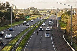
The Johnsonville–Porirua Motorway is a motorway in Wellington, New Zealand. It forms part of State Highway 1, the main route of traffic in and out of the city. Completed in the 1950s, it was New Zealand's first motorway.

Johnsonville railway station is the terminus of the Johnsonville Line, one of eight stations on the commuter branch railway north of Wellington in New Zealand’s North Island. It serves the suburb of Johnsonville, and as a bus interchange attracts traffic from other suburbs to the north and east.

Wadestown is a northern suburb of Wellington, located about 2–3 km by road from the Wellington central business district and the New Zealand Parliament Buildings.
Grenada North is a small suburb in northern Wellington, New Zealand. It is 5 km south of Porirua's city centre, and 13 km north of Wellington's city centre. As of 2006, it has 336 people in 105 occupied dwellings. Its western boundary is formed by State Highway 1 and Takapu Road. The suburb itself was named after Grenada in the Caribbean, and most streets are named after Caribbean islands.
Horokiwi is an outer northern suburb of Wellington. The area is semi-rural and there are no schools; most children attend schools in nearby Lower Hutt, and Primary School zoning is for Korokoro. The only feature other than houses and farms is Horokiwi Quarry.
Paparangi, one of the northern suburbs of Wellington in New Zealand, lies approximately 10 km north of the city centre, north-east of Johnsonville, north-west of Newlands and south of Grenada and Woodridge. The population was 2,841 at the time of the 2013 census, an increase of 96 from the 2006 census population.

Hillpark is a suburb in Auckland, New Zealand. It is bordered by suburbs of The Gardens on the east and Manurewa on the south. It was formerly part of Manukau City until the 2010 amalgamation of all of Auckland's councils, and is now under the governance of Auckland Council.

Woodridge is one of the northern suburbs of Wellington, New Zealand, north of Newlands and Paparangi.
Takapu Valley, one of the northern suburbs of Wellington, New Zealand, is a rural area. The only road, Takapu Road, which runs by the Takapu Stream, goes down past Grenada North to the intersection with the Johnsonville-Porirua Motorway, and to Tawa where most facilities are. There is a supermarket and the Takapu Road Railway Station near the motorway intersection, but neither are in the valley itself.

The Belmont Viaduct was a railway viaduct in Paparangi, New Zealand. The viaduct was originally built by the Wellington and Manawatu Railway Company as part of the Wellington-Manawatu line. When opened in 1885, with its original kauri wood structure, it was the largest of its kind in New Zealand. At the time it was reputed to be the largest wooden viaduct in the world, however this claim was largely disputed.