You can help expand this article with text translated from the corresponding article in Chinese. (September 2022)Click [show] for important translation instructions.
Machine translation, like DeepL or Google Translate, is a useful starting point for translations, but translators must revise errors as necessary and confirm that the translation is accurate, rather than simply copy-pasting machine-translated text into the English Wikipedia.
Do not translate text that appears unreliable or low-quality. If possible, verify the text with references provided in the foreign-language article.
You must provide copyright attribution in the edit summary accompanying your translation by providing an interlanguage link to the source of your translation. A model attribution edit summary is Content in this edit is translated from the existing Chinese Wikipedia article at [[:zh:广德市]]; see its history for attribution.
You may also add the template {{Translated|zh|广德市}} to the talk page.
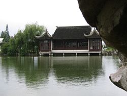
Guangde is a county-level city in the southeast of Anhui Province, People's Republic of China, bordering the provinces of Jiangsu to the north and Zhejiang to the east. It is the easternmost county-level division of Anhui and is under the jurisdiction of the prefecture-level city Xuancheng within Anhui Province. The city has a population of 510,000[when?] and an area of 2,165km2 (836sqmi). The seat of government is at Taozhou Town.
On July 19,1964,China launched and recovered its first successful experimental biological rocket carrying eight white mice from the Chinese Academy of SciencesBase 603 launch site in Shijie Town (誓节镇) within the city.[6]
↑军事史话 <第七部> 导弹部队史话[Military History Part 7 - History of the Rocket Division] (in Chinese). March 1, 2008. Archived from the original on October 7, 2008. Retrieved March 10, 2011.
This page is based on this Wikipedia article Text is available under the CC BY-SA 4.0 license; additional terms may apply. Images, videos and audio are available under their respective licenses.