Guayo, Adjuntas, Puerto Rico

Last updated
Guayo
Barrio
Guayo, Adjuntas, Puerto Rico locator map.png
Location of Guayo barrio within the municipality of Adjuntas shown in red
Caribbean location map.svg
Red pog.svg
Guayo
Location of Puerto Rico
Coordinates: 18°10′43″N66°49′18″W / 18.178565°N 66.82168°W / 18.178565; -66.82168 [1]
Commonwealth Flag of Puerto Rico.svg  Puerto Rico
Municipality Flag of Adjuntas, Puerto Rico.svg Adjuntas
Area
[1]
  Total2.97 sq mi (7.7 km2)
  Land2.87 sq mi (7.4 km2)
  Water0.1 sq mi (0.3 km2)
Elevation
[2]
1,709 ft (521 m)
Population
 (2010)
  Total853
  Density297.2/sq mi (114.7/km2)
 Source: 2010 Census
Time zone UTC−4 (AST)
ZIP Codes
00601, 00631
Area code 787/939
Website adjuntaspr.com

Guayo is a rural barrio in the municipality of Adjuntas, Puerto Rico. [3] [4] [5]

Contents

History

Guayo was in Spain's gazetteers [6] until Puerto Rico was ceded by Spain in the aftermath of the Spanish–American War under the terms of the Treaty of Paris of 1898 and became an unincorporated territory of the United States. In 1899, the United States Department of War conducted a census of Puerto Rico finding that the combined population of Guayo barrio and Vega Abajo barrio was 1,275. [7]

Historical population
CensusPop.Note
1910 639
1920 485−24.1%
1930 5043.9%
1940 87273.0%
1950 1,27245.9%
1960 918−27.8%
1970 9928.1%
1980 979−1.3%
1990 890−9.1%
2000 886−0.4%
2010 853−3.7%
U.S. Decennial Census
1900 (N/A) [8] 1910-1930 [9]
1930-1950 [10] 1960 [11] 1980-2000 [12] 2010 [13]

Special Community

Since 2001 when law 1-2001 was passed, [14] measures have been taken to identify and address the high levels of poverty and the lack of resources and opportunities affecting specific communities in Puerto Rico. Initially there were 686 places that made the list. [15] By 2008, there were 742 places on the list of Comunidades especiales de Puerto Rico. The places on the list are barrios, communities, sectors, or neighborhoods and Guayo was one of the seven areas in Adjuntas which made the list. [15]

See also

Related Research Articles

<span class="mw-page-title-main">Guilarte, Adjuntas, Puerto Rico</span> Barrio in Puerto Rico

Guilarte is a rural barrio in the municipality of Adjuntas, Puerto Rico.

<span class="mw-page-title-main">Vegas Abajo, Adjuntas, Puerto Rico</span> Barrio in Adjuntas, Puerto Rico

Vegas Abajo is a rural barrio in the municipality of Adjuntas, Puerto Rico.

<span class="mw-page-title-main">Yahuecas, Adjuntas, Puerto Rico</span> Barrio in Puerto Rico

Yahuecas is a rural barrio in the municipality of Adjuntas, Puerto Rico. The population of Yahuecas in 2010 was 1396.

<span class="mw-page-title-main">Yayales, Adjuntas, Puerto Rico</span> Barrio in Puerto Rico

Yayales is a rural barrio in the municipality of Adjuntas, Puerto Rico.

<span class="mw-page-title-main">Juan González, Adjuntas, Puerto Rico</span> Barrio in Puerto Rico

Juan González is a rural barrio in the municipality of Adjuntas, Puerto Rico.

<span class="mw-page-title-main">Portillo, Adjuntas, Puerto Rico</span> Barrio in Puerto Rico

Portillo is a rural barrio in the municipality of Adjuntas, Puerto Rico. Its population in 2010 was 606.

<span class="mw-page-title-main">Saltillo, Adjuntas, Puerto Rico</span> Barrio in Puerto Rico

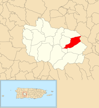
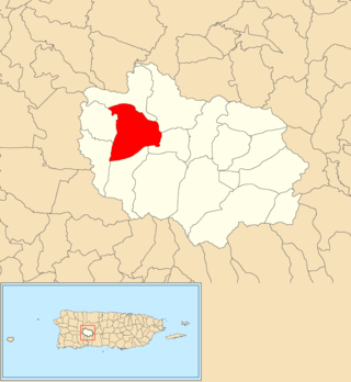
Saltillo is a rural barrio in the municipality of Adjuntas, Puerto Rico.

<span class="mw-page-title-main">Bayamoncito, Aguas Buenas, Puerto Rico</span> Barrio of Puerto Rico

Bayamoncito Barrio is a barrio in the municipality of Aguas Buenas, Puerto Rico. Its population in 2010 was 1,738.

<span class="mw-page-title-main">Cagüitas, Aguas Buenas, Puerto Rico</span> Barrio of Puerto Rico

Cagüitas is a barrio in the municipality of Aguas Buenas, Puerto Rico. Its population in 2010 was 2,664.

<span class="mw-page-title-main">Sumidero, Aguas Buenas, Puerto Rico</span> Barrio of Puerto Rico

Sumidero is a barrio in the municipality of Aguas Buenas, Puerto Rico. Its population in 2010 was 8,008. In Sumidero barrio is part of the Aguas Buenas urban zone and the Santa Clara community.

<span class="mw-page-title-main">Cerro Gordo, Añasco, Puerto Rico</span> Barrio of Puerto Rico

Cerro Gordo is a barrio in the municipality of Añasco, Puerto Rico. Its population in 2010 was 497.

<span class="mw-page-title-main">Palmas, Arroyo, Puerto Rico</span> Barrio of Puerto Rico

Palmas is a barrio in the municipality of Arroyo, Puerto Rico. Its population in 2010 was 3,789.

<span class="mw-page-title-main">Quebrada Grande, Barranquitas, Puerto Rico</span> Barrio of Puerto Rico

Quebrada Grande is a barrio in the municipality of Barranquitas, Puerto Rico. Its population in 2010 was 3,217.

<span class="mw-page-title-main">Tanamá, Adjuntas, Puerto Rico</span> Barrio in Puerto Rico

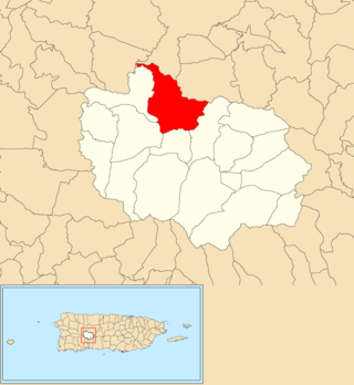
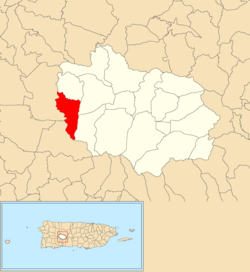
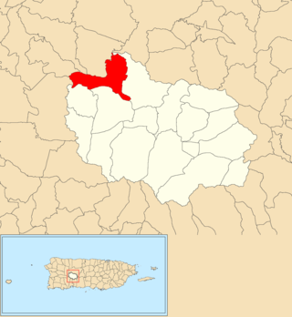
Tanamá is a rural barrio in the municipality of Adjuntas, Puerto Rico. Its population in 2010 was 1,193.

<span class="mw-page-title-main">Cañabón, Barranquitas, Puerto Rico</span> Barrio of Puerto Rico

Cañabón is a barrio in the municipality of Barranquitas, Puerto Rico. Its population in 2010 was 2,654.

<span class="mw-page-title-main">Hatillo, Añasco, Puerto Rico</span> Barrio of Puerto Rico

Hatillo is a barrio in the municipality of Añasco, Puerto Rico. Its population in 2010 was 1,269.

<span class="mw-page-title-main">Sonadora, Aguas Buenas, Puerto Rico</span> Barrio of Puerto Rico

Sonadora is a barrio in the municipality of Aguas Buenas, Puerto Rico. Its population in 2010 was 3,191. In Sonadora barrio is part of the Aguas Buenas urban zone.

<span class="mw-page-title-main">Yaurel, Arroyo, Puerto Rico</span> Barrio of Puerto Rico

Yaurel is a barrio in the municipality of Arroyo, Puerto Rico. Its population in 2010 was 1,589.

<span class="mw-page-title-main">Carrizal, Aguada, Puerto Rico</span> Barrio of Puerto Rico

Carrizal is a barrio in the municipality of Aguada, Puerto Rico. Its population in 2010 was 970.

<span class="mw-page-title-main">Cruces, Aguada, Puerto Rico</span> Barrio of Puerto Rico

Cruces is a barrio in the municipality of Aguada, Puerto Rico. Its population in 2010 was 1,632.

References

  1. 1 2 "US Gazetteer 2019". US Census. US Government.
  2. U.S. Geological Survey Geographic Names Information System: Guayo barrio
  3. Picó, Rafael; Buitrago de Santiago, Zayda; Berrios, Hector H. Nueva geografía de Puerto Rico: física, económica, y social, por Rafael Picó. Con la colaboración de Zayda Buitrago de Santiago y Héctor H. Berrios. San Juan Editorial Universitaria, Universidad de Puerto Rico,1969.
  4. Gwillim Law (20 May 2015). Administrative Subdivisions of Countries: A Comprehensive World Reference, 1900 through 1998. McFarland. p. 300. ISBN   978-1-4766-0447-3 . Retrieved 25 December 2018.
  5. Puerto Rico: 2010 Population and Housing Unit Counts.pdf (PDF). U.S. Dept. of Commerce, Economics and Statistics Administration, U.S. Census Bureau. 2010.
  6. "Anuario del comercio, de la industria, de la magistratura y de la administración. 1881". Biblioteca Nacional de España (in Spanish). p. 1614. Retrieved 4 April 2023.
  7. Joseph Prentiss Sanger; Henry Gannett; Walter Francis Willcox (1900). Informe sobre el censo de Puerto Rico, 1899, United States. War Dept. Porto Rico Census Office (in Spanish). Imprenta del gobierno. p.  165.
  8. "Report of the Census of Porto Rico 1899". War Department Office Director Census of Porto Rico. Archived from the original on July 16, 2017. Retrieved September 21, 2017.
  9. "Table 3-Population of Municipalities: 1930 1920 and 1910" (PDF). United States Census Bureau. Archived (PDF) from the original on August 17, 2017. Retrieved September 21, 2017.
  10. "Table 4-Area and Population of Municipalities Urban and Rural: 1930 to 1950" (PDF). United States Census Bureau. Archived (PDF) from the original on August 30, 2015. Retrieved September 21, 2014.
  11. Census of Population, 1960: Number of Inhabitants, General Population Characteristics, General Social and Economic Characteristics, and Detailed Characteristics. Characteristics of the population. U.S. Bureau of the Census. 1963. pp. 97–101. Retrieved June 10, 2023.
  12. "Table 2 Population and Housing Units: 1960 to 2000" (PDF). United States Census Bureau. Archived (PDF) from the original on July 24, 2017. Retrieved September 21, 2017.
  13. Puerto Rico: 2010 Population and Housing Unit Counts.pdf (PDF). U.S. Dept. of Commerce Economics and Statistics Administration U.S. Census Bureau. 2010. Archived (PDF) from the original on 2017-02-20. Retrieved 2019-08-02.
  14. "Leyes del 2001". Lex Juris Puerto Rico (in Spanish). Retrieved 24 June 2019.
  15. 1 2 "Comunidades Especiales de Puerto Rico" (in Spanish). 8 August 2011. Retrieved 24 June 2019.