It was incorporated by the King of Spain by virtue of a royal decree in 1897.
Etymology
Guimba came from the Ilocano word 'gebba' which refers to the process of heating or fire-hardening molded clay pots in a pit until they become reddish, durable, and ready for use.
Local lore states that when Spanish colonizers arrived, they asked the potters for the name of the place '¿Cómo se llama este lugar?'. Misunderstanding the question as an inquiry into their activity, the natives replied "GEBBA" while pointing at their work. The Spaniards recorded the word as 'GHEBHA', which eventually evolved and was hispanized into Guimba when the town was officially founded as a pueblo in the province of Nueva Ecija.
History
Aerial view of Guimba, circa 1930s
What is now the town of Guimba was once a vast ecological rainforest which was part of the Central Luzon Rainforest during precolonial time, before the arrival of the Spanish. The area is believed to be inhabited by no permanent communities, rather, it is inhabited by hunter-gatherer societies, mainly Ilonggots. The area was once part of the huge territory that the Empire of Tondo, with its capital in a much forested Manila. In the collapse of the Empire of Tondo after the subjugation of Brunei, the area transitioned into a free zone once again, where hunter-gatherers abounded. The area is also believed to once have been visited by migrating Aetas, Cordillerans, Ilokanos, and Ilonggots.
The first Ilocano settlers, arriving in wooden carts and horsebacks, cleared the thick forests and planted the first rice seeds on February 20, 1865, according to an old record found by Guimba's former Parish priest, Rev. Agustin "Gus" Polong, MSC. They called the area 'San Juan de Guimba' in honor of the patron saint the settlers brought from Ilocos, San Juan, and combined it with the pot-making industry called 'gebba' which they used to do in the old land. Since then, rice became the primary agricultural crop in the area. Due to this, it became the province of Nueva Ecija's traditional top rice-producing area in the 20th century.
More settlers arrived mostly from the towns of Bacarra, Paoay, and Candon in the Ilocos. Among the families who came were the Galapons, Mateos, Cudals, Padres, Cayogs, Romanos, Silvestres, Capinpuyans, Batangans, Faigals, Ramoses, Sumawangs, and Catabonas. What would be the town of Guimba was a relatively organized community when the Spanish colonialists arrived and appointed Don Luis De Ocampo as the first Gobernadorcillo, and later, Don Pablo Ramos and Santiago Cudal.
The Spanish left and the Americans came and in 1912, the town's name was abbreviated to Guimba with Don Alfonso Faigal as the first Alcalde Mayor. St. John the Evangelist remained its patron saint. The first municipal hall was also built during this year in what is now known as Faigal Street. The Plaza Municipal evolved and what became the public market opened.
A foot bridge was constructed during the administration of the late Agustin Vigilia, Alcalde Mayor. This foot bridge was constructed across the Binituran River leading to the northern barrios like San Andres, Balbalino, Guiset, Baybayabas, Cinence, Nangabulan to barangay Talugtug from the Parairo Street. Later, the bridge was demolished and transferred to the present site north of Faigal St. This was known as Faigal Bridge going to the north, to the municipality of Talugtug. Other infrastructures were put up with the public market and cleared the space for the Municipal Plaza, now the midtown municipal park.
In 1941, during the Japanese regime, Juan Villamar was appointed Municipal Mayor. During World War II, the Imperial Japanese military forces entered and occupied Guimba in 1942. At daybreak of January 26, to February 15, 1945, advance reconnaissance units of the American troops under the U.S. Army 6th Infantry Division and aided by the local Filipino soldiers of the Philippine Commonwealth Army 2nd, 22nd, 25th and 26th Infantry Division liberated Guimba and, within hours, established outposts nine miles farther to the east along the Licab River and La Paz. Combined U.S. and Philippine Commonwealth military forces liberated the town of Guimba in 1945 and ended World War II.
In 1963, Dr. Virgilio Calica was the Mayor and it was during his term that the old Municipal Hall was constructed, the present site of the present municipal hall constructed in year 2004. This building was demolished during the administration of Jose Bopet Dizon and the new Municipal Hall was constructed and occupied in 2006.
In 2006, Guimba became a first class municipality.
Geography
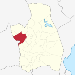
Guimba is located on the western part of the province. It is 152 kilometres (94mi) north-west of Manila, the country's capital, 36 kilometres (22mi) from Cabanatuan, and 50 kilometres (31mi) from Palayan, the provincial capital.
Land
Guimba covers a land area of 25,853.2330 hectares. It have three recognized types of soil in its territory:
Bantug Clay loam
Guingua slit loam
San Fabian Clay loam
Barangays
Guimba is politically subdivided into 64 barangays. Each barangay consist of 7 puroks and some have sitios.
Four are considered urban barangays while 60 are classified as rural barangays.
Guimba is one of the most developed and fastest growing municipalities in the province of Nueva Ecia, together with the towns of Talavera and Cabiao. Guimba has experienced rapid urban growth in the past few years. The town has an employment rate of 74%
Most Guimbanians derive their income from agriculture. As such, the agriculture sector ranks first in terms of generating employment for the populace. At the end of year 2006, Guimba had a total labor force of 38,120.
Guimba economy revolves mainly on agriculture. However, there are also cottages, small and medium scale industries. Local producers are involved in the manufacture of furniture, food processing, panara making, native rice cakes, palay buying, auto parts, clothing, subdivisions, importing, cosmetics, medicine, and construction.
As of 2017, Guimba has a total income of P289,497,138.89; assets of P556,825,821.59; liabilities of P165,318,650.14, and equity of P296,965,545.59[20]
The Ragragsak ti Guimba is the annual festival of Guimba. It is composed of various events that begins at February and ends at March, preparations normally start at January. The highlights include opening Mass, Ms. Guimba, basketball competitions, Ms. Gay, Mr. Teen, band, and street dancing which is the most popular.[23]
The town formerly was known for its potteries, which were introduced by its first settlers from the Ilocos region. However, the tradition vanished sometime before or after the Philippine Revolution.
The town also possessed a rice-pounding tradition during full moons, however, the tradition vanished during the martial law period in the 1980s.
Tangible Cultural Heritage
Façade of Guimba Church
In accordance to Article V Section 4 of the National Heritage Act of 2009 Republic Act 10066, the Philippine Registry of Cultural Property (PRECUP), the repository of all information pertaining to cultural properties in the Philippines deemed significant to Filipino cultural heritage, was established and came to effect last 2009.
Aside from cultural agencies of the government, the law also mandates the Cultural Office of the LGU to establish a "Local Important Cultural Properties List and Documents" as declared by the Sanggunian. These are cultural properties which are significant to local culture and history of Guimba.
Among the ways to register a cultural property in the PRECUP are: (1) Local government units, through their cultural offices, shall likewise maintain an inventory of cultural property under its jurisdiction and shall furnish the commission a copy of the same; and (2) Private collectors and owners shall register their cultural property to the National Museum. Registered cultural properties shall remain in the possession of their private owners.
A building, monuments, or zone aged 50 and above is considered a 'heritage structure.' Archives, books, and works of art with high significance to local culture and history is considered a 'heritage object.' All of which can be registered in the PRECUP.
The Municipality of Guimba, as of 2017, has yet to submit any cultural property to the PRECUP.
The cultural properties of Guimba that may be submitted for registration in the PRECUP includes:
St. John the Baptist Parish Church, known also as Guimba Church - known for its intricate depiction of the mysteries of Christ at its two aisles, its huge altar painting depicting heaven and earth ruled by God, and its ceiling painting which depict rice stalks, the town's main product
Old Municipal Building - established during the American period and has been the former seat of power of the municipality
Ruins of the Philippine National Railway Station in Guimba - which is one of the few connective rail stations in Nueva Ecija
World War 2 Monument - built to honor the American and Filipino fighters in which they liberated the town from the Japanese in 1942
Triala's Mansion - formerly owned by Nueva Ecija's revolutionary leader, General Manuel Tinio
Faigal Bridge and other Spanish and American period bridges within the municipality
Historic Guimba Public Cemetery
Various Spanish and American Era Ancestral Houses - many need urgent conservation as many houses have been demolished already in favor of non-traditional cement buildings
Various barangay landmark sculptures like those in Pasong Inchik's intersection road
Various artifacts and books in Guimba's heritage centers
Our Lady of the Sacred Heart College of Guimba campus - one of the oldest educational institution in the town
Bartolome National High School - possesses the Gabaldon architectural style, a unique architectural style of the Philippines
Environmental Heritage
Prior to Spanish arrival, the entire town of Guimba was completely covered with rainforests. Philippine deer, Luzon warty pig, bleeding heart doves, and Philippine eagles were present as locals or passerby species. In the American period, agriculture was increased and the forest cover began to deplete. By the end of the 21st century, all big aves and wild mammals went extinct, while the forest cover was calculated to be less than 5% of its original extent.
Infrastructure
Roads total length:
National roads - 41.76km (25.95mi)
Provincial roads - 44.70km (27.78mi)
Municipal - 15.60km (9.69mi)
Barangay - 153.72km (95.52mi)
More than half of Guimba's energy is taken from hydro power plants, making it a sustainable town.
Its communications is mainly handled by Digitel, while Globe, Touch Mobile, Dito, and Smart are the predominant cellphone services used.
==Healthcare==
Guimba District Hospital - Brgy. Pacac, Guimba, Nueva Ecija
Guimba General Hospital, Inc. - Bagain St. Santa Veronica District, Guimba, Nueva Ecija
Guimba Community Hospital (Guimba Meternity & Lying-in Clinic) - Saranay District, Guimba Nueva Ecija
Other clinics and Brgy. health centers served the populace around the Municipality of Guimba.
Education
There are two schools district offices which govern all educational institutions within the municipality. They oversee the management and operations of all private and public, from primary to secondary schools.[24] These are the Guimba East School District Office, and Guimba West Schools District Office.
Education in Guimba is taught by various educational institutions in the municipality which offer mostly Information Technology, Hotel and Restaurant Management, and Teacher Education. Other courses are subsidized by Nueva Ecija's only state university, Central Luzon State University, located in the municipality of Munoz and other colleges in Cabanatuan, the province' regional economic center. Guimba has a literacy rate of 97%.
Primary and elementary schools
Bacayao Elementary School
Bagong Barrio Elementary School
Balingog East Elementary School
Balingog West Elementary School
Banitan Elementary School
Bantug Elementary School
Bertese Elementary School
Bonifacio Luz Natividad Educational Foundation Incorporated (BLUN)*
Bunol Integrated School
Caballero Elementary School
Cabaruan Elementary School
Calem Elementary School
Camiing Elementary School
Casongsong Elementary School
Catimon Elementary School
Cavite Elementary School
Cawayang Bugtong Elementary School
Consuelo Elementary School
Culong Elementary School
Don Pedro D. Corpus Elementary School
Escaño Primary School
Essential Academy
Faigal Elementary School
Galvan Elementary School
Guimba East Central School
Guimba United Methodist Church Learning Center
Guimba West Central School
Guiset Elementary School
Lamorito Elementary School
Lennec Elementary School
Macacatuit Elementary School
Macamias Elementary School
Manacsac Elementary School
Manggang Marikit Elementary School
Maturanoc Elementary School
Naglabrahan Elementary School
Nagpandayan Elementary School
Narvacan I Elementary School
Narvacan II Elementary School
Pacac Elementary School
Partida I Elementary School
Pasong Inchik-San Rafael Elementary School
Partida II Elementary School
San Agustin Elementary School
San Andres Elementary School
San Bernardino Integrated School
San Marcelino Elementary School
San Miguel Elementary School
San Roque Elementary School
Sinulatan Elementary School
St. Lawrence Montessori
Sta. Ana Elementary School
Sta. Cruz Elementary School
Sta. Veronica Elementary School
Sto. Cristo Elementary School
Sto. Nino Starbright Montessori School
Subul Elementary School
Triala Elementary School
Yuson Elementary School
Secondary schools
Bartolome Sangguniang National High School
Galvan National High School
Macatcatuit National High School
Manacsac High School
Maybubon Integrated School
Nagpandayan National High School
Pacac High School
San Andres High School
Triala National High School
*BLUN is also a secondary school
Technical and Tertiary school
First Magcor School of Technology
Our Lady of the Sacred Heart College Inc. (OLSHCO)
This page is based on this Wikipedia article Text is available under the CC BY-SA 4.0 license; additional terms may apply. Images, videos and audio are available under their respective licenses.