Related Research Articles

Mornington Crescent is a London Underground station in Camden Town in north west London, named after the nearby street. The station is on the Charing Cross branch of the Northern line, between Euston and Camden Town. It is in Travelcard Zone 2.
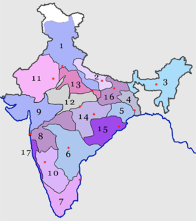
The West Central Railway, one of the 18 zones of the Indian Railways, came into existence on 1 April 2003. It is headquartered at Jabalpur. It was created by taking away two divisions namely Bhopal division and Jabalpur division from central railways and one division namely Kota division from western railway. The WCR zone provides rail route coverage to the west central region of India. Most of its route is in the states of Madhya Pradesh and Rajasthan with a very little porion in the state of Utter Pradesh.
The Southern Railway, headquartered at Chennai, is one of the 18 zones of Indian Railways. It is the earliest of the 18 zones of the Indian Railways created in independent India. It was created on 14 April 1951 by merging three state railways, namely, the Madras and Southern Mahratta Railway, the South Indian Railway Company, and the Mysore State Railway. The South Indian Railway was originally created in the British colonial times as Great Southern India Railway Co founded in Britain in 1853 and registered in 1859. Its original headquarters was in Tiruchirappalli (Trichy) and was registered as a company in London only in 1890. At present, after re-organization of existing railway zones and creation of new zones undertaken by the Indian Railways between 2002–03, Southern Railway has emerged as the 4th largest zone after undertaking some gauge conversion projects and creation of new lines.

Duke of York Island is a mountainous ice-free island, 2.5 miles (4 km) long, lying in the southern part of Robertson Bay, Antarctica, along the northern coast of Victoria Land. It was first charted in 1899 by the British Antarctic Expedition, under Carsten Borchgrevink, who named it for the then Duke of York, later George V. This island lies situated within the borders known as the Pennell Coast, a portion of Antarctica lying between Cape Williams and Cape Adare.

Alexandra Stadium, more commonly known as Gresty Road is a football stadium in Crewe, Cheshire, England. The home ground of Crewe Alexandra, it has an all-seated capacity of 10,153.

Ørestad is a developing city area in Copenhagen, Denmark, on the island of Amager.

Blythe Bridge railway station in Blythe Bridge, Staffordshire, England, is served by trains on the Crewe to Derby Line; it is also a Community rail line known as the North Staffordshire line. The station is owned by Network Rail and managed by East Midlands Railway. The full range of tickets for travel are purchased from the guard on the train at no extra cost.

Kartarpur is a town near the city of Jalandhar and is located in the Doaba region of the state. It was founded by the fifth Guru of Sikhs, Sri Guru Arjan Dev Ji.

Visakhapatnam Junction railway station is a major railway station located in Visakhapatnam, Andhra Pradesh, India. It is administered under the South Coast Railway zone. In 2017, as part of the Swachh Rail campaign, the Quality Council of India rated Visakhapatnam as the cleanest railway station in the country. The station is a major stop on the Howrah–Chennai main line. For its progress in adopting green concepts through reduction of adverse environmental impacts, the Visakhapatnam railway station was awarded a Platinum rating by the Indian Green Building Council (IGBC). The award is based on the efficiency of the station in six environmental categories, including: Sustainable Station Facility; Health, Hygiene and Sanitation; Energy Efficiency; Water Efficiency; Smart Green Initiatives; and Innovation and Development.

Tiruppur railway station is a railway station serving the city of Tiruppur, or the textile city of India.The station is controlled by the Salem railway division and is a major transit point of the Southern Railway zone, one of the 17 Railway Zones of the Indian Railways. It is also known by its official code:TUP.
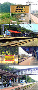
Paravur railway station(Code:PVU) is a railway station in the Indian municipal town of Paravur in Kollam district, Kerala. Paravur railway station falls under the Thiruvananthapuram railway division of the Southern Railway zone of Indian Railways. It is a 'NSG 5' class railway station coming under the Southern Railway zone.

Kerakat railway station (KCT) is a passenger rail station serving the town of Kerakat and nearby villages. It is situated 28 kilometres (17 mi) from Jaunpur Junction. It is very famous and small station of this area. This station has two platforms.

The iSimangaliso Marine Protected Area is a coastal and offshore marine protected area in KwaZulu-Natal from the South Africa-Mozambique border in the north to Cape St Lucia lighthouse in the south.

Parsa Khera railway station is a railway station on the Lucknow–Moradabad line located in village Parsa Khera of Bareilly district in Uttar Pradesh, India. It is under the administrative control of the Moradabad Division of the Northern Railway zone of the Indian Railways.
Aonla railway station is a railway station on the Chandausi loop of the Lucknow–Moradabad line. It is located in the town of Aonla in Bareilly, Uttar Pradesh, India. The station is under the administrative control of the Moradabad Division of the Northern Railway zone of the Indian Railways.
Hamira railway station a railway station on Ambala–Attari line under Firozpur railway division of Northern Railway zone. This is situated at Hamira in Kapurthala district in the Indian state of Punjab.
Kartarpur railway station a railway station on Ambala–Attari line under Firozpur railway division of Northern Railway zone. This is situated at Kartarpur in Jalandhar district in the Indian state of Punjab.
Sura Nussi railway station a railway station on Ambala–Attari line under Firozpur railway division of Northern Railway zone. This is situated beside National Highway 1 at Sura Nussi in Jalandhar district in the Indian state of Punjab.
Chawapall railway station a railway station on Ambala–Attari line under Ambala railway division of Northern Railway zone. This is situated at Payal, Jaspalon in Ludhiana district in the Indian state of Punjab.
Khanna railway station a railway station on Ambala–Attari line under Ambala railway division of Northern Railway zone. This is situated at Shivpuri Mohalla, Khanna in Ludhiana district in the Indian state of Punjab.
References
- ↑ Jain, Rahul Kr. "Hamira Railway Station Map/Atlas NR/Northern Zone - Railway Enquiry". indiarailinfo.com. Retrieved 13 May 2021.
- ↑ TTI. "HMR / Hamira Railway Station | Train Arrival / Departure Timings at Hamira". www.totaltraininfo.com. Retrieved 13 May 2021.