Handsacre

Last updated

Handsacre
A513, Handsacre - geograph.org.uk - 804685.jpg
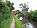
The A513 and the Crown Public house at Handsacre
Staffordshire UK location map.svg
Red pog.svg
Handsacre
Location within Staffordshire
OS grid reference SK0916
District
Shire county
Region
Country England
Sovereign state United Kingdom
Post town RUGELEY
Postcode district WS15
Police Staffordshire
Fire Staffordshire
Ambulance West Midlands
UK Parliament
List of places
UK
England
Staffordshire
52°44′30″N1°52′05″W / 52.74155°N 1.86813°W / 52.74155; -1.86813

Handsacre is a village in the English county of Staffordshire. [1] [2] Population details taken at the 2011 census can be found under Armitage with Handsacre

Contents

Location

The village lies east of the larger village of Armitage. The village is 5.5 miles (8.9 km) north-northwest of the city of Lichfield and is 3.5 miles (5.6 km) south east of Rugeley. The village sits astride of the A513 road which runs from Tamworth to Stafford. [3]

Village services

Handsacre has one shop, which is a convenience store. There is also a Chinese food take-away and a fish and chip shop. There are two pubs within the village. The public houses are called The Old Peculiar [4] and The Crown. [5] The Crown is adjacent to the canal and has a beer garden. The Old Peculiar is on the corner of Hall Road. The Poplar's Pub on Tuppenhurst Lane closed in 2008 and was demolished in June 2010. As of June 2011, twenty houses have been built and are currently occupied.

Schools

The village school is called Hayes Meadow Primary School. [6] The school cater for children from the age of 3 plus, who attend the purpose built nursery unit, to the age of 11. The Headteacher is Sarah Sivieri. [6] The school is also home to its PTA organisation, The Friends of Hayes Meadow (Charity number 1087977). The charity organises events such as Summer Fayres, BBQ's, Craft Fairs and the most successful fundraiser, the Santa Float. Events like these allow the charity to provide students with extra things such as climbing frames, play equipment, selection boxes etc.

Playgrounds

There is a children's play park at the end of Harvey Road on St Barbara's Road in the north easterly part of the village. The playpark was refurbished in 2009.


Transport

The village is currently served 6 days per week by Chaserider bus services 826 and 828. These link the village with Rugeley and Stafford in the west direction, and Lichfield south east.

High Bridge crosses the River Trent on the edge of the village, carrying to the road to Mavesyn Ridware. [7]

Trent and Mersey Canal

The Trent and Mersey Canal skirts around the northern edge of the village. This canal was designed and built by James Brindley who died in 1777, before the canal was completed. The A513 road crosses the canal with the Crown public house next to the bridge designated bridge 56 here. This bridge is a little way west of two further bridges which cross the canal which are Grade II listed structures. these bridges are designated bridges 59 [8] and 60. [9]

Rail

The West Coast Main Line runs through the village although the nearest railway station is at Rugeley which is 3.9 miles (6.3 km) to the north west. The new High Speed 2 rail line is planned to join with the West Coast Main line near Handsacre. [10]

Population

Handsacre has a population [11] of 5,355 people living in the ward of Armitage with Handsacre.

See also

Related Research Articles

<span class="mw-page-title-main">Staffordshire</span> County of England

Staffordshire is a landlocked ceremonial county in the West Midlands of England. It borders Cheshire to the northwest, Derbyshire to the east, Warwickshire to the southeast, the West Midlands county and Worcestershire to the south, as well as Shropshire to the west. The largest settlement is the city of Stoke-on-Trent; the county town is Stafford.

<span class="mw-page-title-main">Rugeley</span> Town in Staffordshire, England

Rugeley is a market town and civil parish in the Cannock Chase District, in Staffordshire, England. It lies on the north-eastern edge of Cannock Chase next to the River Trent; it is situated 8 miles (13 km) north of Lichfield, 10 miles (16 km) south-east of Stafford, 5 miles (8.0 km) north-east of Hednesford and 11 miles (18 km) south-west of Uttoxeter. At the 2021 Census, the population was 24,386.

<span class="mw-page-title-main">Stone, Staffordshire</span> A Town in Staffordshire

Stone is a market town and civil parish in Staffordshire, England, situated approximately 7 miles north of the county town of Stafford, 7 miles south of Stoke-on-Trent, and 15 miles north of Rugeley. As a notable canal town, Stone is recognised for its rich history, originating from the early Bronze Age and continuing through the Industrial Revolution, with the introduction of the Trent and Mersey Canal shaping the town's development and local industry.

<span class="mw-page-title-main">Alrewas</span> Human settlement in England

Alrewas is a village and civil parish in the Lichfield District of Staffordshire, England.

<span class="mw-page-title-main">Armitage</span> Human settlement in England

Armitage is a village in Staffordshire, England on the south side of the Trent and Mersey Canal south just outside of the market town of Rugeley and north of the city of Lichfield, and noteworthy for the Armitage Shanks sanitary porcelain factory. With the adjacent village of Handsacre, it forms the parish of Armitage with Handsacre. The area of Armitage with Handsacre had a population of 5,335 at the 2011 Census.

<span class="mw-page-title-main">Hixon, Staffordshire</span> Human settlement in England

Hixon is a village and a civil parish in the English county of Staffordshire.
grid reference SK003259

<span class="mw-page-title-main">Great Haywood</span>

Milford is a village in the county of Staffordshire, England. It lies at the edge of Cannock Chase, on the A513 road between Stafford and Rugeley. Just to the north of the village is the River Sow.

<span class="mw-page-title-main">Armitage with Handsacre</span> Civil parish in Lichfield, England

Armitage with Handsacre or just Armitage is a civil parish in the Lichfield district of Staffordshire, England. It includes the villages of Armitage and Handsacre, and in 2001 had a population of 5,181, rising to 5,335 at the 2011 Census.

<span class="mw-page-title-main">Fradley</span> Human settlement in England

Fradley is a village and civil parish, in the Lichfield district, in the county of Staffordshire, England. In 1881 the parish had a population of 380.

<span class="mw-page-title-main">Streethay</span> Human settlement in England

Streethay is a village civil parish, in the Lichfield district, in the county of Staffordshire, England, adjoining the city of Lichfield, on the east side of the West Coast Main Line railway. In 2001 the parish had a population of 1111.

Little Haywood is a village in Staffordshire, England. For population details as taken at the 2011 census see under Colwich. It lies beside a main arterial highway, the A51 but traffic through the village is mainly light, owing to this bypass. Nearby also is the West Coast Main Line railway, the Trent and Mersey Canal and beside it, the river Trent. Little Haywood is about 125 miles (201 km) northwest of London, about 25 miles (40 km) north of Birmingham, 4 miles (6.4 km) northwest of Rugeley and 6 miles (9.7 km) east of Stafford.

<span class="mw-page-title-main">Trent Valley line</span> Part of the West Coast Main Line railway in England

The Trent Valley line is a railway line between Rugby and Stafford in England, forming part of the West Coast Main Line. The line is 51 miles (82 km) long and is named after the River Trent which it follows. It was built to provide a direct route from London to North West England and Scotland, avoiding the slower route via Birmingham, which is congested and 7.75 miles (12.47 km) longer.

<span class="mw-page-title-main">Way for the Millennium</span>

The Way for the Millennium is a 41-mile-long (66 km) east–west route across Staffordshire, deliberately designed for easy walking, using towpaths, old railway lines and footpaths and visiting attractive countryside and green spaces.

Colwich is a civil parish and village in Staffordshire, England. It is situated off the A51 road, about 3 miles (5 km) north-west of Rugeley and 7 miles (11 km) south-east of Stafford. It lies principally on the north-east bank of the River Trent, near Wolseley Bridge and just north of The Chase. The parish comprises about 2,862 hectares (28.62 km2) of land in the villages and hamlets of Colwich, Great Haywood, Little Haywood, Moreton, Bishton and Wolseley Bridge.

<span class="mw-page-title-main">Mavesyn Ridware</span> Human settlement in England

Mavesyn Ridware is a village and civil parish in Lichfield District, Staffordshire, England. The parish had a population of 1,048 in 2001, increasing to 1,128 at the 2011 Census. It includes the villages of Hill Ridware, Rake End, Pipe Ridware and Blithbury, all of which lie between the River Trent and a small tributary, the River Blithe. To the east is the parish of Hamstall Ridware and to the south the larger village of Armitage.

Brereton and Ravenhill is a civil parish in the district of Cannock Chase, Staffordshire, England. It contains eleven buildings that are recorded in the National Heritage List for England. Of these, one is listed at Grade II*, the middle grade, and the other is at Grade II, the lowest grade. The parish contains Brereton, a suburb of the town of Rugeley and the countryside to the southwest. The Trent and Mersey Canal passes through the parish, and the listed buildings associated with this are an accommodation bridge and a viaduct. The other listed buildings are houses and associated structures, a church, a barn, a milestone, and a war memorial.

Armitage with Handsacre is a civil parish in the district of Lichfield, Staffordshire, England. It contains 19 buildings that are recorded in the National Heritage List for England. Of these, one is listed at Grade II*, the middle of the three grades, and the others are at Grade II, the lowest grade. The parish contains the villages of Armitage and Handsacre and the surrounding countryside. Most of the listed buildings are houses and farmhouses, the earlier of which are timber framed. The Trent and Mersey Canal passes through the parish, and two accommodation bridges crossing it are listed. Hawkesyard Priory is in the parish, and its priory church is listed, together with nearby Spode House and associated structures, which have connections with the priory. The other listed buildings are another church, a chapel, a churchyard cross, and a war memorial.

References

  1. OS Explorer Map 244: Cannock Chase & Chasewater: (1:25 000) : ISBN   0 319 46269 2
  2. Map Details retrieved 11 April 2013
  3. - Staffordshire A-Z County Atlas: 2011 Edition: Scale:3.8 inches to 1 mile (5.9cm to 1km) ISBN   978 1 84348 748 7
  4. The Old Peculiar website Archived 2013-07-25 at the Wayback Machine retrieved 11 April 2013
  5. Crown Inn website Archived 2012-11-04 at the Wayback Machine retrieved 11 April 2013
  6. 1 2 School website retrieved 11 April 2013
  7. Historic England. "Chetwynd Bridge (1038893)". National Heritage List for England . Retrieved 18 November 2023.
  8. Listed Structure status-Bridge 59 retrieved 11 April 2013
  9. Listed Structure status-Bridge 60 retrieved 11 April 2013
  10. "HIGH SPEED TWO PHASE ONE INFORMATION PAPER A1: DEVELOPMENT OF THE HS2 PROPOSED SCHEME" (PDF). HS2 Ltd. p. 19. Retrieved 15 November 2017.
  11. Key Population statistics retrieved 11 April 2013