
Bloomingdale is an unincorporated census-designated place in Hillsborough County, Florida, United States. The population was 22,711 at the 2010 census. The ZIP Codes serving the community are 33511 and 33596.

Brandon is an unincorporated community and census-designated place (CDP) in Hillsborough County, Florida, United States. It is part of the Tampa–St. Petersburg–Clearwater Metropolitan Statistical Area. The population was 114,626 at the 2020 census, up from 103,483 at the 2010 census.

Northdale is an unincorporated census-designated place in Hillsborough County, Florida, United States. Northdale was named by the combination of the words in North Dale Mabry, the main highway through the Northdale area. The population was 22,079 at the 2010 census.
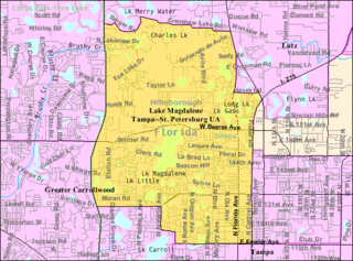
Lake Magdalene is a census-designated place (CDP) in Hillsborough County, Florida, United States. The population was 28,509 at the 2010 census.

Town 'n' Country is a census-designated place (CDP) in Hillsborough County, Florida, United States. The population was 85,951 at the 2020 census.

Carrollwood is a census-designated place (CDP) in northwestern Hillsborough County, Florida, United States. The population was 33,365 at the 2010 census. The census area includes the unincorporated communities of Carrollwood and Carrollwood Village. For the 2000 census the area was enumerated under the name "Greater Carrollwood" and had a population of 33,519. A similar area was listed as "Lake Carroll" in 1970 and 1980; for the 1990 census it was split into the smaller Carrollwood and Carrollwood Village CDPs.

University Square is a neighborhood within the city limits of Tampa, Florida. As of the 2000 census the neighborhood had a population of 7,456. The ZIP Code serving the neighborhood is 33612. The neighborhood is close to many attractions and the University of South Florida.
North Tampa is a neighborhood within the city limits of Tampa, Florida. As of the 2010 census the neighborhood had a population of 5,585. The ZIP Codes neighborhood are 33604 and 33612.
Lowry Park North is a neighborhood within the city limits of Tampa, Florida. As of the 2010 census the neighborhood had a population of 5,936. The ZIP Codes serving the neighborhood are 33604 and 33612. The elevation is 23 feet above sea level.
Old Seminole Heights is a neighborhood within the city limits of Tampa, in the U.S. state of Florida. The neighborhood is one of three which comprise the greater Seminole Heights district within the city. As of the 2010 census the neighborhood had a population of 14,729. The ZIP Codes serving the area are 33603, 33604, and 33610.
Rattlesnake is a neighborhood located in the South Tampa district of Tampa, Florida. The estimated population stands at 488.
Historic Hyde Park North is a neighborhood within the Hyde Park district of the city of Tampa, Florida. As of the 2010 census the neighborhood had a population of 2,689. The latest estimated population given was 2,447. The ZIP Code serving the neighborhood is 33606.
Eastern Heights is a neighborhood within the district of East Tampa, which represents District 5 of the Tampa City Council. The 2000 census numbers are included with East Tampa. The latest estimated population was 192 and the population density was 2,730 people per square mile.
Dixie Farms is a neighborhood near the district of Uceta Yard, which represents District 5 of the Tampa City Council. The 2000 census numbers were unavailable, however, the latest estimated population was 34 and the population density was 249 people per square mile.
Tampa Overlook is a neighborhood in the North Tampa section of Tampa, which represents District 7 of the Tampa City Council. The 2000 census numbers were unavailable; however, the latest estimated population was 1,877 and the population density was 4,904 people per square mile.
Maryland Manor is a neighborhood in the southern area of Tampa, Florida, which represents District 4 of the Tampa City Council. The 2000 census numbers were unavailable, however, the latest estimated population was 1,616.
Fern Cliff is a neighborhood in the Sulphur Springs section of Tampa, Florida, which represents District 5 of the Tampa City Council. The 2000 census numbers were unavailable, however, the latest estimated population was 1,083.

Macfarlane Park is a neighborhood in the West Tampa district of Tampa, Florida, which represents District 6 of the Tampa City Council. The 2000 census numbers were unavailable, however, the latest estimated population was 1,754.
Rivercrest is a neighborhood in the northern area of Tampa, Florida, which represents District 6 of the Tampa City Council. The 2000 census numbers were unavailable, however, the latest estimated population was 616.
Hyde Park Spanishtown Creek, formally West Hyde Park, is a neighborhood within the district of Hyde Park, which represents District 4 of the Tampa City Council. The 2000 census numbers were unavailable, however, the latest estimated population was 1,534 and the population density was 6,356 people per square mile.
