Rivercrest

Last updated
Rivercrest
Neighborhood
USA Florida location map.svg
Red pog.svg
Rivercrest
Location within the state of Florida
Coordinates: 27°59′36″N82°27′44″W / 27.99333°N 82.46222°W / 27.99333; -82.46222 Coordinates: 27°59′36″N82°27′44″W / 27.99333°N 82.46222°W / 27.99333; -82.46222
Country United States
State Florida
County Hillsborough
City Tampa
Elevation 36 ft (11 m)
Time zone Eastern (EST) (UTC-5)
  Summer (DST) EDT (UTC-4)
ZIP codes 33603

Rivercrest is a neighborhood in the northern area of Tampa, Florida, [1] which represents District 6 of the Tampa City Council. [2] The 2000 census numbers were unavailable, however, the latest estimated population was 616.

Tampa, Florida City in Central Florida

Tampa is a major city in, and the county seat of, Hillsborough County, Florida, United States. It is on the west coast of Florida on Tampa Bay, near the Gulf of Mexico, and is the largest city in the Tampa Bay Area. The bay's port is the largest in the state, near downtown's Channel District. Bayshore Boulevard runs along the bay, and is east of the historic Hyde Park neighborhood.

Tampa City Council

The Tampa City Council is the legislative body of the municipal government of the U.S. city of Tampa, in Hillsborough County, Florida. The City Council consists of seven members, each representing one of seven corresponding districts from which they were elected. City Council, as the city's legislative branch, is responsible for enacting ordinances and resolutions administered by the corresponding executive branch, the Mayor of Tampa.

Contents

Geography

Rivercrest is located at 27.99334 and -82.462257. [3] The elevation is 20 feet above sea level. [4]

Elevation Height of a geographic location above a fixed reference point

The elevation of a geographic location is its height above or below a fixed reference point, most commonly a reference geoid, a mathematical model of the Earth's sea level as an equipotential gravitational surface . The term elevation is mainly used when referring to points on the Earth's surface, while altitude or geopotential height is used for points above the surface, such as an aircraft in flight or a spacecraft in orbit, and depth is used for points below the surface.

Sea level Average level for the surface of the ocean at any given geographical position on the planetary surface

Mean sea level (MSL) is an average level of the surface of one or more of Earth's oceans from which heights such as elevation may be measured. MSL is a type of vertical datum – a standardised geodetic datum – that is used, for example, as a chart datum in cartography and marine navigation, or, in aviation, as the standard sea level at which atmospheric pressure is measured to calibrate altitude and, consequently, aircraft flight levels. A common and relatively straightforward mean sea-level standard is the midpoint between a mean low and mean high tide at a particular location.

Rivercrest boundaries are roughly the Hillsborough River to the west, Hillsborough Avenue to the north, Violet Street to the south and Florida Avenue to the east. [5] The ZIP Code serving the neighborhood is 33603. The land area of the neighborhood is 0.120 square miles (310,000 m2) and the population density was 2,498 persons per square mile.

Hillsborough River (Florida) river in the United States of America

The Hillsborough River is a river located in the state of Florida in the United States. It arises in the Green Swamp near the juncture of Hillsborough, Pasco and Polk counties, and flows 60 miles (97 km) through Pasco and Hillsborough Counties to an outlet in the city of Tampa on Tampa Bay. It includes 4 nature trails extending for over seven miles, making it perfect for hikers. The name Hillsborough River first appeared on a British map in 1769. At the time, the Earl of Hillsborough was the British Secretary of State for the Colonies, and thus controlled the pensions of the surveyors working in the American colonies, which included East Florida.

Hillsborough Avenue

Hillsborough Avenue is a major east–west arterial road in Hillsborough County, Florida, also designated as State Road 580, U.S. Highway 41 or U.S. Highway 92 in various places.

A ZIP Code is a postal code used by the United States Postal Service (USPS) in a system it introduced in 1963. The term ZIP is an acronym for Zone Improvement Plan; it was chosen to suggest that the mail travels more efficiently and quickly when senders use the code in the postal address. The basic format consists of five digits. An extended ZIP+4 code was introduced in 1983 which includes the five digits of the ZIP Code, followed by a hyphen and four additional digits that reference a more specific location.

Demographics

The latest estimated population was 616, which consists of 297 males and 319 females. The median age is 31.9 for males and 34.7 for females. The percentage of marriage couple stands at 31%.

The median income for the neighborhood is $43,049. The average family size is 2.9 and the average household size is approximately 2.3 persons.

Education

Rivercrest is served by Hillsborough County Public Schools, which serves the city of Tampa and Hillsborough County.

Hillsborough County Public Schools (HCPS) is a school district that runs the public school system of Hillsborough County in west central Florida and is headquartered in Tampa, Florida. It is frequently referred to as the School District of Hillsborough County (SDHC).

Hillsborough County, Florida county in Florida, United States of America

Hillsborough County is a county in the U.S. state of Florida. In the 2010 census, the population was 1,229,226, making it the fourth-most populous county in Florida and the most populous county outside the Miami Metropolitan Area. A 2017 estimate has the population of Hillsborough County at 1,408,566 people, which itself is greater than the populations of 10 states according to their 2017 population estimates. Its county seat and largest city is Tampa.

Related Research Articles

Northdale, Florida Census-designated place in Florida, United States

Northdale is an unincorporated census-designated place in Hillsborough County, Florida, United States. Northdale was named by the combination of the words in North Dale Mabry, the main highway through the Northdale area. The population was 22,079 at the 2010 census.

Keystone, Florida Census-designated place in Florida, United States

Keystone is an unincorporated census-designated place in Hillsborough County, Florida, United States. The population was 24,039 at the 2010 census, up from 14,627 at the 2000 census. The ZIP Codes encompassing the CDP area are 33556 and 33558.

Lutz, Florida Census-designated place in Florida, United States

Lutz is an unincorporated census-designated place (CDP) in Hillsborough County, Florida, United States. It is fifteen miles north of Tampa. The northern part of Lutz also makes up a portion of south Pasco County. The population was 19,344 at the 2010 census.

Pebble Creek, Florida Census-designated place in Florida, United States

Pebble Creek is a census-designated place (CDP) in Hillsborough County, Florida, United States. The population was 7,622 at the 2010 census, up from 4,824 at the 2000 census. Pebble Creek is located in the unincorporated portion of New Tampa.

Seffner, Florida Census-designated place in Florida, United States

Seffner is a census-designated place (CDP) in Hillsborough County, Florida, United States. The population was 7,579 at the 2010 census, up from 5,467 at the 2000 census. ZIP codes for the Seffner area are 33584 and 33583.

University, Hillsborough County, Florida Census-designated place in Florida, United States

University is an unincorporated census-designated place in Hillsborough County, Florida, United States. The population was 41,163 at the 2010 census, up from 30,736 at the 2000 census. The University of South Florida is located just southeast of the community, within the Tampa city limits. The community is also known as "University West", mainly due to its location in relation to the university. The community is often notoriously referred to by locals as "Suitcase City" due to the high rate of transients.

Odessa, Florida CDP in Florida, United States

Odessa is a census-designated place (CDP) in Pasco County, Florida, United States. The population was 3,173 at the 2000 census and more than doubled to 7,267 in 2010. Northwest of Tampa, Odessa had been an area of open spaces, ranching, and horse properties. More recently it has seen many suburban property developments as Tampa's population expands.
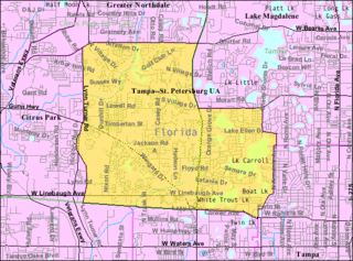
Carrollwood (CDP), Florida Census-designated place in Florida, United States

Carrollwood is a census-designated place (CDP) in northwestern Hillsborough County, Florida, United States. The population was 33,365 at the 2010 census. The census area includes the unincorporated communities of Carrollwood and Carrollwood Village. For the 2000 census the area was enumerated under the name "Greater Carrollwood" and had a population of 33,519. A similar area was listed as "Lake Carroll" in 1970 and 1980; for the 1990 census it was split into the smaller Carrollwood and Carrollwood Village CDPs.

Bayside West Neighborhood in Hillsborough, Florida, United States

Bayside West is a neighborhood within the city limits of Tampa, Florida. As of the 2000 census the neighborhood had a population of 1,629. The ZIP Codes serving the area are 33611 and 33629.

West Meadows Neighborhood in Hillsborough, Florida, United States

West Meadows is a neighborhood located in the New Tampa district of Tampa, Florida. The estimated population stands at 2,381.

Beasley (Tampa) Neighborhood in Hillsborough, Florida, United States

Beasley is a neighborhood within the city limits of Tampa, Florida. The estimated population stands at 122. The neighborhood is part of the East Tampa region and is located within District Five of the Tampa City Council.

Historic Hyde Park North Neighborhood in Hillsborough, Florida, United States

Historic Hyde Park North is a neighborhood within the Hyde Park district of the city of Tampa, Florida. As of the 2010 census the neighborhood had a population of 2,689. The latest estimated population given was 2,447. The ZIP Code serving the neighborhood is 33606.

Eastern Heights (Tampa) Neighborhood in Hillsborough, Florida, United States

Eastern Heights is a neighborhood within the district of East Tampa, which represents District 5 of the Tampa City Council. The 2000 census numbers are included with East Tampa. The latest estimated population was 192 and the population density was 2,730 people per square mile.

Dixie Farms Neighborhood in Hillsborough, Florida, United States

Dixie Farms is a neighborhood near the district of Uceta Yard, which represents District 5 of the Tampa City Council. The 2000 census numbers were unavailable, however, the latest estimated population was 34 and the population density was 249 people per square mile.

Harvey Heights (Tampa) Neighborhood in Hillsborough, Florida, United States

Harvey Heights is a neighborhood in the northern area of Tampa, Florida, which represents District 7 of the Tampa City Council. The 2000 census numbers were unavailable; however, the latest estimated population was 285.

Tampa Overlook Neighborhood in Hillsborough, Florida, United States

Tampa Overlook is a neighborhood in the North Tampa section of Tampa, which represents District 7 of the Tampa City Council. The 2000 census numbers were unavailable; however, the latest estimated population was 1,877 and the population density was 4,904 people per square mile.

Maryland Manor Neighborhood in Hillsborough, Florida, United States

Maryland Manor is a neighborhood in the southern area of Tampa, Florida, which represents District 4 of the Tampa City Council. The 2000 census numbers were unavailable, however, the latest estimated population was 1,616.

Fern Cliff Neighborhood in Hillsborough, Florida, United States

Fern Cliff is a neighborhood in the Sulphur Springs section of Tampa, Florida, which represents District 5 of the Tampa City Council. The 2000 census numbers were unavailable, however, the latest estimated population was 1,083.

Macfarlane Park, Tampa Neighborhood in Hillsborough, Florida, United States

Macfarlane Park is a neighborhood in the West Tampa district of Tampa, Florida, which represents District 6 of the Tampa City Council. The 2000 census numbers were unavailable, however, the latest estimated population was 1,754.

West Hyde Park Neighborhood in Hillsborough, Florida, United States

West Hyde Park is a neighborhood within the district of Hyde Park, which represents District 4 of the Tampa City Council. The 2000 census numbers were unavailable, however, the latest estimated population was 1,534 and the population density was 6,356 people per square mile.

References

  1. Batchgeocode
  2. District 6 Archived 2009-02-09 at the Wayback Machine .
  3. Rivercrest (in Hillsborough County, FL) Populated Place Profile
  4. Rivercrest (in Hillsborough County, FL) Populated Place Profile
  5. Batchgeocode