
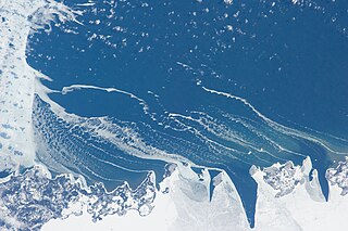
Lake Michigan is one of the five Great Lakes of North America. It is the second-largest of the Great Lakes by volume and depth after Lake Superior and the third-largest by surface area, after Lake Superior and Lake Huron. To the east, its basin is conjoined with that of Lake Huron through the wide and deep Straits of Mackinac, giving it the same surface elevation as its easterly counterpart; hydrologically, the two bodies are a single lake that is, by area, the largest freshwater lake in the world.
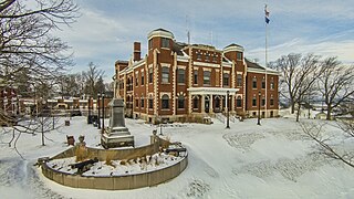
Kewaunee County is a county located in the U.S. state of Wisconsin. As of the 2020 census, the population was 20,563. Its county seat is Kewaunee. The county was created in 1852 and organized in 1859. Its Menominee name is Kewāneh, an archaic name for a species of duck. Kewaunee County is part of the Green Bay, WI Metropolitan Statistical Area as well as the Green Bay-Shawano, WI Combined Statistical Area.

Door County is the easternmost county in the U.S. state of Wisconsin. As of the 2020 census, the population was 30,066. Its county seat is Sturgeon Bay.

Leelanau County is a county located in the U.S. state of Michigan. As of the 2020 census, the population was 22,301. Since 2008, the county seat has been located within Suttons Bay Township, one mile east of the unincorporated village of Lake Leelanau. Before 2008, Leelanau County's seat was Leland. Leelanau County is included in the Traverse City metropolitan area of Northern Michigan. The largest settlement in Leelanau County by population is Greilickville, itself a suburb of Traverse City.
Benzie County is a county in the U.S. state of Michigan. As of the 2020 census, the population was 17,970. The county seat is Beulah. The county was initially set off in 1863 and organized in 1869. At 321 square miles (830 km2), Benzie County is the smallest of the 83 counties in Michigan in terms of land area.

The Door Peninsula is a peninsula in eastern Wisconsin, separating the southern part of the Green Bay from Lake Michigan. The peninsula includes northern Kewaunee County, northeastern Brown County, and the mainland portion of Door County. It is on the western side of the Niagara Escarpment. Well known for its cherry and apple orchards, the Door Peninsula is a popular tourism destination. With the 1881 completion of the Sturgeon Bay Ship Canal, the northern half of the peninsula became an island.

Chambers Island, named in honor of Col. Talbot Chambers, is a 2,834 acre island in Green Bay, about 7 miles (11 km) off the coast of the Door Peninsula, near Gibraltar, Wisconsin. It is part of the Town of Gibraltar in Door County.

Washington Island is an island of the state of Wisconsin situated in Lake Michigan. Lying about 7 miles (11 km) northeast of the tip of the Door Peninsula, it is part of Door County, Wisconsin. The island has a year-round population of 708 people according to the 2010 census. It has a land area of 60.9 km2 and comprises over 92 percent of the land area of the town of Washington, as well as all of its population. The unincorporated community of Detroit Harbor is situated on the island. It is the largest in a group of islands that includes Plum, Detroit, Hog, Pilot, Fish, and Rock Islands. These islands form the Town of Washington. Detroit Harbor bay is on the south side of the island. A large part of Washington Island's economy is based on tourism.

Hog Island is an uninhabited island located off the eastern shore of Washington Island in the town of Washington, Door County, Wisconsin, United States. The island has a land area of 2.14 acres (8,656 m2) and an elevation of 10 feet or 20 feet above Lake Michigan.

Detroit Island is an island in Lake Michigan in the southern part of the town of Washington in Door County, Wisconsin, United States. The island has a land area of 2.578 km2, out of which 27.6% is open to the public. The northern end of the island borders the waters of Detroit Harbor.

Plum Island is an island in Lake Michigan in the southern part of the town of Washington in Door County, off the tip of the Door Peninsula in the U.S. state of Wisconsin. The uninhabited island has a land area of 1.179 square kilometres (0.455 sq mi) or 117.87 hectares. Carp Lake is located on the northwestern side. During years when Lake Michigan's water levels are high, it is a lagoon of Lake Michigan, but it gets cut off as a separate lake during low-water years.
The Potawatomi Islands is the most common historic name given to the string of islands that delineate the transition from Green Bay to Lake Michigan, one of the Great Lakes. The archipelago is also termed the "Grand Traverse Islands".

Wisconsin, a state in the Midwestern United States, has a vast and diverse geography famous for its landforms created by glaciers during the Wisconsin glaciation 17,000 years ago. The state can be generally divided into five geographic regions—Lake Superior Lowland, Northern Highland, Central Plain, Eastern Ridges & Lowlands, and Western Upland. The southwestern part of the state, which was not covered by glaciers during the most recent ice age, is known as the Driftless Area. The Wisconsin glaciation formed the Wisconsin Dells, Devil's Lake, and the Baraboo Range. A number of areas are protected in the state, including Devil's Lake State Park, the Apostle Islands National Lakeshore, and the Chequamegon–Nicolet National Forest.

Cana Island is an island in Lake Michigan in the town of Baileys Harbor in Door County, Wisconsin, United States. The Cana Island Light is on the east side of the island. It is possible to walk to Cana Island from the mainland over the tombolo when water levels are low. Tombolo conditions are monitored by a webcam operated by the county parks department. The island is part of the Town of Baileys Harbor, Wisconsin.

Gravel Island is an island in Lake Michigan. It is located in Ellison Bay, in the town of Liberty Grove, Wisconsin. The Gravel Island National Wildlife Refuge is made up of Gravel Island, and nearby Spider Island. The island is uninhabited, and a botanist who visited in 1999 was unable to find any vascular plants on the island.

Spider Island is an uninhabited island in Lake Michigan. It is located in Ellison Bay, in the town of Liberty Grove, Wisconsin. The Gravel Island National Wildlife Refuge is made up of Spider Island, and nearby Gravel Island. At 23 acres (9.3 ha) it is the larger of the two islands.

The Sister Islands are two islands in Lake Michigan. They are located in the bay of Green Bay, in the town of Liberty Grove, Wisconsin. At one point the islands were connected, but higher water levels have eroded the size of the islands. Combined, the area of the islands sits at 6 acres (2.4 ha).
The flora of Door County, Wisconsin comprise a variety of plant species. Geobotanically, Door County belongs to the North American Atlantic Region.

The climate of Door County, Wisconsin is tempered by Green Bay and Lake Michigan. There are fewer extremely cold days and fewer hot days than in areas of Wisconsin directly to the west. Lake waters delay the coming of spring as well as extend mild temperatures in the fall. Annual precipitation is slightly lower than elsewhere in northern Wisconsin. The county features a humid continental climate with warm summers and cold snowy winters.


