Hawk Springs, Wyoming

Last updated
Hawk Springs, Wyoming
CDP
Hawk Springs, Wyoming Post Office (28708572271).jpg
Hawk Springs Post Office, July 2016
Goshen County Wyoming incorporated and unincorporated areas Hawk Springs highlighted.svg
Location in Goshen County and the state of Wyoming
Usa edcp location map.svg
Red pog.svg
Hawk Springs, Wyoming
Location in the United States
Coordinates: 41°47′5″N104°15′50″W / 41.78472°N 104.26389°W / 41.78472; -104.26389 Coordinates: 41°47′5″N104°15′50″W / 41.78472°N 104.26389°W / 41.78472; -104.26389
Country Flag of the United States.svg  United States
State Flag of Wyoming.svg  Wyoming
County Flag of Goshen County, Wyoming.gif Goshen
Area
  Total1.7 sq mi (4.4 km2)
  Land1.7 sq mi (4.4 km2)
  Water0.0 sq mi (0.0 km2)
Elevation
4,383 ft (1,336 m)
Population
 (2010) [1]
  Total45
  Density26/sq mi (10/km2)
Time zone UTC-7 (Mountain (MST))
  Summer (DST) UTC-6 (MDT)
ZIP code
82217
Area code(s) 307
FIPS code 56-36060 [2]
GNIS feature ID1589386 [3]

Hawk Springs is a census-designated place (CDP) in Goshen County, Wyoming, United States. The population was 45 at the 2010 census.

Contents

Hawk Springs State Recreation Area is located 6 miles (9.7 km) southeast of Hawk Springs.

Geography

Hawk Springs is located at 41°47′5″N104°15′50″W / 41.78472°N 104.26389°W / 41.78472; -104.26389 (41.784703, -104.263877). [4]

According to the United States Census Bureau, the CDP has a total area of 1.7 square miles (4.4 km2), all land.

Demographics

As of the census [2] of 2000, there were 69 people, 27 households, and 15 families residing in the CDP. The population density was 40.5 people per square mile (15.7/km2). There were 40 housing units at an average density of 23.5/sq mi (9.1/km2). The racial makeup of the CDP was 82.61% White, 17.39% from other races. Hispanic or Latino of any race were 17.39% of the population.

There were 27 households, out of which 33.3% had children under the age of 18 living with them, 51.9% were married couples living together, and 44.4% were non-families. 37.0% of all households were made up of individuals, and 11.1% had someone living alone who was 65 years of age or older. The average household size was 2.56 and the average family size was 3.67.

In the CDP, the population was spread out, with 29.0% under the age of 18, 10.1% from 18 to 24, 26.1% from 25 to 44, 20.3% from 45 to 64, and 14.5% who were 65 years of age or older. The median age was 34 years. For every 100 females, there were 102.9 males. For every 100 females age 18 and over, there were 96.0 males.

The median income for a household in the CDP was $8,750, and the median income for a family was $0. Males had a median income of $0 versus $0 for females. The per capita income for the CDP was $9,600. None of the population or families were below the poverty line.

Education

Public education for the community of Hawk Springs is provided by Goshen County School District #1.

Highways

See also

Related Research Articles

Platte County, Wyoming U.S. county in Wyoming

Platte County is a county in the U.S. state of Wyoming. As of the 2010 United States Census, the population was 8,667. Its county seat is Wheatland.

Goshen County, Wyoming U.S. county in Wyoming

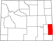
Goshen County is a county in the U.S. state of Wyoming. As of the 2010 United States Census, the population was 13,249. Its county seat is Torrington. The eastern boundary of the County borders the Nebraska state line.

Dunlap, Indiana Census-designated place in Indiana, United States

Dunlap is a census-designated place (CDP) in Elkhart County, Indiana, United States. The population was 6,235 at the 2010 census. Once a small farming community, by the 1980s it had become a suburb of Elkhart and Goshen, Indiana. Most of the town was destroyed by two violent F4 tornadoes during the Palm Sunday Tornado Outbreak on April 11, 1965. Both tornadoes killed over 60 in the region.

Huntley, Wyoming CDP in Wyoming, United States

Huntley is a census-designated place (CDP) in Goshen County, Wyoming, United States. The population was 30 at the 2010 census.

Lingle, Wyoming Town in Wyoming, United States

Lingle is a town in Goshen County, Wyoming, United States. The population was 468 at the 2010 census.

Torrington, Wyoming City in Wyoming, United States

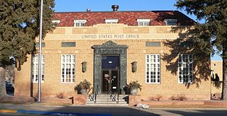
Torrington is a city in, and the county seat of, Goshen County, Wyoming, United States. The population was 6,501 at the 2010 census.

Veteran, Wyoming CDP in Wyoming, United States

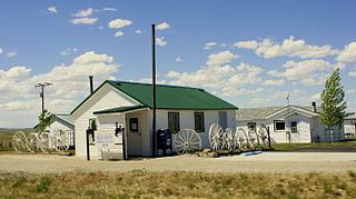
Veteran is a census-designated place (CDP) located in Goshen County, Wyoming, United States. The population was 23 at the 2010 census.

Yoder, Wyoming Town in Wyoming, United States

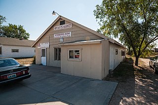
Yoder is a town in Goshen County, Wyoming, United States. The population was 151 at the 2010 census.

Fox Farm-College, Wyoming Census-designated place in Wyoming, United States

Fox Farm-College is a census-designated place (CDP) in Laramie County, Wyoming, United States. It is part of the Cheyenne, Wyoming Metropolitan Statistical Area. The population was 3,647 at the 2010 census.

Ranchettes, Wyoming Census-designated place in Wyoming, United States

Ranchettes is a census-designated place (CDP) in Laramie County, Wyoming, United States. It is part of the Cheyenne, Wyoming Metropolitan Statistical Area. The population was 5,798 at the 2010 census.

South Greeley, Wyoming Census-designated place in Wyoming, United States

South Greeley is a census-designated place (CDP) in Laramie County, Wyoming, United States. It is part of the Cheyenne, Wyoming Metropolitan Statistical Area. The population was 4,217 at the 2010 census.

Powder River, Wyoming CDP in Wyoming, United States

Powder River is a census-designated place (CDP) in Natrona County, Wyoming, United States. It is part of the Casper, Wyoming Metropolitan Statistical Area. The population was 44 at the 2010 census.

Chugcreek, Wyoming CDP in Wyoming, United States

Chugcreek is a census-designated place (CDP) in Platte County, Wyoming, United States. The population was 156 at the 2010 census.

Lakeview North, Wyoming CDP in Wyoming, United States

Lakeview North is a census-designated place (CDP) in Platte County, Wyoming, United States. The population was 84 at the 2010 census.

Slater, Wyoming CDP in Wyoming, United States

Slater is a census-designated place (CDP) in Platte County, Wyoming, United States. The population was 80 at the 2010 census.

James Town, Wyoming CDP in Wyoming, United States

James Town is a census-designated place (CDP) in Sweetwater County, Wyoming, United States. The population was 536 at the 2010 census.

North Rock Springs, Wyoming CDP in Wyoming, United States

North Rock Springs is a census-designated place (CDP) in Sweetwater County, Wyoming, United States. The population was 2,207 at the 2010 census.

Washam, Wyoming CDP in Wyoming, United States

Washam is a census-designated place (CDP) in Sweetwater County, Wyoming, United States. The population was 51 at the 2010 census.

Lonetree, Wyoming CDP in Wyoming, United States

Lonetree is a census-designated place (CDP) in Uinta County, Wyoming, United States. The population was 49 at the 2010 census.

Hill View Heights, Wyoming CDP in Wyoming, United States

Hill View Heights is a census-designated place (CDP) in Weston County, Wyoming, United States. The population was 170 at the 2010 census.

References

  1. "2010 City Population and Housing Occupancy Status". U.S. Census Bureau. Retrieved July 13, 2012.[ dead link ]
  2. 1 2 "U.S. Census website". United States Census Bureau . Retrieved 2008-01-31.
  3. "US Board on Geographic Names". United States Geological Survey. 2007-10-25. Retrieved 2008-01-31.
  4. "US Gazetteer files: 2010, 2000, and 1990". United States Census Bureau. 2011-02-12. Retrieved 2011-04-23.

Commons-logo.svg Media related to Hawk Springs, Wyoming at Wikimedia Commons