Fort Laramie, Wyoming

Last updated

Fort Laramie, Wyoming
Town
Fort Laramie, WY.jpg
Goshen County Wyoming Incorporated and Unincorporated areas Fort Laramie Highlighted 5628230.svg
Location of Fort Laramie in Goshen County, Wyoming.
Usa edcp location map.svg
Red pog.svg
Fort Laramie
Location in the United States
Coordinates: 42°12′48″N104°31′2″W / 42.21333°N 104.51722°W / 42.21333; -104.51722
Country Flag of the United States.svg  United States
State Flag of Wyoming.svg  Wyoming
County Flag of Goshen County, Wyoming.gif Goshen
Area
[1]
  Total0.25 sq mi (0.65 km2)
  Land0.25 sq mi (0.65 km2)
  Water0.00 sq mi (0.00 km2)
Elevation
4,239 ft (1,292 m)
Population
 (2020) [2]
  Total206
  Density820.7/sq mi (316.9/km2)
Time zone UTC-7 (Mountain (MST))
  Summer (DST) UTC-6 (MDT)
ZIP code
82212
Area code 307
FIPS code 56-28230 [3]
GNIS feature ID1588642 [4]

Fort Laramie is a town in Goshen County, Wyoming, United States. The population was 206 at the 2020 census. The town is named after historic Fort Laramie, an important stop on the Oregon, California and Mormon trails, as well as a staging point for various military excursions and treaty signings. The old fort was located south of town across the North Platte River, at the mouth of the Laramie River.

Contents

History

Entrance to Fort Laramie National Historic Site Fort Laramie NHS-Gate.jpg
Entrance to Fort Laramie National Historic Site

In 1860 Fort Laramie served as a Pony Express station.

Geography

Fort Laramie is located at 42°12′48″N104°31′2″W / 42.21333°N 104.51722°W / 42.21333; -104.51722 (42.213233, -104.517123). [5]

According to the United States Census Bureau, the town has a total area of 0.25 square miles (0.65 km2), all land. [1]

Climate

According to the Köppen Climate Classification system, Fort Laramie has a cold semi-arid climate, abbreviated "BSk" on climate maps. The hottest temperature recorded in Fort Laramie was 106 °F (41.1 °C) on July 3, 1990, while the coldest temperature recorded was −40 °F (−40.0 °C) on December 22, 1989. [6]

Climate data for Old Fort Laramie, Wyoming, 1991–2020 normals, extremes 1989–present
MonthJanFebMarAprMayJunJulAugSepOctNovDecYear
Record high °F (°C)72
(22)
72
(22)
81
(27)
89
(32)
98
(37)
105
(41)
106
(41)
104
(40)
102
(39)
92
(33)
80
(27)
73
(23)
106
(41)
Mean maximum °F (°C)61.0
(16.1)
63.4
(17.4)
74.0
(23.3)
81.0
(27.2)
89.1
(31.7)
96.5
(35.8)
100.4
(38.0)
98.8
(37.1)
94.4
(34.7)
84.4
(29.1)
71.4
(21.9)
61.4
(16.3)
101.3
(38.5)
Mean daily maximum °F (°C)43.0
(6.1)
45.0
(7.2)
54.8
(12.7)
61.9
(16.6)
71.0
(21.7)
82.8
(28.2)
91.0
(32.8)
89.2
(31.8)
79.8
(26.6)
65.2
(18.4)
52.0
(11.1)
42.6
(5.9)
64.9
(18.3)
Daily mean °F (°C)29.1
(−1.6)
31.0
(−0.6)
39.1
(3.9)
46.0
(7.8)
55.8
(13.2)
66.4
(19.1)
73.8
(23.2)
71.6
(22.0)
61.8
(16.6)
48.2
(9.0)
37.0
(2.8)
29.0
(−1.7)
49.1
(9.5)
Mean daily minimum °F (°C)15.3
(−9.3)
17.1
(−8.3)
23.5
(−4.7)
30.1
(−1.1)
40.6
(4.8)
50.0
(10.0)
56.5
(13.6)
54.1
(12.3)
43.8
(6.6)
31.1
(−0.5)
22.1
(−5.5)
15.4
(−9.2)
33.3
(0.7)
Mean minimum °F (°C)−13.4
(−25.2)
−9.5
(−23.1)
3.2
(−16.0)
14.2
(−9.9)
25.1
(−3.8)
36.4
(2.4)
44.1
(6.7)
40.9
(4.9)
27.1
(−2.7)
11.2
(−11.6)
−1.4
(−18.6)
−12.3
(−24.6)
−21.4
(−29.7)
Record low °F (°C)−28
(−33)
−36
(−38)
−18
(−28)
0
(−18)
18
(−8)
28
(−2)
37
(3)
29
(−2)
20
(−7)
−16
(−27)
−16
(−27)
−40
(−40)
−40
(−40)
Average precipitation inches (mm)0.24
(6.1)
0.53
(13)
0.80
(20)
1.71
(43)
2.93
(74)
2.19
(56)
1.78
(45)
1.36
(35)
1.39
(35)
1.13
(29)
0.46
(12)
0.42
(11)
14.94
(379.1)
Average snowfall inches (cm)2.2
(5.6)
6.3
(16)
3.1
(7.9)
3.5
(8.9)
0.6
(1.5)
0.0
(0.0)
0.0
(0.0)
0.0
(0.0)
0.0
(0.0)
2.4
(6.1)
3.2
(8.1)
6.2
(16)
27.5
(70.1)
Average extreme snow depth inches (cm)2.4
(6.1)
3.6
(9.1)
2.6
(6.6)
2.2
(5.6)
0.7
(1.8)
0.0
(0.0)
0.0
(0.0)
0.0
(0.0)
0.0
(0.0)
1.3
(3.3)
2.3
(5.8)
3.3
(8.4)
6.3
(16)
Average precipitation days (≥ 0.01 in)3.54.64.97.39.87.76.85.75.55.54.04.269.5
Average snowy days (≥ 0.1 in)1.92.81.71.60.30.00.00.00.01.11.82.914.1
Source 1: NOAA [7]
Source 2: National Weather Service [6]

Demographics

Historical population
CensusPop.Note
1930 245
1940 31126.9%
1950 300−3.5%
1960 233−22.3%
1970 197−15.5%
1980 35680.7%
1990 243−31.7%
2000 2430.0%
2010 230−5.3%
2020 206−10.4%
U.S. Decennial Census
Sign in Fort Laramie Fort-Laramie-Sign.jpg
Sign in Fort Laramie

2010 census

As of the census [8] of 2010, there were 230 people, 111 households, and 60 families residing in the town. The population density was 851.9 inhabitants per square mile (328.9/km2). There were 143 housing units at an average density of 529.6 per square mile (204.5/km2). The racial makeup of the town was 91.7% White, 1.3% Native American, 3.9% from other races, and 3.0% from two or more races. Hispanic or Latino of any race were 5.7% of the population.

There were 111 households, of which 19.8% had children under the age of 18 living with them, 43.2% were married couples living together, 7.2% had a female householder with no husband present, 3.6% had a male householder with no wife present, and 45.9% were non-families. 43.2% of all households were made up of individuals, and 19.8% had someone living alone who was 65 years of age or older. The average household size was 2.07 and the average family size was 2.88.

The median age in the town was 49.5 years. 18.3% of residents were under the age of 18; 4.7% were between the ages of 18 and 24; 20% were from 25 to 44; 32.6% were from 45 to 64; and 24.3% were 65 years of age or older. The gender makeup of the town was 53.5% male and 46.5% female.

2000 census

As of the census [3] of 2000, there were 243 people, 119 households, and 59 families residing in the town. The population density was 916.7 people per square mile (347.5/km2). There were 149 housing units at an average density of 562.1 per square mile (213.1/km2). The racial makeup of the town was 94.65% White, 1.23% Native American, 2.06% from other races, and 2.06% from two or more races. Hispanic or Latino of any race were 4.53% of the population.

There were 119 households, out of which 20.2% had children under the age of 18 living with them, 39.5% were married couples living together, 6.7% had a female householder with no husband present, and 50.4% were non-families. 42.0% of all households were made up of individuals, and 21.0% had someone living alone who was 65 years of age or older. The average household size was 2.04 and the average family size was 2.86.

In the town, the population was spread out, with 21.8% under the age of 18, 4.5% from 18 to 24, 24.3% from 25 to 44, 25.9% from 45 to 64, and 23.5% who were 65 years of age or older. The median age was 45 years. For every 100 females, there were 91.3 males. For every 100 females age 18 and over, there were 84.5 males.

The median income for a household in the town was $22,500, and the median income for a family was $32,917. Males had a median income of $28,929 versus $13,125 for females. The per capita income for the town was $13,236. About 18.9% of families and 20.5% of the population were below the poverty line, including 23.3% of those under the age of eighteen and 12.5% of those 65 or over.

Education

Public education for the town of Fort Laramie is provided by Goshen County School District #1.

Highways

Notable people

See also

Related Research Articles

<span class="mw-page-title-main">Washakie County, Wyoming</span> County in Wyoming, United States

Washakie County is a county in the U.S. state of Wyoming. As of the 2020 United States Census, the population was 7,685. Its county seat is Worland.

<span class="mw-page-title-main">Platte County, Wyoming</span> County in Wyoming, United States

Platte County is a county located in the U.S. state of Wyoming. As of the 2020 United States Census, the population was 8,605. Its county seat is Wheatland.

<span class="mw-page-title-main">Park County, Wyoming</span> County in Wyoming, United States

Park County is a county in the U.S. state of Wyoming. As of the 2020 United States Census, the population was 29,624. The county seat is Cody.

<span class="mw-page-title-main">Laramie County, Wyoming</span> County in Wyoming, United States

Laramie County is a county located at the southeast corner of the state of Wyoming. As of the 2020 United States Census, the population was 100,512 or 17.4% of the state's total 2020 population, making it the most populous county in Wyoming, but the least populous county in the United States to be the most populous in its state.

<span class="mw-page-title-main">Goshen County, Wyoming</span> County in Wyoming, United States

Goshen County is a county in the U.S. state of Wyoming. As of the 2020 United States Census, the population was 12,498. Its county seat is Torrington. The eastern boundary of the County borders the Nebraska state line.

<span class="mw-page-title-main">Converse County, Wyoming</span> County in Wyoming, United States

Converse County is a county located in the U.S. state of Wyoming. As of the 2020 United States Census, the population was 13,751. Its county seat is Douglas.

<span class="mw-page-title-main">Carbon County, Wyoming</span> County in Wyoming, United States

Carbon County is a county in the U.S. state of Wyoming. As of the 2020 United States Census, the population was 14,537. Its county seat is Rawlins. Its south border abuts the north line of Colorado.

<span class="mw-page-title-main">Albany County, Wyoming</span> County in Wyoming, United States

Albany County is a county in the U.S. state of Wyoming. As of the 2020 United States Census, the population was 37,066. Its county seat is Laramie, the site of the University of Wyoming. Its south border lies on the northern Colorado state line.

<span class="mw-page-title-main">Cliff Village, Missouri</span> Village in Missouri, United States

Cliff Village is a village in Newton County, Missouri, United States. The population was 40 at the 2010 census. It is part of the Joplin, Missouri Metropolitan Statistical Area.

<span class="mw-page-title-main">Sinclair, Wyoming</span> Town in Wyoming, United States

Sinclair is a town in Carbon County, Wyoming, United States.

<span class="mw-page-title-main">Glenrock, Wyoming</span> Town in Wyoming, United States

Glenrock is a town in Converse County, Wyoming, United States. The population was 2,576 at the 2010 census.

<span class="mw-page-title-main">Torrington, Wyoming</span> City in Wyoming, United States

Torrington is a city in, and the county seat of, Goshen County, Wyoming, United States. The population was 6,501 at the 2010 census.

<span class="mw-page-title-main">Albin, Wyoming</span> Town in Laramie County, Wyoming, United States

Albin is a town in Laramie County, Wyoming, United States. It is part of the Cheyenne Metropolitan Statistical Area. The population was 169 at the 2020 census.

<span class="mw-page-title-main">Burns, Wyoming</span> Town in Laramie County, Wyoming, United States

Burns is a town in Laramie County, Wyoming, United States. It is part of the Cheyenne, Wyoming Metropolitan Statistical Area. The population was 301 at the 2010 census.

<span class="mw-page-title-main">Fox Farm-College, Wyoming</span> Census-designated place in Wyoming, United States

Fox Farm-College is a census-designated place (CDP) in Laramie County, Wyoming, United States. It is part of the Cheyenne, Wyoming Metropolitan Statistical Area. The population was 3,876 people at the 2020 census.

<span class="mw-page-title-main">Pine Bluffs, Wyoming</span> Town in Wyoming, United States

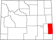
Pine Bluffs is a town in eastern Laramie County, Wyoming, United States. It is located on the county's border with Nebraska. Pine Bluffs is part of the Cheyenne, Wyoming, Metropolitan Statistical Area. The population was 1,129 at the 2010 census. It was first known as Rock Ranch, but the name was changed by railroad officials for the pines on the nearby bluffs.

<span class="mw-page-title-main">Ranchettes, Wyoming</span> Census-designated place in Wyoming, United States

Ranchettes is a census-designated place (CDP) in Laramie County, Wyoming, United States. It is part of the Cheyenne, Wyoming Metropolitan Statistical Area. The population was 5,798 at the 2010 census.

<span class="mw-page-title-main">South Greeley, Wyoming</span> Census-designated place in Wyoming, United States

South Greeley is a census-designated place (CDP) in Laramie County, Wyoming, United States. It is part of the Cheyenne, Wyoming Metropolitan Statistical Area. The population was 4,733 at the 2020 census. The population was 4,217 at the 2010 census.

<span class="mw-page-title-main">Chugwater, Wyoming</span> Town in Wyoming, United States

Chugwater is a town in Platte County, Wyoming, United States. As of the 2020 census, the town population was 175. The High Plains town, located 45 miles north of Cheyenne and 25 miles south of Wheatland.

<span class="mw-page-title-main">Lyman, Wyoming</span> Town in Wyoming, United States

Lyman is a town in Uinta County, Wyoming, United States. The population was 2,115 at the 2010 census.

References

  1. 1 2 "2020 U.S. Gazetteer Files". United States Census Bureau . Retrieved March 22, 2024.
  2. "Profile of General Population and Housing Characteristics: 2020 Demographic Profile Data (DP-1): Fort Laramie town, Wyoming". United States Census Bureau . Retrieved March 22, 2024.
  3. 1 2 "U.S. Census website". United States Census Bureau . Retrieved January 31, 2008.
  4. "US Board on Geographic Names". United States Geological Survey. October 25, 2007. Retrieved January 31, 2008.
  5. "US Gazetteer files: 2010, 2000, and 1990". United States Census Bureau. February 12, 2011. Retrieved April 23, 2011.
  6. 1 2 "NOAA Online Weather Data – NWS Cheyenne". National Weather Service. Retrieved November 1, 2022.
  7. "U.S. Climate Normals Quick Access – Station: Old Ft Laramie, WY". National Oceanic and Atmospheric Administration. Retrieved November 1, 2022.
  8. "U.S. Census website". United States Census Bureau . Retrieved December 14, 2012.