Hermanville, Mississippi

Last updated

Hermanville, Mississippi
USA Mississippi location map.svg
Red pog.svg
Hermanville
Usa edcp location map.svg
Red pog.svg
Hermanville
Coordinates: 31°57′34″N90°50′24″W / 31.95944°N 90.84000°W / 31.95944; -90.84000
Country Flag of the United States.svg  United States
State Flag of Mississippi.svg  Mississippi
County Claiborne
Area
[1]
  Total3.10 sq mi (8.03 km2)
  Land3.09 sq mi (8.01 km2)
  Water0.01 sq mi (0.02 km2)
Elevation
167 ft (51 m)
Population
 (2020)
  Total692
  Density223.88/sq mi (86.44/km2)
Time zone UTC-6 (Central (CST))
  Summer (DST) UTC-5 (CDT)
ZIP code
39086
Area code(s) 601 & 769
GNIS feature ID671128 [2]

Hermanville is a census-designated place and unincorporated community in Claiborne County, in southwest Mississippi, United States. [2] Its ZIP code is 39086. [3]

Contents

It was first named as a CDP in the 2020 Census which listed a population of 692. [4]

History

Hermanville was established on March 15, 1886. [5] The town's economy was based on cotton, cattle, and timber products. [6]

The Episcopal Church of the Epiphany was built in Hermanville in 1887. By 1982, the congregation had become inactive as population decreased. In 1985 the building was moved to the Mississippi Agriculture and Forestry Museum in Jackson, where it is used as a chapel. [7]

The Natchez, Jackson and Columbus Railroad was completed in 1882, and a depot was established in Hermanville. Known locally as "The Little J", the line ran between the state capital of Jackson and Natchez. It had various owners; the last was the Illinois Central Railroad, which abandoned the line in railroad industry restructuring between 1979 and 1981. [8] [9]

During the early 1960s, a lumber mill in Hermanville was producing 10,000,000 board feet (24,000 m3) of high-quality southern pine annually. [9]

The Pink Palace in Hermanville was described in 2000 as "probably the most photogenic juke joint in Mississippi". [10] The building was constructed of three side-by-side mobile homes with their common walls removed. The inside walls were painted in folk art. [10]

Author Nevada Barr wrote of Hermanville in 2000:

The town, if such a humble scatter of buildings around a crossroads and a single-room post office could be called a town, embodied the Northerner's view of the "real" Mississippi. The gracious homes of Natchez were not in evidence, nor was the classic architecture...seen in Port Gibson and the city of Clinton. Trailer houses and shacks sat at odd angles to the two-lane road as if they had fallen haphazardly from a passing cargo plane. [11]

Demographics

Historical population
CensusPop.Note
2020 692
U.S. Decennial Census [12]
2020 [13]

2020 census

Hermanville CDP, Mississippi – Racial and ethnic composition
Note: the US Census treats Hispanic/Latino as an ethnic category. This table excludes Latinos from the racial categories and assigns them to a separate category. Hispanics/Latinos may be of any race.
Race / Ethnicity (NH = Non-Hispanic)Pop 2020 [13] % 2020
White alone (NH)182.60%
Black or African American alone (NH)66395.81%
Native American or Alaska Native alone (NH)20.29%
Asian alone (NH)00.00%
Pacific Islander alone (NH)00.00%
Some Other Race alone (NH)00.00%
Mixed Race or Multi-Racial (NH)50.72%
Hispanic or Latino (any race)40.58%
Total692100.00%

Education

Hermanville is served by the Claiborne County School District. [14] Port Gibson High School is the comprehensive high school of the district.

Notable people

Related Research Articles

<span class="mw-page-title-main">Claiborne County, Mississippi</span> County in Mississippi, United States

Claiborne County is a county located in the U.S. state of Mississippi. As of the 2020 census, the population was 9,135. Its county seat is Port Gibson. The county is named after William Claiborne, the second governor of the Mississippi Territory.

<span class="mw-page-title-main">Winchester, Nevada</span> Unincorporated town in the State of Nevada, United States

Winchester is an unincorporated town and census-designated place (CDP) in Clark County, Nevada, United States that contains part of the Las Vegas Strip. It is one of a number of CDPs in the unincorporated urbanized area directly south of Las Vegas. The population was 36,403 at the 2020 census. It is governed by the Clark County Commission with advice from the Winchester Town Advisory Board. "Winchester, NV" does not appear in postal addresses; the United States Postal Service has assigned "Las Vegas, NV" as the place name for the ZIP codes containing Winchester.

<span class="mw-page-title-main">Crosby, Texas</span> Census-designated place in Texas, United States

Crosby is a census-designated place in Harris County, Texas, United States. The population was 3,417 at the 2020 census.

<span class="mw-page-title-main">Alcorn State University</span> Historically black public college in Lorman, Mississippi, US

Alcorn State University is a public historically black land-grant university adjacent to Lorman, Mississippi. It was founded in 1871 and was the first black land grant college established in the United States. The university is a member-school of the Thurgood Marshall College Fund.

<span class="mw-page-title-main">Knoxville, Georgia</span> Place in Georgia, United States

Knoxville is an unincorporated community and census-designated place in Crawford County, Georgia, United States. It is the county seat of Crawford County. The community is part of the Macon Metropolitan Statistical Area. As of the 2020 census, Knoxville had a population of 65.

<span class="mw-page-title-main">Tunica Resorts, Mississippi</span> Census-designated place in the United States

Tunica Resorts, formerly known as Robinsonville until 2005, is a census-designated place (CDP) in northern Tunica County, Mississippi, United States, north of the county seat of Tunica. The community is situated mostly between the Mississippi River and U.S. Route 61, along the border with Arkansas. The population as of the 2020 census was 2,132.

Bogue Chitto is an unincorporated community and census-designated place (CDP) in Lincoln County, Mississippi, United States. As of the 2020 census, it had a population of 437. Bogue Chitto is the only municipal hamlet in the state of Mississippi.

<span class="mw-page-title-main">Valley Park, Mississippi</span> Census-designated place in Mississippi, United States

Valley Park is a census-designated place and unincorporated community in Issaquena County, Mississippi, United States. Its elevation is 95 feet. Although unincorporated, it has a post office, with the ZIP code of 39177.

<span class="mw-page-title-main">Winterville, Mississippi</span> Census-designated place in Mississippi, United States

Winterville is a census-designated place and unincorporated community located in Washington County, Mississippi, near Mississippi Highway 1. Winterville is approximately 3 miles (4.8 km) north of Greenville, the county seat, and approximately 4 miles (6.4 km) south of Lamont.

<span class="mw-page-title-main">Rena Lara, Mississippi</span> Census-designated place in Mississippi, United States

Rena Lara is a census-designated place and unincorporated community located along Mississippi Highway 1 in southwestern Coahoma County, Mississippi, United States. Rena Lara is located on the former Riverside Division of the Yazoo and Mississippi Valley Railroad. Rena Lara was once home to two general stores, two grocery stores, and the Richardson and May Land & Planting Company.

Ovett is a census-designated place and unincorporated community in southeastern Jones County, Mississippi. Ovett is part of the Laurel Micropolitan Statistical Area.

<span class="mw-page-title-main">Eastabuchie, Mississippi</span> Community in Mississippi, U.S.

Eastabuchie is a census-designated place and unincorporated community in southwestern Jones County, Mississippi. It is located along U.S. Route 11, just north of the Forrest County line. the community has a post office with the ZIP code 39436. Eastabuchie is part of the Laurel Micropolitan Statistical Area.

Lamar is a census-designated place and unincorporated community in Benton County, Mississippi, United States. It is located along Mississippi Highway 7 in western Benton County. Lamar has a post office with the ZIP code 38642. The nearly abandoned Mississippi Central Railroad runs through Lamar, and is only used rarely for freight trafficking. Lamar shares its ZIP code with the nearby community of Slayden.

Grace is a census-designated place and unincorporated community in Issaquena County, Mississippi, United States. It is located several miles northeast of Mayersville.

<span class="mw-page-title-main">Dundee, Mississippi</span> Census-designated place in Mississippi, United States

Dundee is a census-designated place and unincorporated community in Tunica County, Mississippi, United States. Dundee is 12 miles (19 km) south-southwest of Tunica. Dundee has a post office with ZIP code 38626.

Fernwood is a census-designated place and unincorporated community in Pike County, Mississippi, United States. Its ZIP code is 39635.

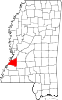
Pattison, also known as Martin, is a census-designated place and unincorporated community in Claiborne County, Mississippi, United States. Its ZIP code is 39144.

Morgantown is a census-designated place (CDP) in Adams County, Mississippi, United States, located to the northeast of the city of Natchez. As of the 2020 census, it had a population of 1,334.

Cloverdale is a census-designated place (CDP) in Adams County, Mississippi, United States, located to the south of the city of Natchez. As of the 2020 census, it had a population of 557.

Bethlehem is a census-designated place and unincorporated community in Marshall County, Mississippi, United States. Its ZIP code is 38659.

References

  1. "2020 U.S. Gazetteer Files". United States Census Bureau. Retrieved July 24, 2022.
  2. 1 2 "Hermanville, Mississippi". Geographic Names Information System . United States Geological Survey, United States Department of the Interior.
  3. United States Postal Service (2012). "USPS - Look Up a ZIP Code" . Retrieved February 15, 2012.
  4. "Hermanville CDP, Mississippi". United States Census Bureau . Retrieved March 13, 2022.
  5. Laws of the State of Mississippi. R.H. Henry, State Printer. 1886.
  6. Wyatt, Dorothy M. (2005). The Planted Seed. Organizational Desktop. ISBN   9780595340255.
  7. Pace, Sherry (2007). Historic Churches of Mississippi. University Press of Mississippi. ISBN   9781617034091.
  8. Hoffman, Gil. "Natchez, Jackson & Columbus Railroad". Mississippi Rails.
  9. 1 2 Soil survey: Clairborne County Mississippi. United States Department of Agriculture. July 1963.
  10. 1 2 "Juke Joint Photographs". John L. Doughty, Jr. 2000. Archived from the original on September 5, 2013.
  11. Barr, Nevada Barr (2000). Deep South. Berkley. ISBN   9781440672989.
  12. "Decennial Census of Population and Housing by Decades". US Census Bureau.
  13. 1 2 "P2 Hispanic or Latino, and Not Hispanic or Latino by Race – 2020: DEC Redistricting Data (PL 94-171) - Hermanville CDP, Mississippi". United States Census Bureau .
  14. "2020 CENSUS - SCHOOL DISTRICT REFERENCE MAP: Claiborne County, MS" (PDF). U.S. Census Bureau . Retrieved July 31, 2022. - Text list

Further reading