
Bradwell is a village and civil parish in the English county of Norfolk. The village is immediately to the west of, and largely indistinguishable from, the built-up urban area of the town of Great Yarmouth.

Hurst Green is a village and civil parish in the Rother district of East Sussex, England, and is located south of the East Sussex / Kent border at Flimwell.

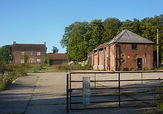
Bunwell is a village and civil parish in the English county of Norfolk.

Alpheton is a village and civil parish in the Babergh district of Suffolk, England. Located on the A134 road about six miles north of Sudbury, in 2005 it had a population of 260, reducing to 256 at the 2011 Census. According to Eilert Ekwall the meaning of the village name is the homestead of Aelfled.

Brooke is a village and civil parish in the English county of Norfolk.

Brinton is a village and a civil parish in the English county of Norfolk.

Briston is a village, civil parish and electoral ward in the English county of Norfolk.

Minshull Vernon is a hamlet and civil parish in the unitary authority of Cheshire East and the ceremonial county of Cheshire, England. The hamlet lies 3 miles (5 km) to the north west of Crewe, south east of Winsford and south west of Middlewich. The parish also includes the small settlements of Bradfield Green, Eardswick, Hoolgrave, Minshull Hill, Walley's Green and Weaver Bank. The total population of the civil parish is somewhat over 200, measured at 391 in the Census 2011. Nearby villages include Church Minshull, Warmingham and Wimboldsley.

Lawshall is a village and civil parish in Suffolk, England. Located around a mile off the A134 between Bury St Edmunds and Sudbury, it is part of Babergh district. The parish has nine settlements comprising the three main settlements of The Street, Lambs Lane and Bury Road along with the six small hamlets of Audley End, Hanningfield Green, Harrow Green, Hart's Green, Hibb's Green and Lawshall Green.

Cutlers Green is a hamlet in the civil parish of Thaxted, and the Uttlesford district of Essex, England. The hamlet is 1 mile (1.6 km) west from the town of Thaxted.

The Parish Church of All Saints' Lawshall, is an Anglican church in the village of Lawshall, Suffolk, England. It has been designated by English Heritage as a Grade I listed building. The church is located in between Lawshall Hall and All Saints CEVCP Primary School. The church is in the process of joining the Chadbrooke benefice, whose Rector is Revd Matthew Lawson.
Lawshall Hall is a Grade II* listed building, re-built in 1557, that is located in the parish of Lawshall in Suffolk. The Hall is adjacent to All Saints Church and is very close to the centre of the village.

Harrow Green is a hamlet in the civil parish of Lawshall in the Babergh district in the county of Suffolk, England. It is located between Lambs Lane and The Street and is just over a mile off the A134 between Bury St Edmunds and Sudbury.

Lawshall Green is a hamlet in the civil parish of Lawshall in the Babergh district in the county of Suffolk, England. It is located east of Hibb's Green and is less than half a mile off the A134 between Bury St Edmunds and Sudbury.

Hanningfield Green, sometimes referred to as Hanningfields Green, is a hamlet in the civil parish of Lawshall in the Babergh district in the county of Suffolk, England. It is located between The Street and Hibb's Green and is just under a mile off the A134 between Bury St Edmunds and Sudbury.

Hart's Green is a hamlet in the civil parish of Lawshall in the Babergh District in the county of Suffolk, England. It is located between Stanningfield and Hanningfield Green and is just over a mile off the A134 between Bury St Edmunds and Sudbury. The road that serves Hart's Green is known as Donkey Lane.

Bury Road, Lawshall is a linear settlement in the civil parish of Lawshall in the Babergh district in the county of Suffolk, England. The northern part of the settlement is in the civil parish of Bradfield Combust with Stanningfield in West Suffolk. Bury Road is located between Hawstead and Lambs Lane / The Glebe and is two miles off the A134 between Bury St Edmunds and Sudbury.

The Street is a linear settlement in the civil parish of Lawshall in the Babergh district in the county of Suffolk, England. It extends from Lawshall Hall in the west to Donkey Lane in the east. The settlement includes Swanfield, east of the Swan Public House and the small residential development of Hall Mead which is opposite All Saints Church.

Lambs Lane is a nucleated settlement in the civil parish of Lawshall in the Babergh district in the county of Suffolk, England. In addition to Lambs Lane, the settlement includes The Glebe, Shepherds Drive, Windsor Drive, Churchill Close and Rectory Corner. Melford Road is partly within Lambs Lane and Golden Lane is to the west of the settlement.
The Church of Our Lady Immaculate and St Joseph, otherwise known as Coldham Cottage is the oldest continuing Roman Catholic church in Suffolk. It is in Bury Road, Lawshall and is part of the Diocese of East Anglia. It is in the Catholic parish of Bury St Edmunds. In 1998, it was designated as a Grade II Listed Building.
An acknowledgement is made to the work of Elizabeth Clarke, the Local History Recorder for Lawshall, whose endeavours obtaining and collating information from various sources has made this article possible.

