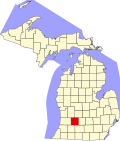
Hickory Corners, Michigan

Last updated
Hickory Corners, Michigan
USA Michigan location map.svg
Red pog.svg
Hickory Corners
Coordinates: 42°26′29″N85°22′33″W / 42.44139°N 85.37583°W / 42.44139; -85.37583 Coordinates: 42°26′29″N85°22′33″W / 42.44139°N 85.37583°W / 42.44139; -85.37583
Country United States
State Michigan
County Barry
Township Barry
Area
[1]
  Total2.08 sq mi (5.38 km2)
  Land2.07 sq mi (5.36 km2)
  Water0.01 sq mi (0.01 km2)
Elevation
947 ft (289 m)
Population
 (2020)
  Total313
  Density151.21/sq mi (58.37/km2)
Time zone UTC-5 (Eastern (EST))
  Summer (DST) UTC-4 (EDT)
ZIP code
49060
Area code(s) 269 Exchange: 671
FIPS code 26-37960
GNIS feature ID0628188

Hickory Corners is a census-designated place (CDP) in Barry Township in Barry County, Michigan, United States. The population was 322 at the 2010 census. [2]

Contents

History

The first settler, the Rev. Moses Lawrence, built his home in 1834 on the shore of Lawrence Lake about a half mile east of the present town. In 1837, surveyors found a large hickory tree in the center of section 28, from which the settlement took its name. Solomon C. Hall built the first house in the town and became the first postmaster in July 1844. [3]

Geography

Hickory Corners is located in southwestern Barry County at the intersection of Kellogg School Road and West Hickory Road. It is 1.5 miles (2.4 km) north of the southern boundary of Barry County with Kalamazoo County and 2.5 miles (4.0 km) east of state highway M-43.

According to the United States Census Bureau, the Hickory Corners CDP has a total area of 2.1 square miles (5.4 km2), of which 0.004 square miles (0.01 km2), or 0.28%, is water. [2]

Demographics

Historical population
CensusPop.
2020 313
U.S. Decennial Census [4]

Sites of interest

The Gilmore Car Museum, a collection of classic automobiles, is located at the intersection of M-43 and West Hickory Road, with a Hickory Corners mailing address. The museum includes the Michigan Motor Sports Hall of Fame.

The Kellogg Biological Station, an off-campus education complex of Michigan State University, has a Hickory Corners mailing address and is located 3 miles (5 km) southwest of the center of town, on the northeast shore of Gull Lake.

Media

On the CBS TV series The Neighborhood , the character Gemma is from Hickory Corners. Her husband, Dave, is from East Kalamazoo.

Related Research Articles

Van Buren County, Michigan County in Michigan, United States

Van Buren County is a county located in the U.S. state of Michigan. As of the 2020 Census, the population was 75,587. The county seat is Paw Paw. The county was founded in 1829 and organized in 1837.

Kalamazoo County, Michigan County in Michigan, United States

Kalamazoo County is a county located in the U.S. state of Michigan. As of 2020, the population was 261,670. The county seat is Kalamazoo.

Clare County, Michigan County in Michigan, United States

Clare County is a county in the U.S. state of Michigan. As of the 2020 Census, the population was 30,856. The county seat is Harrison.

Berrien County, Michigan County in Michigan, United States

Berrien County is a county on the south line of Michigan, at the southwestern corner of the state. As of the 2020 Census, the population was 154,316. The county seat is St. Joseph.

Barry County, Michigan County in Michigan, United States

Barry County is a county in the U.S. state of Michigan. As of the 2020 United States Census, the population was 62,423. The county seat is Hastings.

Baraga County, Michigan County in Michigan, United States

Baraga County is a county in the Upper Peninsula in the U.S. state of Michigan. As of the 2020 Census, the population was 8,158, making it Michigan's fifth-least populous county. The county seat is L'Anse. The county is named after Bishop Frederic Baraga, a Catholic missionary who ministered to the Ojibwa Indians in the Michigan Territory.

Barry Township, Michigan Township in Michigan, United States

Barry Township is a civil township of Barry County in the U.S. state of Michigan. As of the 2010 census, the township population was 3,378.

Paw Paw Lake, Michigan Census-designated place & unincorporated community in Michigan, United States

Paw Paw Lake is an unincorporated community in Berrien County in the U.S. state of Michigan. It is a census-designated place (CDP) for statistical purposes, without legal status as a municipality. The community is located within areas of both Coloma Charter Township and Watervliet Township in the area surrounding Paw Paw Lake and Little Paw Paw Lake, excluding the cities of Watervliet and Coloma. The population of the CDP was 3,511 at the 2010 census.

Argentine, Michigan Census-designated place & unincorporated community in Michigan, United States

Argentine is an unincorporated community and census-designated place (CDP) in Argentine Township, Genesee County, in the U.S. state of Michigan. The population was 2,525 as of the 2010 census, up from 2,285 at the 2000 census. It was first settled in 1836.

South Gull Lake, Michigan Census-designated place & unincorporated community in Michigan, United States

South Gull Lake is a census-designated place (CDP) in Ross Township, Kalamazoo County, in the U.S. state of Michigan. It includes the unincorporated communities of Yorkville, Gull Lake, and Midland Park and does not have any legal status as an incorporated municipality. The population of the CDP was 1,182 at the 2010 census, down from 1,526 at the 2000 census.

Greilickville, Michigan Census-designated place & unincorporated community in Michigan, United States

Greilickville is an unincorporated community in Leelanau County in the U.S. state of Michigan. It is a census-designated place (CDP) used for statistical purposes and has no legal standing as a municipality. The population was 1,530 at the 2010 census, up from 1,415 at the 2000 census.

Houghton Lake, Michigan Census-designated place & unincorporated community in Michigan, United States

Houghton Lake is an unincorporated community and census-designated place (CDP) in Roscommon County in the U.S. state of Michigan. The CDP is located within Denton, Lake, and Roscommon townships. The population was 3,427 at the 2010 census.

Orleans is a town in Jefferson County, New York, United States. The population was 2,789 at the 2010 census, up from 2,463 in 2000. The town is located in the northern part of the county and is north of Watertown. Orleans is named after the commune of Orléans in France.

Scriba, New York Town in New York, United States

Scriba is a town in Oswego County, New York, United States. The population was 6,840 at the 2010 census. The town is named after landowner George Scriba.

Seven Corners, Virginia Census-designated place in Virginia, United States

Seven Corners is a commercial center and census-designated place (CDP) in Fairfax County, Virginia, United States. The population was 9,255 at the 2010 census. Seven Corners has a "Falls Church" mailing address but is not within Falls Church's city limits. The area got its name from the intersection of State Route 7, U.S. Route 50, State Route 613, State Route 338 and Wilson Boulevard. The junction of these four roads once created seven corners.

North Shore is a census-designated place (CDP) in Franklin County, Virginia, United States. The population was 3,094 at the 2010 census, up from 2,112 in 2000. It is part of the Roanoke Metropolitan Statistical Area.

Short Pump is a census-designated place (CDP) in Henrico County, Virginia, United States. It is a suburb of Richmond, Virginia. The population was 24,729 at the 2010 census.

Galway, New York Town in New York, United States

Galway is a town located in Saratoga County, New York, United States. As of the 2000 census, the town had a total population of 3,589. The town contains a village also named Galway. Both the town and village are located in the western part of the county, north of Schenectady.

Delton is a census-designated place (CDP) in Barry Township in Barry County, Michigan, United States. The population was 872 at the 2010 census.

Dowling is a census-designated place (CDP) in Baltimore Township in Barry County, Michigan, United States. The population was 374 at the 2010 census.

References

  1. "2020 U.S. Gazetteer Files". United States Census Bureau. Retrieved May 21, 2022.
  2. 1 2 "Geographic Identifiers: 2010 Demographic Profile Data (G001): Hickory Corners CDP, Michigan". U.S. Census Bureau, American Factfinder. Archived from the original on February 12, 2020. Retrieved December 23, 2013.
  3. Romig, Walter (1986) [1973]. Michigan Place Names. Detroit, Michigan: Wayne State University Press. ISBN   0-8143-1838-X.
  4. "Census of Population and Housing". Census.gov. Retrieved June 4, 2016.