References
- ↑ U.S. Geological Survey Geographic Names Information System: Hickory Corners, Ohio
- ↑ Butler, Joseph Green (1921). History of Youngstown and the Mahoning Valley, Ohio. American Historical Society. p. 592.
- ↑ "Mahoning County". Jim Forte Postal History. Retrieved January 18, 2016.
Municipalities and communities of Mahoning County, Ohio, United States | ||
|---|---|---|
| Cities | 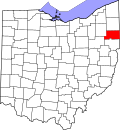 | |
| Villages | ||
| Townships | ||
| CDPs | ||
| Other communities | ||
| Footnotes | ‡This populated place also has portions in an adjacent county or counties | |
40°58′23″N80°51′21″W / 40.97306°N 80.85583°W
| | This Mahoning County, Ohio state location article is a stub. You can help Wikipedia by expanding it. |