Millville, Ohio | |
|---|---|
 Millville  Millville | |
| Coordinates: 40°54′21″N80°48′23″W / 40.90583°N 80.80639°W | |
| Country | United States |
| State | Ohio |
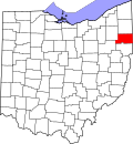
| Counties | Mahoning |
| Township | Green |
| Elevation | 1,033 ft (315 m) |
| Time zone | UTC-5 (Eastern (EST)) |
| • Summer (DST) | UTC-4 (EDT) |
| ZIP Code | 44460 (Salem) |
| GNIS feature ID | 1048979 [1] |
Millville is an unincorporated community in Green Township, Mahoning County, Ohio, in the U.S. state of Ohio.