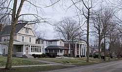
Salem was founded by a New Jersey clockmaker, Zadok Street, and a Pennsylvanian potter, John Straughan, in 1806. The city was named after Salem, New Jersey, Street's native community. The name Salem itself is a biblical derivative of Jerusalem in the Middle East, which means "city of peace".[7] The city's early settlers included the Religious Society of Friends, also known as Quakers, which the local school district's sports teams honor by referring to themselves collectively as the Salem Quakers.[8][9] Salem was incorporated in 1830.[10]
Salem was a center of abolitionist and suffragist activity in the 19th century. The Anti-Slavery Bugle, an abolitionist newspaper, was published in Salem beginning in 1845.[11] A local group of the Progressive Friends, an association of Quakers who separated from the main body partly to be freer to work for such causes as abolitionism and women's rights, formed in Salem in 1849.[12] The local school board at that time was composed entirely of abolitionists.[13] Salem was the site of an annual conference, the Anti-Slavery Fair, whose purpose was to raise money for anti-slavery activities.[14] The Daniel Howell Hise House and John Street House were stops on the Underground Railroad.[15][16]
In April 1850, Salem hosted the first Women's Rights Convention in Ohio, the third such convention in the United States (the first two being the Seneca Falls Convention and Rochester Women's Rights Convention of 1848). The Salem Convention was the first of these conventions to be organized on a statewide basis.[17] All the convention officers were women. Men were not allowed to vote, sit on the platform, or speak during the convention. The male spectators were supportive, however, and when the convention was over, they created an organization of their own and endorsed the actions of the women's convention.[18]
Advantageously located between Cleveland and Pittsburgh, Salem thrived on an industrial-based economy in the 19th and 20th centuries. For several decades, Salem's largest employers included American Standard Brands, Eljer, Mullins Manufacturing,[19] Deming Pump, and Salem China. Today, American Standard retains production in the city, as well as the Fresh Mark meat production facility and several tool-and-die manufacturers.[20]
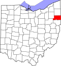
Salem is located about 18 miles (29km) southwest of Youngstown, 28 miles (45km) east of Canton, and 60 miles (97km) southeast of Cleveland. According to the United States Census Bureau, the city has an area of 6.43 square miles (16.65km2), all land.[21] Salem is the largest incorporated place by area in Columbiana County.
The city is mostly surrounded by unincorporated Perry Township. Salem has annexed portions of Perry Township.[22][23][24] Several acres of Salem Township and Green Township were annexed into the city limits in 2000 and 2001. Other actions to spur economic development undertaken around the same time annexed specific land: in 1999, 82.24 acres (332,800m2) of Salem Township were granted police and fire protection, snow removal service, and other city services.[25]
As of the 2020 census, Salem had a population of 11,915 and a median age of 43.0 years. 20.9% of residents were under the age of 18 and 22.2% of residents were 65 years of age or older. For every 100 females there were 95.5 males, and for every 100 females age 18 and over there were 92.0 males.[29]
99.3% of residents lived in urban areas, while 0.7% lived in rural areas.[30]
There were 5,151 households in Salem, of which 24.2% had children under the age of 18 living in them. Of all households, 38.2% were married-couple households, 21.3% were households with a male householder and no spouse or partner present, and 32.0% were households with a female householder and no spouse or partner present. About 37.1% of all households were made up of individuals and 17.3% had someone living alone who was 65 years of age or older.[29]
There were 5,704 housing units, of which 9.7% were vacant. The homeowner vacancy rate was 2.7% and the rental vacancy rate was 8.7%.[29]
As of the census[32] of 2010, there were 12,303 people, 5,272 households, and 3,118 families living in the city. The population density was 1,913.4 inhabitants per square mile (738.8/km2). There were 5,763 housing units at an average density of 896.3 per square mile (346.1/km2). The racial makeup of the city was 95.9% White, 0.7% African American, 0.2% Native American, 0.4% Asian, 1.6% from other races, and 1.2% from two or more races. Hispanic or Latino of any race were 2.5% of the population.
There were 5,272 households, of which 26.3% had children under the age of 18 living with them, 41.5% were married couples living together, 12.3% had a female householder with no husband present, 5.3% had a male householder with no wife present, and 40.9% were non-families. 34.9% of all households were made up of individuals, and 15.9% had someone living alone who was 65 years of age or older. The average household size was 2.25 and the average family size was 2.87.
The median age in the city was 42.8 years. 21.2% of residents were under the age of 18; 7.7% were between the ages of 18 and 24; 23.6% were from 25 to 44; 28.3% were from 45 to 64; and 19.1% were 65 years of age or older. The gender makeup of the city was 47.9% male and 52.1% female.
2000 census
As of the census[4] of 2000, there were 12,197 people, 5,146 households, and 3,247 families living in the city. The population density was 2,228.2 peopleper square mile (860.3 people/km2). There were 5,505 housing units at an average density of 1,005.7 per square mile (388.3/km2). The racial makeup of the city was 98.35% White, 0.52% African American, 0.09% Native American, 0.34% Asian, 0.02% Pacific Islander, 0.08% from other races, and 0.59% from two or more races. Hispanic or Latino of any race were 0.54% of the population.
There were 5,146 households, out of which 28.1% had children under the age of 18 living with them, 48.7% were married couples living together, 10.6% had a female householder with no husband present, and 36.9% were non-families. 32.8% of all households were made up of individuals, and 17.1% had someone living alone who was 65 years of age or older. The average household size was 2.31 and the average family size was 2.92.
In the city the population was spread out, with 22.8% under the age of 18, 8.1% from 18 to 24, 27.4% from 25 to 44, 21.6% from 45 to 64, and 20.1% who were 65 years of age or older. The median age was 40 years. For every 100 females, there were 84.9 males. For every 100 females age 18 and over, there were 81.0 males.
The median income for a household in the city was $30,006, and the median income for a family was $40,191. Males had a median income of $31,630 versus $19,471 for females. The per capita income for the city was $16,579. About 9.8% of families and 11.7% of the population were below the poverty line, including 17.9% of those under age 18 and 9.8% of those age 65 or over.
Economy
The corner of Lundy and State streets downtown
According to the Sustainable Opportunity Development Center in Salem,[33] as of 2022, the top employers in the city are:
Salem operates under a statutory mayor–council government. Eight council members are elected as a legislature for two-year terms, which constitutes four separate wards, three at-large districts, and a council president.[36] An independently elected mayor serves as an executive.[36] As of 2026, the mayor is Cyndi Baronzzi Dickey (R) and the council president is Evan Newman (R).[37] The mayor, auditor, treasurer, and law director are all elected to four-year terms.
U.S. Route 62 travels around downtown Salem on an east–west route. State Route 9 runs north–south through the city and terminates at its intersection with U.S. 62. State Route 14 travels east–west through Salem, sharing a short concurrency with SR 9 and State Route 173 on State Street. SR 173's eastern terminus is in downtown Salem and travels east–west to Alliance. State Route 344's western terminus is also in downtown Salem and travels east–west to Columbiana.[42]
Notable people
Dustin Bates, lead singer and songwriter for Starset and formerly Downplay
Chalkley Beeson, businessman, musician, lawman, and owner of Long Branch Saloon
↑The girls' and boys' teams' individual mascots are known as the "Quaker Lady" (or "Quaker Sadie") and "Quaker Sam," respectively.
↑The team nickname (and, possibly, the American tradition of placing the word "Fighting" in front of such nicknames) was noted by USA Today as one of several "that could be considered offensive". See "What's in a Nickname?" USA Today, October 23, 1991, Sports section, 06C.
↑Anti-Slavery Bugle, Chronicling America: Historic American Newspapers. Library of Congress.
↑Thomas, Allen C., (November 1920). "Congregational or Progressive Friends". Bulletin of Friends' Historical Society of Philadelphia, Vol. 10, No. 1. p. 28.
↑Stanton, Elizabeth Cady; Anthony, Susan B.; Gage, Matilda Joslyn (1881). History of Woman Suffrage, p. 110. Volume 1 of 6. Rochester, NY: Susan B. Anthony (Charles Mann Press).
↑Ohio Department of Transportation (2015). Official Ohio Transportation Map(PDF) (Map). c. 1:570,240. Columbus: Ohio Department of Transportation. Retrieved March 29, 2025.
This page is based on this Wikipedia article Text is available under the CC BY-SA 4.0 license; additional terms may apply. Images, videos and audio are available under their respective licenses.


