Damascus, Ohio

Last updated

Damascus, Ohio
Damascus Grade School.jpg
Damascus Grade School (1902)
Columbiana County Ohio incorporated and unincorporated areas Damascus highlighted.png
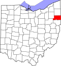
Location of Damascus in Mahoning and Columbiana counties and in the State of Ohio
Coordinates: 40°54′15″N80°57′08″W / 40.90417°N 80.95222°W / 40.90417; -80.95222
Country United States
State Ohio
Counties Mahoning, Columbiana
Townships Goshen, Butler
Area
[1]
  Total0.81 sq mi (2.09 km2)
  Land0.80 sq mi (2.07 km2)
  Water0.01 sq mi (0.02 km2)
Elevation
[2]
1,207 ft (368 m)
Population
 (2020)
  Total418
  Density523.15/sq mi (202.04/km2)
Time zone UTC-5 (Eastern (EST))
  Summer (DST) UTC-4 (EDT)
ZIP code
44619
Area code(s) 330, 234
FIPS code 39-20030
GNIS feature ID2628881 [2]
School District West Branch High School

Damascus is an unincorporated community and census-designated place in southern Mahoning and northern Columbiana counties in the U.S. state of Ohio. [3] [2] As of the 2020 census, it had a population of 418. The community lies at the intersection of U.S. Route 62 and State Routes 173 and 534. [4]

Contents

The community is located in southwestern Goshen Township in Mahoning County and northwestern Butler Township in Columbiana County. Damascus has a post office, with the ZIP code of 44619. [5] It is part of the Youngstown–Warren metropolitan area and the Salem micropolitan area.

History

Damascus was platted in 1808. [6] The community derives its name from the ancient city of Damascus, Syria. [7] Damascus was originally built up chiefly by Quakers. [8]

The Damascus post office opened in 1828. [9]

Demographics

Historical population
CensusPop.Note
2010 443
2020 418−5.6%
U.S. Decennial Census [10] [11]

Related Research Articles

<span class="mw-page-title-main">Beaver Township, Mahoning County, Ohio</span> Township in Ohio, United States

Beaver Township is one of the fourteen townships of Mahoning County, Ohio, United States. The 2020 census found 6,756 people in the township.

<span class="mw-page-title-main">Lees Creek, Ohio</span> Unincorporated community in Ohio, U.S.

Lees Creek, also known as Centerville, is an unincorporated community in central Wayne Township, Clinton County, Ohio, United States. It lies at the intersection of State Route 729 with Cox Road, 6 miles south of Sabina and 12 miles (19 km) southeast of Wilmington, the county seat of Clinton County. It lies between the headwaters of the Middle Fork of Lees Creek, to the southeast, and the Anderson Fork of Caesar Creek. it had a post office, with the ZIP code 45138. The Post Office closed in 2012 and the town, including East Clinton High School, now carries a Sabina mailing address.

<span class="mw-page-title-main">Goshen Township, Mahoning County, Ohio</span> Township in Ohio, United States

Goshen Township is one of the fourteen townships of Mahoning County, Ohio, United States. The 2020 census recorded 3,101 people in the township.

<span class="mw-page-title-main">Middleburg, Logan County, Ohio</span> Unincorporated community in Ohio, United States

Middleburg is an unincorporated community in northern Zane Township, Logan County, Ohio, United States. It has a post office with the ZIP code 43336. It is located at the intersection of State Route 287 with County Road 153, near the headwaters of the Big Darby Creek and a short distance southwest of U.S. Route 33.

<span class="mw-page-title-main">Roundhead, Ohio</span> Unincorporated community in Ohio, U.S.

Roundhead is an unincorporated community in southeastern Roundhead Township, Hardin County, Ohio, United States. It has a post office with the ZIP code 43346.

<span class="mw-page-title-main">Johnsville, Ohio</span> Unincorporated community in Ohio, U.S.

Johnsville, also known as Shauck, is an unincorporated community in northern Perry Township, Morrow County, Ohio, United States. It has a post office with the ZIP code 43349. It is located at the intersection of U.S. Route 42 with State Route 314.

<span class="mw-page-title-main">Dola, Ohio</span> Census-designated place in Ohio, United States

Dola is a census-designated place in central Washington Township, Hardin County, Ohio, United States. As of the 2020 United States Census it had a population of 143. It has a post office with the ZIP code 45835.

<span class="mw-page-title-main">Raymond, Ohio</span> CDP in Ohio, United States

Raymond is a census-designated place in eastern Liberty Township, Union County, Ohio, United States. It has a post office with the ZIP code 43067. It is located at the intersection of State Routes 347 and 739. The population was 280 at the 2020 census.

<span class="mw-page-title-main">Radnor, Ohio</span> Census-designated place in Ohio, United States

Radnor is an unincorporated community and census-designated place (CDP) in central Radnor Township, Delaware County, Ohio, United States. As of the 2020 census it had a population of 180. Radnor has a post office with the ZIP code of 43066. It lies along State Route 203 at its intersection with Radnor Road.

<span class="mw-page-title-main">Haydenville, Ohio</span> United States historic place

Haydenville is an unincorporated community and census-designated place (CDP) in southern Green Township, Hocking County, Ohio, United States. As of the 2020 census the population of the CDP was 337.

<span class="mw-page-title-main">Wingett Run, Ohio</span> Unincorporated community in Ohio, U.S.

Wingett Run is an unincorporated community in western Ludlow Township, Washington County, Ohio, United States. It has a post office with the ZIP code 45789. It is located along State Route 26 and the Little Muskingum River.

<span class="mw-page-title-main">Vincent, Ohio</span> Census-designated place in Ohio, US

Vincent is a census-designated place in southern Barlow Township, Washington County, Ohio, United States. It lies along State Route 339 near Tupper Creek, a subsidiary of the Little Hocking River, which in turn meets the Ohio River at Little Hocking to the south. The population was 329 at the 2020 census.

<span class="mw-page-title-main">Reno, Ohio</span> Census-designated place in Ohio, US

Reno is a census-designated place in southern Marietta Township, Washington County, Ohio, United States. It has a post office with the ZIP code 45773. It is located on the Ohio River a short distance south of the county seat of Marietta. State Route 7 forms its main street. The population was 1,129 at the 2020 census.

<span class="mw-page-title-main">Newport, Washington County, Ohio</span> CDP in Ohio, United States

Newport is a census-designated place in eastern Newport Township, Washington County, Ohio, United States. It has a post office with the ZIP code 45768. Newport lies along the Ohio River several miles above the county seat of Marietta. Today its main street is designated as State Route 7. The population of the CPD was 895 at the 2020 census.

<span class="mw-page-title-main">Little Hocking, Ohio</span> Census-designated place in Ohio, US

Little Hocking is a census-designated place in southern Belpre Township, Washington County, Ohio, United States. It has a post office with the ZIP code 45742. The population of the CPD was 244 at the 2020 census.

<span class="mw-page-title-main">Cutler, Ohio</span> Unincorporated community in Ohio, U.S.

Cutler is an unincorporated community in southwestern Fairfield Township, Washington County, Ohio, United States. It has a post office with the ZIP code 45724. It lies at the intersection of State Route 555 and County Road 59 near Gilbert Run, a subsidiary of the Little Hocking River, which meets the Ohio River at Little Hocking to the southeast.

<span class="mw-page-title-main">Bartlett, Ohio</span> Unincorporated community in Ohio, U.S.

Bartlett is an unincorporated community in southwestern Wesley Township, Washington County, Ohio, United States. It has a post office with the ZIP code 45713. It sits at the intersection of State Routes 550 and 555 near Coal Run, a subsidiary of Wolf Creek, which meets the Muskingum River at Waterford to the north. Near Bartlett is located the Shinn Covered Bridge, which spans Wolf Creek.

<span class="mw-page-title-main">Barlow, Ohio</span> Unincorporated community in Ohio, U.S.

Barlow is an unincorporated community in western Barlow Township, Washington County, Ohio, United States. Although it is unincorporated, it has a ZIP code 45712. It lies at the intersection of State Routes 339 and 550 near the South Fork of Wolf Creek, which meets the Muskingum River at Waterford to the north.

<span class="mw-page-title-main">Kansas, Ohio</span> Census-designated place in Ohio, United States

Kansas is a census-designated place in northwestern Liberty Township, Seneca County, Ohio, United States. It has a post office with the ZIP code 44841. It is located along State Route 635. The population was 175 at the 2020 census.

<span class="mw-page-title-main">Tedrow, Ohio</span> Census-designated place in Ohio, United States

Tedrow is an unincorporated community and census-designated place (CDP) in southwestern Dover Township, Fulton County, Ohio, United States. It lies at the intersection of the east-west County Road J with the north-south County Roads 17-2 and 17-3, 3 miles (5 km) north and 3.5 miles (5.6 km) west of the northern edge of the city of Wauseon, the county seat of Fulton County. The community lies less than one mile north of the Ohio Turnpike, although the nearest exit is several miles away.

References

  1. "ArcGIS REST Services Directory". United States Census Bureau. Retrieved September 20, 2022.
  2. 1 2 3 U.S. Geological Survey Geographic Names Information System: Damascus, Ohio
  3. DeLorme, Ohio Atlas & Gazetteer, 7th ed., 2004, p. 52 ISBN   0-89933-281-1
  4. DeLorme, Ohio Atlas & Gazetteer, 7th ed., 2004, p. 34 ISBN   0-89933-281-1
  5. Zip Code Lookup
  6. Mack, Horace (1879). History of Columbiana County, Ohio: With Illustrations and Biographical Sketches of Some of Its Prominent Men and Pioneers. Unigraphic. p. 100.
  7. Overman, William Daniel (1958). Ohio Town Names. Akron, OH: Atlantic Press. p. 36.
  8. McCord, William B. (1905). History of Columbiana County, Ohio and Representative Citizens. Biographical Publishing Company. pp.  267.
  9. Sanderson, Thomas W. (1907). Twentieth Century History of Youngstown and Mahoning County. Biographical Publishing Company. pp.  204.
  10. "Census of Population and Housing". Census.gov. Retrieved June 4, 2016.
  11. "Geographic Identifiers: 2010 Demographic Profile Data (G001): Damascus CDP, Ohio". U.S. Census Bureau, American Factfinder. Archived from the original on February 10, 2020. Retrieved March 28, 2013.