References
- ↑ U.S. Geological Survey Geographic Names Information System: Snodes, Ohio
- ↑ "Mahoning County". Jim Forte Postal History. Retrieved January 18, 2016.
- ↑ Department Reports of the State of Ohio: Containing the Decisions, Opinions, Rulings of the Supreme Court, Attorney General, Public Utilities Commission, State Treasurer and Several Other State Departments. Department Reports Publishing Company. 1919. p. 741.
Municipalities and communities of Mahoning County, Ohio, United States | ||
|---|---|---|
| Cities | 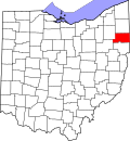 | |
| Villages | ||
| Townships | ||
| CDPs | ||
| Other communities | ||
| Footnotes | ‡This populated place also has portions in an adjacent county or counties | |
40°57′33″N80°59′37″W / 40.95917°N 80.99361°W
| | This Mahoning County, Ohio state location article is a stub. You can help Wikipedia by expanding it. |