Woodworth, Ohio

Last updated

Woodworth, Ohio
Mahoning County Ohio incorporated and unincorporated areas Woodworth highlighted.png
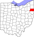
Location in Mahoning County, Ohio
USA Ohio relief location map.svg
Red pog.svg
Woodworth
Usa edcp relief location map.png
Red pog.svg
Woodworth
Coordinates: 40°58′40″N80°39′17″W / 40.97778°N 80.65472°W / 40.97778; -80.65472
CountryUnited States
State Ohio
County Mahoning
Township Beaver
Area
[1]
  Total
3.14 sq mi (8.14 km2)
  Land3.09 sq mi (7.99 km2)
  Water0.05 sq mi (0.14 km2)
Elevation
[2]
1,125 ft (343 m)
Population
 (2020) [3]
  Total
1,784
  Density577.91/sq mi (223.15/km2)
Time zone UTC-5 (Eastern (EST))
  Summer (DST) UTC-4 (EDT)
ZIP Codes
Area code(s) 330, 234
FIPS code39-86534
GNIS feature ID2812829 [2]

Woodworth is an unincorporated community and census-designated place in Beaver Township, Mahoning County, Ohio, United States. [2] The population was 1,784 at the 2020 census. [3] It lies along State Routes 7 and 626, bordering the communities of Boardman to the north and North Lima to the south. It is part of the Youngstown–Warren metropolitan area.

Contents

History

Woodworth was originally called Steamtown. [4] A post office called Steamtown was in operation from 1857 until 1860 and a post office called Woodworth from 1874 until 1905. [5]

Demographics

Historical population
CensusPop.Note
2020 1,784
U.S. Decennial Census [6]

References

  1. "2024 U.S. Gazetteer Files: Ohio". United States Census Bureau. Retrieved April 16, 2025.
  2. 1 2 3 U.S. Geological Survey Geographic Names Information System: Woodworth, Ohio
  3. 1 2 "P1. Race – Woodworth CDP, Ohio: 2020 DEC Redistricting Data (PL 94-171)". U.S. Census Bureau. Retrieved April 16, 2025.
  4. Butler, Joseph Green (1921). History of Youngstown and the Mahoning Valley, Ohio. American Historical Society. p.  587.
  5. "Mahoning County". Jim Forte Postal History. Retrieved January 18, 2016.
  6. "Census of Population and Housing". Census.gov. Retrieved June 4, 2016.