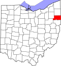
East Alliance, Ohio | |
---|---|
Coordinates: 40°54′48″N81°4′42″W / 40.91333°N 81.07833°W | |
Country | United States |
State | Ohio |
County | Mahoning |
Township | Smith |
Area | |
• Total | 0.83 sq mi (2.14 km2) |
• Land | 0.79 sq mi (2.05 km2) |
• Water | 0.03 sq mi (0.09 km2) |
Elevation | 1,059 ft (323 m) |
Population (2020) | |
• Total | 268 |
• Density | 337.96/sq mi (130.48/km2) |
Time zone | UTC-5 (Eastern (EST)) |
• Summer (DST) | UTC-4 (EDT) |
ZIP Code | 44601 (Alliance) |
Area code(s) | 234/330 |
FIPS code | 38-23254 |
GNIS feature ID | 2812832 [2] |
East Alliance is an unincorporated community and census-designated place (CDP) in Mahoning County, Ohio, United States. [2] It was first listed as a CDP prior to the 2020 census.
The CDP is in the southwest corner of Mahoning County and the southwest corner of Smith Township. It is bordered to the west by the city of Alliance in Stark County and to the south by Knox Township in Columbiana County. U.S. Route 62, following the Columbiana County line, runs along the south edge of East Alliance; it leads west into Alliance and east 11 miles (18 km) to Salem.
Census | Pop. | Note | %± |
---|---|---|---|
2020 | 268 | — | |
U.S. Decennial Census [3] |
Glenmoor is an unincorporated community and census-designated place in southwestern St. Clair Township, Columbiana County, Ohio, United States. The population was 1,829 at the 2020 census. Glenmoor is located in the Salem micropolitan area and the greater Youngstown–Warren area.
Braceville Township is one of the twenty-four townships of Trumbull County, Ohio, United States. The 2020 census found 2,467 people in the township.
Beaver Township is one of the fourteen townships of Mahoning County, Ohio, United States. The 2020 census found 6,756 people in the township.
Weathersfield Township is one of the twenty-four townships of Trumbull County, Ohio, United States. The 2020 census found 24,689 people in the township.>
Goshen Township is one of the fourteen townships of Mahoning County, Ohio, United States. The 2020 census recorded 3,101 people in the township.
Smith Township is one of the fourteen townships of Mahoning County, Ohio, United States. The 2020 census found 4,097 people in the township.
Unity Township is one of the eighteen townships of Columbiana County, Ohio, United States. The 2020 census reported 9,721 people living in the township.
St. Clair Township is one of the eighteen townships of Columbiana County, Ohio, United States. As of the 2020 census the population was 7,804.
Springfield Township is one of the fourteen townships of Mahoning County, Ohio, United States. The 2020 census found 6,800 people in the township.
Salem Township is one of the eighteen townships of Columbiana County, Ohio, United States. The 2020 census reported 5,142 people living in the township.
Lexington Township is one of the seventeen townships of Stark County, Ohio, United States. The 2020 census found 4,925 people in the township.
Perry Township is one of the eighteen townships of Columbiana County, Ohio, United States. The 2020 census reported 16,318 people living in the township.
Butler Township is one of the eighteen townships of Columbiana County, Ohio, United States. As of the 2020 census the population was 3,542.
Fairfield Township is one of the eighteen townships of Columbiana County, Ohio, United States, extending into southern Mahoning County. The 2020 census reported 9,769 people living in the township.
Knox Township is one of the eighteen townships of Columbiana County, Ohio, United States. As of the 2020 census it had a population of 4,068.
Liverpool Township is one of the eighteen townships of Columbiana County, Ohio, United States. As of the 2020 census the population was 3,862.
Middleton Township is one of the eighteen townships of Columbiana County, Ohio, United States. The 2020 census reported 3,359 people living in the township.
Green Township is one of the fourteen townships of Mahoning County, Ohio, United States. The 2020 census found 3,414 people in the township.
Salem Heights is an unincorporated community and census-designated place (CDP) in Columbiana County, Ohio, United States. It was first listed as a CDP prior to the 2020 census, in which its population was 336. Salem Heights sits on the 1,275-foot (389 m) Blackburn Hill, separated from the city of Salem by the valley of the Middle Fork of the Little Beaver Creek. It is part of the Salem micropolitan area.
Bolton is an unincorporated area and census-designated place (CDP) in Stark County, Ohio, United States. It was first listed as a CDP prior to the 2020 census.