Beloit, Ohio

Last updated • 4 min readFrom Wikipedia, The Free Encyclopedia

Beloit, Ohio
Beloit high school.jpg
West Branch High School in southern Beloit
Mahoning County Ohio incorporated and unincorporated areas Beloit highlighted.png
Location of Beloit in Mahoning County, Ohio.
USA Ohio relief location map.svg
Red pog.svg
Beloit
Usa edcp relief location map.png
Red pog.svg
Beloit
Coordinates: 40°55′16″N81°00′05″W / 40.92111°N 81.00139°W / 40.92111; -81.00139
Country United States
State Ohio
County Mahoning
Township Smith
Area
[1]
  Total
0.98 sq mi (2.55 km2)
  Land0.97 sq mi (2.53 km2)
  Water0.01 sq mi (0.02 km2)
Elevation
[2]
1,132 ft (345 m)
Population
 (2020)
  Total
903
  Estimate 
(2023) [3]
892
  Density926.15/sq mi (357.54/km2)
Time zone UTC-5 (Eastern (EST))
  Summer (DST) UTC-4 (EDT)
ZIP code
44609
Area codes 234/330
FIPS code 39-05410 [4]
GNIS feature ID2398089 [2]

Beloit ( /bəˈlɔɪt/ bə-LOYT [5] ) is a village in southwestern Mahoning County, Ohio, United States. The population was 903 at the 2020 census. [6] [7] It is part of the Youngstown–Warren metropolitan area.

Contents

History

Beloit had its start in the late 1840s by the building of the railroad through that territory. [8] It was originally called Smithfield Station, and the name Beloit was adopted in 1863. [9] The name Beloit is a transfer from Beloit, Wisconsin. [10]

Geography

According to the United States Census Bureau, the village has a total area of 0.99 square miles (2.56 km2), of which 0.98 square miles (2.54 km2) is land and 0.01 square miles (0.03 km2) is water. [11]

Demographics

Historical population
CensusPop.Note
1880 162
1910 510
1920 58915.5%
1930 69417.8%
1940 7061.7%
1950 77810.2%
1960 87712.7%
1970 9215.0%
1980 1,09318.7%
1990 1,037−5.1%
2000 1,024−1.3%
2010 978−4.5%
2020 903−7.7%
2023 (est.)892 [3] −1.2%
U.S. Decennial Census [12]

2020 census

As of the 2020 census, [7] there were 903 people and 456 households living in Beloit. The racial makeup was 94.5% White, 1% Hispanic or Latino and >1% each African American, Native American, or some other race, with 7% of the population identifying as two or more races. 0.4% of the population speak a language other than English at home.

Of the families in Beloit, 23.1% were under 18 years of age, the average family size was 2.92 people, and 29.1% were never married. 18% are disabled and 4.2% are living without health insurance.

The median household income was $40,833, 8.8% were living in poverty, and of those living in poverty, 26.6% were male and 73.3% were female. [13] 12.8% have a bachelor's degree of higher, 73.6% are enrolled in K-12 education. 6% are under 5, 17.9% are 6-19, 59.2% are 20-64, and 16.8% are 65 or older. The median age is 40.8. 40.6% are male and 59.3% are female.

2010 census

As of the census [6] of 2010, there were 978 people, 425 households, and 275 families living in the village. The population density was 998.0 inhabitants per square mile (385.3/km2). There were 468 housing units at an average density of 477.6 per square mile (184.4/km2). The racial makeup of the village was 97.3% White, 0.3% African American, 0.1% Native American, 0.4% Asian, and 1.8% from two or more races. Hispanic or Latino people of any race were 0.3% of the population.

There were 425 households, of which 31.5% had children under the age of 18 living with them, 44.7% were married couples living together, 14.6% had a female householder with no husband present, 5.4% had a male householder with no wife present, and 35.3% were non-families. 31.5% of all households were made up of individuals, and 16.4% had someone living alone who was 65 years of age or older. The average household size was 2.30 and the average family size was 2.86.

The median age in the village was 43.4 years. 23.8% of residents were under the age of 18; 5.9% were between the ages of 18 and 24; 21.9% were from 25 to 44; 26.3% were from 45 to 64; and 22.1% were 65 years of age or older. The gender makeup of the village was 47.6% male and 52.4% female.

2000 census

As of the census [4] of 2000, there were 1,024 people, 426 households, and 287 families living in the village. The population density was 1,332.9 inhabitants per square mile (514.6/km2). There were 452 housing units at an average density of 588.4 per square mile (227.2/km2). The racial makeup of the village was 98.54% White, 0.29% African American, 0.10% Asian, 0.10% from other races, and 0.98% from two or more races. Hispanic or Latino people of any race were 0.10% of the population.

There were 426 households, out of which 28.9% had children under the age of 18 living with them, 49.1% were married couples living together, 14.8% had a female householder with no husband present, and 32.6% were non-families. 28.2% of all households were made up of individuals, and 12.4% had someone living alone who was 65 years of age or older. The average household size was 2.40 and the average family size was 2.94.

In the village, the population was spread out, with 23.3% under the age of 18, 8.0% from 18 to 24, 26.4% from 25 to 44, 22.0% from 45 to 64, and 20.3% who were 65 years of age or older. The median age was 40 years. For every 100 females there were 83.8 males. For every 100 females age 18 and over, there were 80.5 males.

The median income for a household in the village was $32,279, and the median income for a family was $40,096. Males had a median income of $31,042 versus $19,615 for females. The per capita income for the village was $16,359. About 8.7% of families and 10.6% of the population were below the poverty line, including 17.4% of those under age 18 and 8.3% of those age 65 or over.

Related Research Articles

<span class="mw-page-title-main">Galena, Ohio</span> Village in Ohio, United States

Galena is a village in Delaware County, Ohio, United States. The population was 924 at the 2020 United States Census.

<span class="mw-page-title-main">Lyons, Ohio</span> Village in Ohio, United States

Lyons is a village in Fulton County, Ohio, United States. The population was 602 at the 2020 census.

<span class="mw-page-title-main">Addyston, Ohio</span> Village in Ohio, United States

Addyston is a village in Miami Township, Hamilton County, Ohio, United States. Located along the Ohio River, it is a western suburb of the neighboring city of Cincinnati. The population was 927 at the 2020 census.

<span class="mw-page-title-main">Cleves, Ohio</span> Village in Ohio, United States

Cleves is a village in Miami Township, Hamilton County, Ohio, United States. Located along the Ohio River, it is a western suburb of Cincinnati. The population was 3,414 at the 2020 census.

<span class="mw-page-title-main">Evendale, Ohio</span> Village in Ohio, United States

Evendale is a village in Hamilton County, Ohio, United States, within the Cincinnati metropolitan area. The population was 2,669 at the 2020 census.
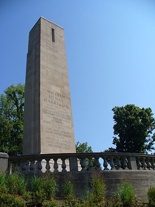
<span class="mw-page-title-main">North Bend, Ohio</span> Village in Ohio, United States

North Bend is a village in Miami Township, Hamilton County, Ohio, United States, along the Ohio River. It is a part of the Greater Cincinnati area. The population was 835 at the 2020 census.
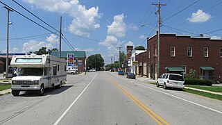
<span class="mw-page-title-main">Mowrystown, Ohio</span> Village in Ohio, United States

Mowrystown is a village in Highland County, Ohio, United States. The population was 385 at the 2020 census.

<span class="mw-page-title-main">Brinkhaven, Ohio</span> Village in Ohio, United States

Brinkhaven is a village in Union Township, Knox County, Ohio, United States. The population was 114 at the 2020 census.

<span class="mw-page-title-main">Athalia, Ohio</span> Village in Ohio, United States

Athalia is a village in Lawrence County, Ohio, United States, along the Ohio River. The population was 279 at the 2020 census.

<span class="mw-page-title-main">Hartford, Ohio</span> Village in Ohio, United States

Hartford is a village in the township of the same name in Licking County, Ohio, United States. The population was 404 at the 2020 census.

<span class="mw-page-title-main">Lowellville, Ohio</span> Village in Ohio, United States

Lowellville is a village in eastern Mahoning County, Ohio, United States, along the Mahoning River. The population was 996 at the 2020 census. Located about 8 miles (13 km) southeast of Youngstown, it is part of the Youngstown–Warren metropolitan area.

<span class="mw-page-title-main">Darbyville, Ohio</span> Village in Ohio, United States

Darbyville is a village in Pickaway County, Ohio, United States. The population was 186 at the 2020 census.

<span class="mw-page-title-main">Port Jefferson, Ohio</span> Village in Ohio, United States

Port Jefferson is a village in Salem Township, Shelby County, Ohio, United States. The population was 308 at the 2020 census.

<span class="mw-page-title-main">Limaville, Ohio</span> Census-designated place in Ohio, United States

Limaville is a census-designated place (CDP) and former village in Stark County, Ohio, United States. The population was 151 at the 2020 census. It is part of the Canton–Massillon Metropolitan Statistical Area.
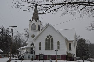
<span class="mw-page-title-main">Macksburg, Ohio</span> Village in Ohio, United States

Macksburg is a village in Washington County, Ohio, United States, along the West Fork of Duck Creek. The population was 120 at the 2020 census. The village is about 28 miles (45 km) south of Cambridge, Ohio.

<span class="mw-page-title-main">Wilson, Ohio</span> Village in Ohio, United States

Wilson is a village in Belmont and Monroe counties in the U.S. state of Ohio. The population was 129 at the 2020 census. It is part of the Wheeling metropolitan area.

<span class="mw-page-title-main">Clifton, Ohio</span> Village in Ohio, United States

Clifton is a village in Clark and Greene counties in the U.S. state of Ohio and is home to the Clifton Mill, one of the largest water-powered grist mills still in existence. The population was 131 at the 2020 census.

<span class="mw-page-title-main">Burkettsville, Ohio</span> Village in Ohio, United States

Burkettsville is a village in Darke and Mercer counties in the U.S. state of Ohio. The population was 272 at the 2020 census.

<span class="mw-page-title-main">Verona, Ohio</span> Village in Ohio, United States

Verona is a village in Montgomery and Preble counties in the U.S. state of Ohio. The population was 403 at the 2020 census. It is part of the Dayton Metropolitan Statistical Area.

<span class="mw-page-title-main">Beloit (town), Wisconsin</span> Town in Wisconsin, United States

The Town of Beloit is located in Rock County, Wisconsin, United States. The population was 7,721 at the 2020 census. The City of Beloit is located adjacent to the Town of Beloit. The unincorporated communities of Belcrest, Crestview, and Victory Heights are located in the town. The town hosts Festival on the Rock, an annual celebration held in September at Preservation Park.

References

  1. "ArcGIS REST Services Directory". United States Census Bureau. Retrieved September 20, 2022.
  2. 1 2 U.S. Geological Survey Geographic Names Information System: Beloit, Ohio
  3. 1 2 "Annual Estimates of the Resident Population for Incorporated Places in Ohio: April 1, 2020 to July 1, 2023". United States Census Bureau. Retrieved June 2, 2024.
  4. 1 2 "U.S. Census website". United States Census Bureau . Retrieved January 31, 2008.
  5. "E.W. Scripps School of Journalism Ohio Pronunciation Guide | Ohio University". www.ohio.edu. Ohio University. 2016. Retrieved October 22, 2022.
  6. 1 2 "U.S. Census website". United States Census Bureau . Retrieved January 6, 2013.
  7. 1 2 "Explore Census Data". data.census.gov. Retrieved October 23, 2021.
  8. Mack, Horace (1879). History of Columbiana County, Ohio: With Illustrations and Biographical Sketches of Some of Its Prominent Men and Pioneers. Unigraphic. p. 348.
  9. Sanderson, Thomas W. (1907). Twentieth Century History of Youngstown and Mahoning County. Biographical Publishing Company. pp.  226.
  10. Overman, William Daniel (1958). Ohio Town Names. Akron, OH: Atlantic Press. p. 12.
  11. "US Gazetteer files 2010". United States Census Bureau. Archived from the original on July 2, 2012. Retrieved January 6, 2013.
  12. "Census of Population and Housing". Census.gov. Retrieved June 4, 2015.
  13. "Beloit village, OH Profile". data.census.gov. U.S. Department of Commerce. Retrieved October 24, 2021.