West Township, Columbiana County, Ohio

Last updated

West Township, Columbiana County, Ohio
Great Trail Marker.JPG
The Great Trail passed through this area
Columbiana County Ohio incorporated and unincorporated areas West highlighted.png
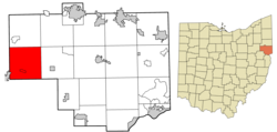
Location of West Township in Columbiana County
Coordinates: 40°46′11″N81°2′13″W / 40.76972°N 81.03694°W / 40.76972; -81.03694
Country United States
State Ohio
County Columbiana
Area
  Total
35.1 sq mi (90.9 km2)
  Land34.9 sq mi (90.4 km2)
  Water0.2 sq mi (0.5 km2)
Elevation
[1]
1,112 ft (339 m)
Population
 (2020) [2]
  Total
3,173
  Density90/sq mi (35/km2)
Time zone UTC-5 (Eastern (EST))
  Summer (DST) UTC-4 (EDT)
FIPS code 39-82852 [3]
GNIS feature ID1085907 [1]

West Township is one of the eighteen townships of Columbiana County, Ohio, United States. The 2020 census reported 3,173 people living in the township.

Contents

Geography

Located in the western part of the county, it borders the following townships:

One village and one unincorporated community are located in West Township:

Name and history

Historical population
CensusPop.Note
1980 3,022
1990 3,1624.6%
2000 3,3516.0%
2010 3,307−1.3%
2020 3,173−4.1%

It is the only West Township statewide. [4]

The township was organized in 1814. [5]

Government

The township is governed by a three-member board of trustees, who are elected in November of odd-numbered years to a four-year term beginning on the following January 1. Two are elected in the year after the presidential election and one is elected in the year before it. There is also an elected township fiscal officer, [6] who serves a four-year term beginning on April 1 of the year after the election, which is held in November of the year before the presidential election. Vacancies in the fiscal officership or on the board of trustees are filled by the remaining trustees.

Township Trustees

Fiscal Officer

References

  1. 1 2 "US Board on Geographic Names". United States Geological Survey. October 25, 2007. Retrieved January 31, 2008.
  2. "West township, Columbiana County, Ohio - Census Bureau Profile". United States Census Bureau. Retrieved June 5, 2023.
  3. "U.S. Census website". United States Census Bureau . Retrieved January 31, 2008.
  4. "Detailed map of Ohio" (PDF). United States Census Bureau. 2000. Retrieved February 16, 2007.
  5. Cranmer, Gibson Lamb (1891). History of the upper Ohio Valley. Vol. 2. Madison, Wisconsin: Brant & Fuller. p. 22.
  6. §503.24, §505.01, and §507.01 of the Ohio Revised Code. Accessed April 30, 2009.
  7. 1 2 3 4 "2020 General Election Results for Columbiana County" (PDF). Archived from the original (PDF) on June 8, 2021. Retrieved February 19, 2021.