
Highway M05 is a state international highway in Ukraine connecting the two largest cities: Kyiv and Odessa.
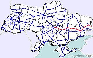
Highway M04 was a Ukraine international highway connecting Znamianka to Krasnodon on the border with Russia, where it continued into Russia as the A260.

Highway M03 is a Ukrainian international highway (M-highway) connecting Kyiv with Dovzhansky on the border with Russia, where it continues into Russia as the A270. It is part of European route E40 from Kyiv to Debaltseve at which it is part of European route E50 to the border with Russia. At 844 km (524 mi), the M03 is the longest international state highway in Ukraine.

Highway M07 is a Ukrainian international highway (M-highway) connecting Kyiv to Yahodyn on the border with Poland, where it continues into Poland as National Road 12 (DK12).
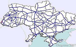
Highway M08 is the shortest Ukraine international highway. It serves as a loop route bypassing the city of Uzhhorod on the northern (mountainous) side. It is part of European route E50 and European route E58.

Highway M09 is a Ukrainian international highway (M-highway) which is part of the Warsaw - Lviv route. It starts as a split-off from the M12 near Ternopil, runs through Lviv, then turns north and heads towards the border with Poland. The highway terminates at the border checkpoint Rava-Ruska. Across the Polish border it continues as National Road 17 (DK17). The entire route is part of European route E372.

Highway M11 is a Ukraine international highway (M-highway) connecting Lviv with Przemyśl across the Polish - Ukrainian border, where it continues into Poland as National Road 28.
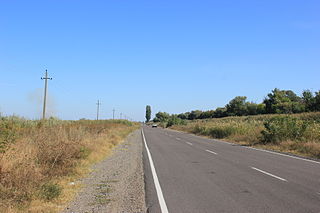
Highway M15 is a Ukrainian international highway (M-highway) connecting Odessa to Reni. The entire route is part of European route E87. The highway is also known as the highway Odesa–Reni.
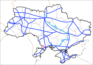
Highway M16 is a Ukrainian international highway (M-highway) connecting Odessa to Kuchurhan on the border with Moldova, where it continues as national road M14. The M16 is part of European route E58 and European route E581.
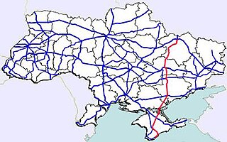
Highway M18 is a Ukrainian international highway (M-highway) connecting Kharkiv to the southern coast of Crimea in Yalta. The highway is also has an alternative route (M29) which runs parallel and designed as an expressway between Kharkiv and Novomoskovsk. The section from Novomoskovsk to Yalta is part of European route E105. The section from Kharkiv to Krasnohrad was previously P51.

Highway M19 is a Ukrainian international highway (M-highway) that completely corresponds to whole length of European route E85 that runs through Ukraine.

Highway H01 is a Ukrainian national highway (H-highway) connecting the capital of Ukraine Kyiv with the central regions. It runs through Kyiv, Kyiv Oblast, Cherkasy Oblast, and ends in Kirovohrad Oblast.

H20 is an important Ukraine national highway (H-highway) in the Donetsk Oblast, Donbas, Ukraine, running mainly north–south and connecting Sloviansk though Donetsk with Mariupol on the shores of Taganrog Bay in the Sea of Azov near the mouth of the Kalmius River. It passes through Kramatorsk, Druzhkivka, Oleksijevo-Druzhkivka & Osykove, Kostiantynivka, Berestok, Romanivka, Kamianka in Yasynuvats’kyi, Makiivka, Donetsk, Dolya in Volnovas'kyi, Syhnal'ne-Olenivka in Marinskyi, Berezove in Marinskyi, Novotroits'ke in Volnovas'kyi, Buhas, Volnovakha, Dmytrivka, Polkove, Pryvil'ne, Hranitne, and Kasyanivka in Telmanove Raion.
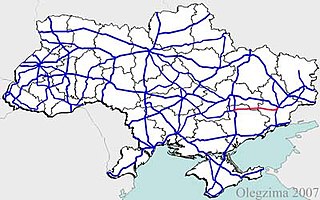
Highway H15 is a Ukrainian national highway (H-highway) connecting Zaporizhzhia with Donetsk. It passes through Vil'nians'k, Mykhailo-Lukasheve, and Kolos in Vilniansk Raion, Rodyns'ke, Petropavlivka, Novomykolaivka in Novomykolaivka Raion; Kyivs'ke and Trudove in Bilmak Raion; Novokasyanivka in Novomykolaivka Raion; Zelena Dolyna, Pysantsi, Mechetne, Orly, Dibrova, and Havrylivke in Synelnykove Raion; Iskra, Piddubne-Tolstoi, Perebudova-Komar, Ordradne, Bahatyr, Kostayantynopil', Andriivka, and Ulakly in Velyka Novosilka Raion; Dachne in Marinka Raion; Kurakhove, and Maksymil'yanivka-Heorhiivka-Marinka. The H15 has a brief concurrency with highway T-04-01 in Synelnykove Raion.

H21 is an important Ukraine national highway (H-highway) in the Donetsk Oblast and Luhansk Oblast of Donbas, Ukraine. It connects Donetsk through Luhansk with Starobilsk. The highway runs both, west–east between Donetsk and Luhansk, and south–north between Luhansk and Starobilsk. It passes either through or near Makiivka, Kolosnykove, Khartsyzk, Zuhres; Serdyte, Molodetske, and Shakhtarsk in Shakhtarsky; Torez, Snizhne, Miusynsk, Krasnyi Luch; Ivanivka and Malomykolaivka in Antratsitivsky; Myrne, Uspenka, Lutuhyne, and Heorhiivka in Lutuhynsky; Luhansk; Metalisk, Stukalova Balka, and Lyman-Tsvitni Pisky-Svitle in Slovianoserbsky; Shchastia; Mykhailivka in Troitsky; Novoaidar, Denezhnykove, and Peremorzhne-Shtormove in Novoaidarsky; Shul'hynka in Markivsky, Baidivke, and Polovynkyne in Starobilsky.
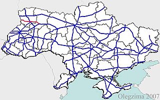
H22 is a Ukrainian national highway (H-highway) connecting the city of Rivne with the Poland-Ukraine border.
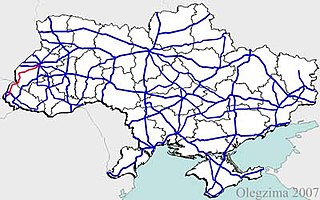
H13 is a national road (H-Highway) in Lviv Oblast and Zakarpattia Oblast, Ukraine. It runs north-south and connects Uzhhorod with Lviv.
H09 is a national road (H-Highway) in Lviv Oblast, Ivano-Frankivsk Oblast and Zakarpattia Oblast, Ukraine. It runs north-south and connects Mukachevo with Lviv.
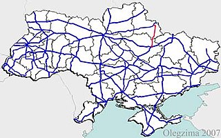
H12 is an important Ukraine national highway (H-highway) in Sumy and Poltava Oblasts, Ukraine, running mainly north–south, and connecting Sumy with Poltava in a more or less straight line. It begins in Sumy at Bandera Street and Illinska Street, and travels straight through central Sumy. It passes through Syrovatka, Boromlya, Trostyanets, Klymentove, Okhtyrka, Khukhra, Kotelva, Velyki Budyshcha, and Dykanka, and then loops around Poltava and terminates at the intersection of Highway M03 and Polovky Street.
P61 is a regional Ukraine road (P-highway) in Sumy Oblast, Ukraine, running mainly west-east and connecting Baturyn with Sumy in a more or less straight line. It begins at Highway M01/European route E101 and passes through Mytchenky, Krasne, Popivka, Konotop, Simyanivka, Dubovyazivka, Krasne, Chernecha Sloboda, Terny, Bobryk, Tuchne, Mykolaivka, Stepanivka, and ends in Sumy at Stepana Bandera Street and Illinska Street. There is also a branch road starting at Highway M03/European route E101 to Hetman's Capital National Park.


