Hiles, Wisconsin | |
---|---|
Coordinates: 45°49′21″N88°59′29″W / 45.82250°N 88.99139°W | |
Country | United States |
State | Wisconsin |
County | Forest |
Organized | 1903 |
Area | |
• Total | 141.0 sq mi (365.1 km2) |
• Land | 131.4 sq mi (340.4 km2) |
• Water | 9.5 sq mi (24.7 km2) |
Elevation | 1,657 ft (505 m) |
Population (2010) | |
• Total | 311 |
• Density | 2.2/sq mi (0.85/km2) |
Time zone | UTC-6 (Central (CST)) |
• Summer (DST) | UTC-5 (CDT) |
Area code(s) | 715 & 534 |
FIPS code | 55-34650 [2] |
GNIS feature ID | 1583390 [1] |
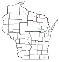
Hiles is a town in Forest County, Wisconsin, United States. The population was 311 at the 2010 census. [3] The unincorporated communities of Atkins and Hiles are located in the town.
Hiles is named for Franklin P. Hiles, a major landowner when the town was organized in 1903. [4]
According to the United States Census Bureau, the town has a total area of 141.0 square miles (365 km2), of which 131.4 square miles (340 km2) is land and 9.5 square miles (25 km2), or 6.75%, is water.
At the 2000 census, [2] there were 404 people, 199 households and 143 families residing in the town. The population density was 3.1 per square mile (1.2/km2). There were 761 housing units at an average density of 5.8 per square mile (2.2/km2). The racial makeup of the town was 97.03% White and 2.97% Native American.
There were 199 households, of which 13.1% had children under the age of 18 living with them, 63.3% were married couples living together, 3.5% had a female householder with no husband present, and 28.1% were non-families. 27.1% of all households were made up of individuals, and 14.6% had someone living alone who was 65 years of age or older. The average household size was 2.03 and the average family size was 2.40.
The age distribution was 11.6% under the age of 18, 3.0% from 18 to 24, 13.4% from 25 to 44, 37.6% from 45 to 64, and 34.4% who were 65 years of age or older. The median age was 58 years. For every 100 females, there were 110.4 males. For every 100 females age 18 and over, there were 107.6 males.
The median household income was $26,806, and the median family income was $37,083. Males had a median income of $26,250 versus $21,875 for females. The per capita income for the town was $17,830. About 7.6% of families and 11.9% of the population were below the poverty line, including 40.4% of those under age 18 and 4.3% of those age 65 or over.
Huttonsville is a town in Randolph County, West Virginia, United States, along the Tygart Valley River. The population was 163 at the 2020 census.
Tainter Lake is a census-designated place (CDP) in part of the Town of Tainter, Dunn County, Wisconsin, and part of the Town of Red Cedar, Dunn County, Wisconsin, United States. The population was 2,550 at the 2020 census.
Eldorado is a town in Fond du Lac County, Wisconsin, United States. The population was 1,447 at the 2000 census. The unincorporated community of Eldorado is located in the town.
Armstrong Creek is a town in Forest County, Wisconsin, United States. The population was 409 at the 2010 census. The unincorporated communities of Armstrong Creek and Bonneval are located within the town.
Blackwell is a town in Forest County, Wisconsin. The population was 332 at the time of the 2010 census. The unincorporated community of Blackwell is located in the town. The unincorporated community of Blackwell Junction is also located partially in the town. The town was named for sawmill owner John Blackwell.
Freedom is a town in Forest County, Wisconsin, United States. The population was 345 at the 2010 census.
Popple River is a town in Forest County, Wisconsin, United States. The population was 44 at the 2010 census.
Farmington is a town in Jefferson County, Wisconsin, United States. The population as of the 2010 census was 1,380.
Polar is a town in Langlade County, Wisconsin, United States. The population was 984 at the 2010 census.
Bern is a town in Marathon County, Wisconsin, United States. It is part of the Wausau, Wisconsin Metropolitan Statistical Area. The population was 591 at the 2010 census. The unincorporated community of Gad is located partially in the town.
Day is a town in southwest Marathon County, Wisconsin, United States. It is part of the Wausau, Wisconsin Metropolitan Statistical Area. The population was 1,085 at the 2010 census. The unincorporated community of Rozellville is located in the town. The unincorporated community of Rangeline is also located partially in the town.
Mountain is a town in Oconto County, Wisconsin, United States. The population was 860 at the 2000 census.
Oneida is a town in Outagamie County, Wisconsin, United States. The population was 4,001 at the 2000 census. The unincorporated communities of Chicago Corners and Oneida are located in the town. The town occupies the Outagamie County portion of Wisconsin's Oneida Nation of Wisconsin.
Whitewater is a town in Walworth County, Wisconsin, United States. The population was 1,433 at the 2020 census.
The Town of Dexter is located in Wood County, Wisconsin, United States. The population was 379 at the 2000 census. The unincorporated communities of Dexterville and Veedum are located in the town.
The Town of Hiles is in Wood County, Wisconsin, United States. Its population was 188 at the 2000 census.
Lowell is a village in Dodge County, Wisconsin, United States, along the Beaver Dam River. The population was 340 at the 2010 census. The village is located within the Town of Lowell.
Jefferson is a town in Jefferson County, Wisconsin, United States. The population was 2,178 at the 2010 census. The city of Jefferson is located partially within the town. The census-designated place of Helenville is also located in the town.
Elderon is a town in Marathon County, Wisconsin, United States. It is part of the Wausau, Wisconsin Metropolitan Statistical Area. The population was 606 at the 2010 census. The unincorporated community of Ingersoll is located in the town.
Somerset is a town in St. Croix County, Wisconsin, United States. The population was 4,036 at the 2010 census. The Village of Somerset is adjacent to the town.