Hockingport, Ohio

Last updated

Hockingport, Ohio
Hockingport campground.jpg
Looking eastward from State Route 124 into a campground in Hockingport, Ohio
OHMap-doton-Hockingport.png
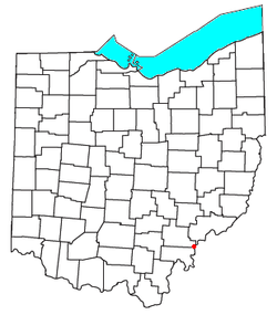
Location of Hockingport, Ohio
Coordinates: 39°11′25″N81°4′13″W / 39.19028°N 81.07028°W / 39.19028; -81.07028
Country United States
State Ohio
County Athens
Elevation
[1]
633 ft (193 m)
Population
 (2020)
  Total205
Time zone UTC-5 (Eastern (EST))
  Summer (DST) UTC-4 (EDT)
ZIP code
45739
Area code 740
GNIS feature ID2628901 [1]

Hockingport is a census-designated place in southeastern Troy Township, Athens County, Ohio, United States. As of the 2020 census it had a population of 205. [2] It has a post office with the ZIP code 45739. [3] It is located at the intersection of State Routes 124 and 144.

It lies on the Ohio River, located below Little Hocking and above Reedsville.

History

Hockingport was the site of a pre-revolutionary military camp and fortification built in October 1774 by Virginia militiamen under Lord Dunmore at the confluence of the Hocking and Ohio Rivers called Fort Gower. The fort served as the base camp for the militia during Dunmore's War. It was the namesake fort of the Fort Gower Resolves issued by the soldiers stationed there in Nov. 1774. Among the officers present were many Virginians that would go on to become famous during the revolution. Present were William Campbell, George Rogers Clark, William Crawford, Simon Kenton, Andrew Lewis, Daniel Morgan, William Russell, Adam Stephen and many others. The fort was abandoned after Dunmore's War. Today the site of the fort is believed to be under water just beyond the point.

A post office called Hockingport has been in operation since 1838. [4] The community was a shipping point on the Hocking River, hence the name. [5]

Related Research Articles

<span class="mw-page-title-main">Mason County, West Virginia</span> County in West Virginia, United States

Mason County is a county in the U.S. state of West Virginia. As of the 2020 census, the population was 25,453. Its county seat and largest city is Point Pleasant. The county was founded in 1804 and named for George Mason, delegate to the U.S. Constitutional Convention. Before the Civil War, the county was in the State of Virginia.

<span class="mw-page-title-main">Athens County, Ohio</span> County in Ohio, United States

Athens County is a county in southeastern Ohio. As of the 2020 census, the population was 62,431. Its county seat and largest city is Athens. The county was formed in 1805 from Washington County. Because Ohio's first state university, Ohio University, was established here in 1804, the town and the county are named for the ancient center of learning, Athens, Greece.

<span class="mw-page-title-main">Point Pleasant, West Virginia</span> City in West Virginia, United States

Point Pleasant is a city in and the county seat of Mason County, West Virginia, United States, at the confluence of the Ohio and Kanawha Rivers. The population was 4,101 at the 2020 census. It is the principal city of the Point Pleasant micropolitan area extending into Ohio. The town is best known for the Mothman, a purported humanoid creature reportedly sighted in the area that has become a part of West Virginia folklore.

<span class="mw-page-title-main">Lord Dunmore's War</span> 1774 conflict in the Colony of Virginia

Lord Dunmore's War, also known as Dunmore's War, was a brief conflict in fall 1774 between the British Colony of Virginia and the Shawnee and Mingo in the trans-Appalachian region of the colony south of the Ohio River. Broadly, the war included events between May and October 1774. The governor of Virginia during the conflict was John Murray, 4th Earl of Dunmore, who in May 1774, asked the House of Burgesses to declare a state of war with the Indians and call out the Virginia militia.

<span class="mw-page-title-main">Battle of Point Pleasant</span> Battle between Virginian militia and Indigenous Americans

The Battle of Point Pleasant, also known as the Battle of Kanawha and the Battle of Great Kanawha, was the only major action of Dunmore's War. It was fought on October 10, 1774, between the Virginia militia and Shawnee and Mingo warriors. Along the Ohio River near modern-day Point Pleasant, West Virginia, forces under the Shawnee chief Cornstalk attacked Virginia militiamen under Colonel Andrew Lewis, hoping to halt Lewis's advance into the Ohio Valley. After a long and furious battle, Cornstalk retreated. After the battle, the Virginians, along with a second force led by Lord Dunmore, the Royal Governor of Virginia, marched into the Ohio Valley and compelled Cornstalk to agree to a treaty, which ended the war.

<span class="mw-page-title-main">Cornstalk</span> Shawnee leader in the American Revolution

Cornstalk was a Shawnee leader in the Ohio Country in the 1760s and 1770s. His name in the Shawnee language was Hokoleskwa. Little is known about his early life. He may have been born in the Province of Pennsylvania. In 1763, he reportedly led a raid against British American colonists in Pontiac's War. He first appears in historical documents in 1764, when he was one of the hostages surrendered to the British as part of the peace negotiations ending Pontiac's War.

<span class="mw-page-title-main">Fort Randolph (West Virginia)</span> Former fort in Point Pleasant, West Virginia

Fort Randolph was an American Revolutionary War fort which stood at the confluence of the Ohio and Kanawha Rivers, on the site of present-day Point Pleasant, West Virginia, United States.

<span class="mw-page-title-main">Old Fort, Ohio</span> Census-designated place in Ohio, United States

Old Fort is a census-designated place located in northern Pleasant Township, Seneca County, Ohio, United States; located about a mile east of Ohio State Route 53 where N. Township Rd. 73 intersects with E. County Rd. 51. The ZIP code is 44861. The population was 143 at the 2020 census.

<span class="mw-page-title-main">Troy Township, Athens County, Ohio</span> Township in Ohio, United States

Troy Township is one of the fourteen townships of Athens County, Ohio, United States. The 2020 census found 2,490 people in the township.

<span class="mw-page-title-main">Ridgeville Corners, Ohio</span> Census-designated place in Ohio, United States

Ridgeville Corners is an unincorporated community and census-designated place (CDP) in southern Ridgeville Township, Henry County, Ohio, United States. It has a post office with the ZIP code 43555. The population was 416 at the 2020 census.

<span class="mw-page-title-main">Rockbridge, Ohio</span> Census-designated place in Ohio, United States

Rockbridge is an unincorporated community and census-designated place (CDP) in eastern Good Hope Township, Hocking County, Ohio, United States. It has a post office with the ZIP code 43149. It is located at the interchange of U.S. Route 33 and State Route 374, between Logan and Lancaster. As of the 2020 census the population of the CDP was 160.

<span class="mw-page-title-main">Haydenville, Ohio</span> United States historic place

Haydenville is an unincorporated community and census-designated place (CDP) in southern Green Township, Hocking County, Ohio, United States. As of the 2020 census the population of the CDP was 337.

<span class="mw-page-title-main">Stewart, Ohio</span> Census-designated place in Ohio, United States

Stewart is an unincorporated community and census-designated place in central Rome Township, Athens County, Ohio, United States. The population was 221 at the 2020 census. It has a post office with the ZIP code 45778.

<span class="mw-page-title-main">New Marshfield, Ohio</span> Census-designated place in Ohio, United States

New Marshfield is a census-designated place in central Waterloo Township, Athens County, Ohio, United States. The population was 316 at the 2020 census. It has a post office with the ZIP code 45766. It is located along State Route 56 west of the county seat of Athens.

<span class="mw-page-title-main">Millfield, Ohio</span> Census-designated place in Ohio, United States

Millfield is a census-designated place in northern Dover Township, Athens County, Ohio, United States. It had a population of 311 at the 2020 census. It has a post office with the ZIP code 45761. It is located near State Route 13 midway between Chauncey and Jacksonville. Route 13 formerly ran through the community, but a bypass relocated it close by.

<span class="mw-page-title-main">Guysville, Ohio</span> Unincorporated community in Ohio, U.S.

Guysville is an unincorporated community in southern Rome Township, Athens County, Ohio, United States. It has a post office with the ZIP code 45735.

<span class="mw-page-title-main">Little Hocking, Ohio</span> Census-designated place in Ohio, US

Little Hocking is a census-designated place in southern Belpre Township, Washington County, Ohio, United States. It has a post office with the ZIP code 45742. The population of the CPD was 244 at the 2020 census.

<span class="mw-page-title-main">Cutler, Ohio</span> Unincorporated community in Ohio, U.S.

Cutler is an unincorporated community in southwestern Fairfield Township, Washington County, Ohio, United States. It has a post office with the ZIP code 45724. It lies at the intersection of State Route 555 and County Road 59 near Gilbert Run, a subsidiary of the Little Hocking River, which meets the Ohio River at Little Hocking to the southeast.

<span class="mw-page-title-main">Fort Seneca, Ohio</span> CDP in Ohio, United States

Fort Seneca is a census-designated place in Pleasant Township, Seneca County, Ohio, United States. It is located on State Route 53, approximately 6 miles (9.7 km) North of Tiffin. The population was 230 at the 2020 census.

<span class="mw-page-title-main">Lewis District, Mason County, West Virginia</span> Magisterial district in West Virginia, United States

Lewis Magisterial District is one of ten magisterial districts in Mason County, West Virginia, United States. The district was originally established as a civil township in 1863, and converted into a magisterial district in 1872. In 2020, Robinson District was home to 5,635 people.

References

  1. 1 2 U.S. Geological Survey Geographic Names Information System: Hockingport, Ohio
  2. "Hockingport CPD, Ohio - Census Bureau Profile". United States Census Bureau. Retrieved May 20, 2023.
  3. USPS – Cities by ZIP Code
  4. "Athens County". Jim Forte Postal History. Retrieved December 31, 2015.
  5. History of Hocking Valley, Ohio: together with sketches of its cities, villages and townships. Chicago: Inter-State Pub. Co. 1883. p.  659.