Trimble, Ohio | |
---|---|
Coordinates: 39°29′09″N82°04′48″W / 39.48583°N 82.08000°W | |
Country | United States |
State | Ohio |
County | Athens |
Area | |
• Total | 0.69 sq mi (1.79 km2) |
• Land | 0.68 sq mi (1.76 km2) |
• Water | 0.01 sq mi (0.03 km2) |
Elevation | 673 ft (205 m) |
Population (2020) | |
• Total | 329 |
• Density | 483.82/sq mi (186.67/km2) |
Time zone | UTC-5 (Eastern (EST)) |
• Summer (DST) | UTC-4 (EDT) |
ZIP code | 45782 |
Area code | 740 |
FIPS code | 39-77406 [3] |
GNIS feature ID | 2400003 [2] |
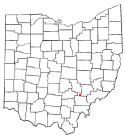
Trimble is a village in Trimble Township, Athens County, Ohio, United States. The population was 329 at the 2020 census.
Trimble village was originally called Oxford. [4] A post office called Trimble has been in operation since 1839. [5] The present name is derived from Allen Trimble, 8th & 10th Governor of Ohio. [6]
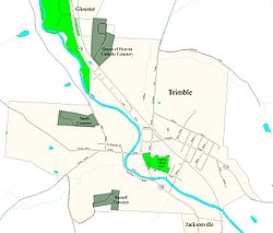
Trimble is located along Sunday Creek. [7]
According to the United States Census Bureau, the village has a total area of 0.67 square miles (1.74 km2), of which 0.66 square miles (1.71 km2) is land and 0.01 square miles (0.03 km2) is water. [8]
Trimble is one of three bordering incorporated villages in northern Athens County, all of which began as coal mining towns. Just north of Trimble is Glouster, and just south of Trimble is Jacksonville.
Census | Pop. | Note | %± |
---|---|---|---|
1870 | 81 | — | |
1880 | 121 | 49.4% | |
1890 | 440 | 263.6% | |
1900 | 625 | 42.0% | |
1910 | 711 | 13.8% | |
1920 | 806 | 13.4% | |
1930 | 680 | −15.6% | |
1940 | 686 | 0.9% | |
1950 | 566 | −17.5% | |
1960 | 481 | −15.0% | |
1970 | 542 | 12.7% | |
1980 | 579 | 6.8% | |
1990 | 441 | −23.8% | |
2000 | 466 | 5.7% | |
2010 | 390 | −16.3% | |
2020 | 329 | −15.6% | |
U.S. Decennial Census [9] |
As of the census [10] of 2010, there were 390 people, 145 households, and 103 families living in the village. The population density was 590.9 inhabitants per square mile (228.1/km2). There were 171 housing units at an average density of 259.1 per square mile (100.0/km2). The racial makeup of the village was 97.4% White, 0.3% Native American, and 2.3% from two or more races.
There were 145 households, of which 34.5% had children under the age of 18 living with them, 47.6% were married couples living together, 17.9% had a female householder with no husband present, 5.5% had a male householder with no wife present, and 29.0% were non-families. 20.7% of all households were made up of individuals, and 7.6% had someone living alone who was 65 years of age or older. The average household size was 2.69 and the average family size was 3.04.
The median age in the village was 39.5 years. 22.8% of residents were under the age of 18; 11.6% were between the ages of 18 and 24; 24% were from 25 to 44; 25.6% were from 45 to 64; and 15.9% were 65 years of age or older. The gender makeup of the village was 52.3% male and 47.7% female.
As of the census [3] of 2000, there were 466 people, 175 households, and 121 families living in the village. The population density was 713.1 inhabitants per square mile (275.3/km2). There were 195 housing units at an average density of 298.4 per square mile (115.2/km2). The racial makeup of the village was 98.50% White, 0.21% Asian, and 1.29% from two or more races.
There were 175 households, out of which 38.3% had children under the age of 18 living with them, 49.1% were married couples living together, 17.1% had a female householder with no husband present, and 30.3% were non-families. 22.9% of all households were made up of individuals, and 10.3% had someone living alone who was 65 years of age or older. The average household size was 2.66 and the average family size was 3.14.
In the village, the population was spread out, with 30.7% under the age of 18, 9.4% from 18 to 24, 27.3% from 25 to 44, 23.8% from 45 to 64, and 8.8% who were 65 years of age or older. The median age was 33 years. For every 100 females there were 99.1 males. For every 100 females age 18 and over, there were 86.7 males.
The median income for a household in the village was $30,500, and the median income for a family was $30,938. Males had a median income of $29,107 versus $21,667 for females. The per capita income for the village was $11,437. About 22.0% of families and 26.1% of the population were below the poverty line, including 30.8% of those under age 18 and 21.6% of those age 65 or over.
Athens County is a county in southeastern Ohio. As of the 2020 census, the population was 62,431. Its county seat and largest city is Athens. The county was formed in 1805 from Washington County. Because Ohio's first state university, Ohio University, was established here in 1804, the town and the county are named for the ancient center of learning, Athens, Greece.
Athens is a village in Calhoun County in the U.S. state of Michigan. The population was 936 at the 2020 census. The village is located in southern Athens Township, and is part of the Battle Creek, Michigan Metropolitan Statistical Area. It was settled in 1831.
Chauncey is a village in Athens County, Ohio, United States. The population was 959 at the 2020 census. The village is located near The Plains.
Coolville is a village located in Troy Township, Athens County, Ohio, United States, in the southeast area of the state. The population was 452 at the 2020 census.
Glouster is a village in Trimble Township, Athens County, Ohio, United States. The population was 1,659 at the 2020 census. It is close to Burr Oak State Park.
Jacksonville is a village in Athens County, Ohio, United States. The population was 400 at the 2020 census.
Glenwillow is a village in Cuyahoga County, Ohio, United States. The population was 994 at the 2020 census. A suburb of Cleveland, it is a part of the Cleveland metropolitan area.
Addyston is a village in Miami Township, Hamilton County, Ohio, United States. Located along the Ohio River, it is a western suburb of the neighboring city of Cincinnati. The population was 927 at the 2020 census.
Cleves is a village in Miami Township, Hamilton County, Ohio, United States. Located along the Ohio River, it is a western suburb of Cincinnati. The population was 3,414 at the 2020 census.
Harrisville is a village in Harrison County, Ohio, United States. The population was 179 at the 2020 census.
New Athens is a village in Harrison County, Ohio, United States. The population was 222 at the 2020 census.
Mowrystown is a village in Highland County, Ohio, United States. The population was 385 at the 2020 census.
Wintersville is a village in central Jefferson County, Ohio, United States. The population was 3,609 as of the 2020 Census. It is part of the Weirton–Steubenville metropolitan area. The village is suburban in nature and is governed by a mayor and council elected by non-partisan ballot.
Darbyville is a village in Pickaway County, Ohio, United States. The population was 186 at the 2020 census.
Cloverdale is a village in Perry Township, Putnam County, Ohio, United States. The population was 170 at the 2020 census.
Limaville is a census-designated place (CDP) and former village in Stark County, Ohio, United States. The population was 151 at the 2020 census. It is part of the Canton–Massillon Metropolitan Statistical Area.
Macksburg is a village in Washington County, Ohio, United States, along the West Fork of Duck Creek. The population was 120 at the 2020 census. The village is about 28 miles (45 km) south of Cambridge, Ohio.
Buchtel is a village in Athens and Hocking counties in the U.S. state of Ohio, just northeast of Nelsonville. Located in the Hocking Valley, it was a center of coal mining in the late 19th and early 20th centuries. The population was 518 at the 2020 census. A former name for the village is Bessemer.
Wilson is a village in Belmont and Monroe counties in the U.S. state of Ohio. The population was 129 at the 2020 census. It is part of the Wheeling metropolitan area.
Verona is a village in Montgomery and Preble counties in the U.S. state of Ohio. The population was 403 at the 2020 census. It is part of the Dayton Metropolitan Statistical Area.