New Marshfield, Ohio

Last updated

New Marshfield, Ohio
OHMap-doton-New Marshfield.png
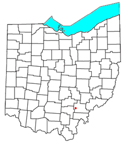
Location of New Marshfield, Ohio
Coordinates: 39°19′31″N82°12′59″W / 39.32528°N 82.21639°W / 39.32528; -82.21639
Country United States
State Ohio
County Athens
Elevation
[1]
843 ft (257 m)
Population
 (2020)
  Total316
Time zone UTC-5 (Eastern (EST))
  Summer (DST) UTC-4 (EDT)
ZIP code
45766
Area code 740
GNIS feature ID2628942 [1]

New Marshfield is a census-designated place in central Waterloo Township, Athens County, Ohio, United States. The population was 316 at the 2020 census. [2] It has a post office with the ZIP code 45766. [3] It is located along State Route 56 west of the county seat of Athens.

Contents

New marshfield, ohio.jpg

History

The B&O Railroad formerly passed through the community, but the line was abandoned in the 1980s.[ citation needed ]

A post office called Marshfield was established in 1857, and the post office was renamed New Marshfield in 1909. [4] By the 1880s, (New) Marshfield had a train station and several stores. [5]

Education

Public Education in the community of New Marshfield is provided by the Alexander Local School District. Campuses serving the community include Alexander Elementary School] (Grades PK-5), Alexander Middle School] (Grades 6–8), and Alexander High School (Grades 9–12).

Related Research Articles

<span class="mw-page-title-main">Homeworth, Ohio</span> Census-designated place in Ohio, United States

Homeworth is an unincorporated community and census-designated place in southwestern Knox Township, Columbiana County, Ohio, United States. The population was 492 as of the 2020 census. It is part of the Salem micropolitan area, about 16.5 miles (26.6 km) east of Canton, and has a post office with the ZIP code 44634.

<span class="mw-page-title-main">New Hampshire, Ohio</span> Unincorporated community in Ohio, United States

New Hampshire is a census-designated place in central Goshen Township, Auglaize County, Ohio, United States. As of the 2010 census, it had a population of 150.

<span class="mw-page-title-main">Winn, Michigan</span> Census-designated place & unincorporated community in Michigan, United States

Winn is an unincorporated community and census-designated place (CDP) in Isabella County in the U.S. state of Michigan. The CDP had a population of 166 at the 2020 census. The community is located within Fremont Township.

<span class="mw-page-title-main">Waterloo Township, Athens County, Ohio</span> Township in Ohio, United States

Waterloo Township is one of the fourteen townships of Athens County, Ohio, United States. The 2020 census found 2,352 people in the township.

<span class="mw-page-title-main">Radnor, Ohio</span> Census-designated place in Ohio, United States

Radnor is an unincorporated community and census-designated place (CDP) in central Radnor Township, Delaware County, Ohio, United States. As of the 2020 census it had a population of 180. Radnor has a post office with the ZIP code of 43066. It lies along State Route 203 at its intersection with Radnor Road.

<span class="mw-page-title-main">North Lima, Ohio</span> Census-designated place in Ohio, United States

North Lima is an unincorporated community and census-designated place in eastern Beaver Township, Mahoning County, Ohio, United States. The population was 1,369 at the 2020 census. Located at the intersection of State Routes 7, 164, and 165, it is part of the Youngstown–Warren metropolitan area.

<span class="mw-page-title-main">New Springfield, Ohio</span> Census-designated place in Ohio, United States

New Springfield is an unincorporated community and census-designated place in southern Springfield Township, Mahoning County, Ohio, United States. The population was 579 at the 2020 census. It is part of the Youngstown–Warren metropolitan area. It lies at the intersection of State Routes 165 and 617.

<span class="mw-page-title-main">Damascus, Ohio</span> Census-designated place in Ohio, United States

Damascus is an unincorporated community and census-designated place in southern Mahoning and northern Columbiana counties in the U.S. state of Ohio. As of the 2020 census, it had a population of 418. The community lies at the intersection of U.S. Route 62 and State Routes 173 and 534.

<span class="mw-page-title-main">East Springfield, Ohio</span> Census-designated place in Ohio, United States

East Springfield is a census-designated place (CDP) in northwestern Salem Township, Jefferson County, Ohio, United States. It has a post office with the ZIP code 43925. It lies along State Route 43, 16 miles (26 km) northwest of the county seat of Steubenville and 17 miles (27 km) southeast of Carrollton. The community is part of the Weirton–Steubenville, WV-OH Metropolitan Statistical Area.

<span class="mw-page-title-main">Haydenville, Ohio</span> United States historic place

Haydenville is an unincorporated community and census-designated place (CDP) in southern Green Township, Hocking County, Ohio, United States. As of the 2020 census the population of the CDP was 337.

<span class="mw-page-title-main">Negley, Ohio</span> Census-designated place in Ohio, United States

Negley is an unincorporated community and census-designated place in Middleton Township, Columbiana County, Ohio, United States. The population was 274 at the 2020 census. It is part of the Salem micropolitan area, 22 miles (35 km) south of Youngstown.

<span class="mw-page-title-main">East Rochester, Ohio</span> Census-designated place in Ohio, United States

East Rochester is an unincorporated community and census-designated place (CDP) in southern West Township, Columbiana County, Ohio, United States. The population was 224 as of the 2020 census. It lies along U.S. Route 30, and has a post office with the ZIP code 44625. It is a part of the Salem micropolitan area, about 20 miles (32 km) east of Canton.

<span class="mw-page-title-main">Stewart, Ohio</span> Census-designated place in Ohio, United States

Stewart is an unincorporated community and census-designated place in central Rome Township, Athens County, Ohio, United States. The population was 221 at the 2020 census. It has a post office with the ZIP code 45778.

<span class="mw-page-title-main">Shade, Ohio</span> Unincorporated community in Ohio, U.S.

Shade is an unincorporated community in southern Lodi Township, Athens County, Ohio, United States. It has a post office with the ZIP code 45776. It lies along U.S. Route 33.

<span class="mw-page-title-main">Millfield, Ohio</span> Census-designated place in Ohio, United States

Millfield is a census-designated place in northern Dover Township, Athens County, Ohio, United States. It had a population of 311 at the 2020 census. It has a post office with the ZIP code 45761. It is located near State Route 13 midway between Chauncey and Jacksonville. Route 13 formerly ran through the community, but a bypass relocated it close by.

<span class="mw-page-title-main">Hockingport, Ohio</span> Census-designated place in Ohio, United States

Hockingport is a census-designated place in southeastern Troy Township, Athens County, Ohio, United States. As of the 2020 census it had a population of 205. It has a post office with the ZIP code 45739. It is located at the intersection of State Routes 124 and 144.

<span class="mw-page-title-main">Carbondale, Ohio</span> Unincorporated community in Ohio, U.S.

Carbondale is an unincorporated community in northwestern Waterloo Township, Athens County, Ohio, United States. It has a post office with the ZIP code 45717. It is located a short distance north of State Route 56.

<span class="mw-page-title-main">Sandyville, Ohio</span> CDP in Ohio, United States

Sandyville is an unincorporated community and census-designated place in northern Sandy Township, Tuscarawas County, Ohio, United States. It has a post office with the ZIP code 44671. It lies along State Route 800 between Canton and New Philadelphia. The population was 350 at the 2020 census.

<span class="mw-page-title-main">Middlebranch, Ohio</span> CDP in Ohio, United States

Middlebranch is a census-designated place in northeastern Plain Township, Stark County, Ohio, United States. It is located about 7 miles Northeast of Canton. It has a post office with the ZIP code 44652. The community is part of the Canton–Massillon Metropolitan Statistical Area. The population was 2,117 at the 2020 census. Trains from the Wheeling and Lake Erie Railway often run through the area carrying loads of scrap metal bound for other Ohio cities.

South Seaville is an unincorporated community located within Dennis Township in Cape May County, in the U.S. state of New Jersey. South Seaville is 4 miles (6.4 km) northwest of Sea Isle City. South Seaville has a post office with ZIP Code 08246.

References

  1. 1 2 U.S. Geological Survey Geographic Names Information System: New Marshfield, Ohio
  2. "New Marshfield CPD, Ohio - Census Bureau Profile". United States Census Bureau. Retrieved May 20, 2023.
  3. USPS – Cities by ZIP Code
  4. "Athens County". Jim Forte Postal History. Retrieved December 31, 2015.
  5. History of Hocking Valley, Ohio: together with sketches of its cities, villages and townships. Chicago: Inter-State Pub. Co. 1883. p.  691.