"},"elevation_ft":{"wt":"637"},"coordinates":{"wt":"{{coord|39|24|05|N|81|57|18|W|region:US_type:city|display=inline,title}}"},"postal_code_type":{"wt":"[[ZIP code]]s"},"postal_code":{"wt":"45711, 45777"},"area_code":{"wt":"[[Area code 740|740]]"},"blank_name":{"wt":"[[Federal Information Processing Standard|FIPS code]]"},"blank_info":{"wt":"39-01784{{cite web|url=https://www.census.gov |publisher=[[United States Census Bureau]] |access-date=January 31, 2008 |title=U.S. Census website }}"},"blank1_name":{"wt":"[[Geographic Names Information System|GNIS]] feature ID"},"blank1_info":{"wt":"2397956{{GNIS|2397956}}"},"website":{"wt":"{{URL|http://www.amesvilleohio.org/|Village website}}"},"footnotes":{"wt":""}},"i":0}}]}" id="mwBQ">Village in Ohio, United States
Amesville, Ohio | |
---|---|
![]() | |
![]() Location of Amesville, Ohio | |
![]() Location of Amesville in Athens County | |
Coordinates: 39°24′05″N81°57′18″W / 39.40139°N 81.95500°W | |
Country | United States |
State | Ohio |
County | Athens |
Township | Ames |
Government | |
• Type | Town Council |
Area | |
• Total | 0.23 sq mi (0.60 km2) |
• Land | 0.23 sq mi (0.59 km2) |
• Water | 0.00 sq mi (0.01 km2) |
Elevation | 637 ft (194 m) |
Population (2020) | |
• Total | 171 |
170 | |
• Density | 753.30/sq mi (290.49/km2) |
Time zone | UTC-5 (Eastern (EST)) |
• Summer (DST) | UTC-4 (EDT) |
ZIP codes | 45711, 45777 |
Area code | 740 |
FIPS code | 39-01784 [4] |
GNIS feature ID | 2397956 [2] |
Website | Village website |
Amesville /ˈeɪmzvɪl/ [5] is a village in Athens County, Ohio, United States, located on Federal Creek. The population was 171 at the 2020 census.
Amesville was laid out in 1837. [6] The village derives its name from Fisher Ames who was instrumental in gaining federal support for the Ohio Company of Associates which managed much of the settlement in the area. [7]
Amesville is perhaps best known for the Coonskin Library. At an 1803 town meeting—held to discuss roads—settlers talked about their desire for books and their lack of money to pay for them. Most of the business was done by barter, so little money was in circulation. However, the surrounding forest had pelts that could be sold in the East to buy books. In the spring of 1804, Samuel B. Brown was given the pelts and, accompanied by Ephraim Cutler, went east to bring back books for the town. Fifty-one books—mostly on religion, travel, biography and history—were purchased for $73.50. These books were passed from home to home until Ephraim Cutler was elected librarian in 1804. The original books can be found at the Ohio Historical Society, as well as Ohio University's Alden Library. A commemorative marker, placed by the Nabby Lee Ames D.A.R. Chapter of Athens in 1925, is located near the Community Bank on State Street. The Coonskin Library Museum opened in May 1994 in the former cafeteria of the Amesville Grade School. [8]
A post office called Amesville was established 1820. [9]
Another unique feature of Amesville history was the election of Alonzo Weed as mayor in 1903. Research by Tyler Buchanon, of the Athens Messenger, [10] tells the story of a wandering hobo that became mayor of the village. Alonzo Weed was likely born somewhere on the west coast around 1850. Amesville residents found Weed a strange, but friendly figure. It's hard to say for sure what first prompted his name to get placed on the ballot. In many versions, he was nominated by a few friends on Election Day as a joke.
One way or another, Weed's name was indeed placed on the mayoral ballot of April 1903. The election ended in a tie. Weed and Gibson both received exactly 21 votes. Weed was sworn in as the new mayor of Amesville after a tie-breaker. He proved to be unqualified for the job. He was an alcoholic in a dry town, a drifter with little appreciation or experience with municipal government.[ citation needed ]
Eventually, Alonzo left town, but not after becoming the center of news stories all across the country.[ citation needed ]
On June 28, 1998, a storm front stalled over Federal Creek and dropped over 10 inches of rain. Quickly, Federal Creek rose beyond its banks and crossed State Street and Main Street. It reached a depth of 15 feet at the restaurant on the corner of those two roads. When the water receded it had devastated most of the businesses and houses on the south side of the village. The majority of these buildings were demolished (through FEMA grants) and the resulting open land became Gifford Park. [ citation needed ]
In 2007 Amesville became the first village in Ohio to pioneer a new, aerobic wastewater treatment system. The village had been grappling with the waste-water issue since at least 1959, when a village ordinance was passed addressing the question, following the contamination of some wells by sewage." [11] The Appalachian Regional Commission awarded a $750,000 grant to the Athens County Commissioners for the project, with the county providing $216,320 in local funds according to a press release from U.S. Senator Sherrod Brown’s office. Athens County Commissioner Chris Chmiel said local funds will be provided through the county’s American Recovery Plan Act dollars." [12]
Amesville is situated in the foothills of the Appalachian Mountains, approximately 45 miles south by southeast of the terminal moraine, a topographical feature often associated with the boundaries of glaciers, and is surrounded by wooded hills, narrow valleys, and numerous creeks flanked by lowland pastures and farmland.
These features are largely indicative of the areas in the State of Ohio that fall to the south of the terminal moraine. The terminal moraine in the State of Ohio, and to the north of Amesville, effectively serves to bisect the state along a line running on a west to east axis across the south by southeastern third of Ohio thereby contributing to certain distinctive topographical, socio-economic, and cultural attributes on either side of this feature.
According to the United States Census Bureau, the village has a total area of 0.22 square miles (0.57 km2), all land. [13]
The climate in this area is characterized by hot, humid summers and generally mild to cool winters. According to the Köppen Climate Classification system, Amesville has a humid subtropical climate, abbreviated "Cfa" on climate maps. [14]
Census | Pop. | Note | %± |
---|---|---|---|
1880 | 159 | — | |
1910 | 267 | — | |
1920 | 273 | 2.2% | |
1930 | 298 | 9.2% | |
1940 | 286 | −4.0% | |
1950 | 269 | −5.9% | |
1960 | 255 | −5.2% | |
1970 | 295 | 15.7% | |
1980 | 247 | −16.3% | |
1990 | 250 | 1.2% | |
2000 | 184 | −26.4% | |
2010 | 154 | −16.3% | |
2020 | 171 | 11.0% | |
2023 (est.) | 170 | [3] | −0.6% |
U.S. Decennial Census [15] |
As of the census [16] of 2010, there were 154 people, 63 households, and 38 families residing in the village of Amesville, Ohio. The population density was 700.0 inhabitants per square mile (270.3/km2). There were 70 housing units at an average density of 318.2 per square mile (122.9/km2). The racial makeup of the village was 88.3% White, 3.2% African American, 0.6% Native American, 4.5% Asian, and 3.2% from two or more races. Hispanic or Latino of any race were 2.6% of the population.
There were 63 households, of which 27.0% had children under the age of 18 living with them, 46.0% were married couples living together, 9.5% had a female householder with no husband present, 4.8% had a male householder with no wife present, 39.7% were households composed of non-geanologically related persons, 31.7% of all households were made up of sole individuals, and 11.1% had someone living alone who was 65 years of age or older. The average household size was 2.44 and the average family size was 3.03.
The median age in the village was 36.5 years. 25.3% of residents were under the age of 18; 9.7% of residents were between the ages of 18 and 24; 19.3% were from between the ages of 25 and 44; 31.1% were from 45 to 64; and 14.3% were 65 years of age or older. Gender distribution of the village was 48.7% male and 51.3% female.
As of the census [4] of 2000, there were 184 people, 70 households, and 52 families residing in the village. The population density was 829.8 inhabitants per square mile (320.4/km2). There were 82 housing units at an average density of 369.8 per square mile (142.8/km2). The racial makeup of the village was 95.65% White, 1.09% African American, 1.63% Native American, and 1.63% from two or more races. Hispanic or Latino of any race were 2.17% of the population.
There were 70 households, out of which 44.3% had children under the age of 18 living with them, 50.0% were married couples living together, 22.9% had a female householder with no husband present, and 25.7% were non-families. 22.9% of all households were made up of individuals, and 7.1% had someone living alone who was 65 years of age or older. The average household size was 2.63 and the average family size was 2.90.
In the village, the population was spread out, with 33.2% under the age of 18, 6.0% from 18 to 24, 30.4% from 25 to 44, 20.7% from 45 to 64, and 9.8% who were 65 years of age or older. The median age was 36 years. For every 100 females there were 91.7 males. For every 100 females age 18 and over, there were 73.2 males.
The median income for a household in the village was $35,000, and the median income for a family was $44,000. Males had a median income of $29,583 versus $24,063 for females. The per capita income for the village was $16,554. About 8.3% of families and 8.0% of the population were below the poverty line, including 11.5% of those under the age of eighteen and none of those 65 or over.
Athens County is a county in southeastern Ohio. As of the 2020 census, the population was 62,431. Its county seat and largest city is Athens. The county was formed in 1805 from Washington County. Because Ohio's first state university, Ohio University, was established here in 1804, the town and the county are named for the ancient center of learning, Athens, Greece.
Steamboat Rock is a city in Hardin County, Iowa, United States. The population was 264 at the time of the 2020 census.
Ames is a village in Montgomery County, New York, United States. The population was 145 at the 2010 census.
Chauncey is a village in Athens County, Ohio, United States. The population was 959 at the 2020 census.
Coolville is a village located in Troy Township, Athens County, Ohio, United States, in the southeast area of the state. The population was 452 at the 2020 census.
Jacksonville is a village in Athens County, Ohio, United States. The population was 400 at the 2020 census.
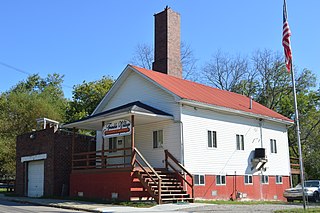
Trimble is a village in Trimble Township, Athens County, Ohio, United States. The population was 329 at the 2020 census.
Addyston is a village in Miami Township, Hamilton County, Ohio, United States. Located along the Ohio River, it is a western suburb of the neighboring city of Cincinnati. The population was 927 at the 2020 census.
New Athens is a village in Harrison County, Ohio, United States. The population was 222 at the 2020 census.
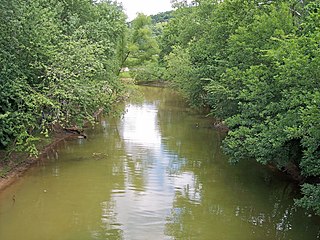
Chesapeake is a village in Lawrence County, Ohio, United States. The population was 765 as of the 2020 census. It lies across the Ohio River from Huntington, West Virginia, at the mouth of Symmes Creek.
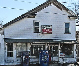
Adamsville is a village in Muskingum County, Ohio, United States. The population was 140 at the 2020 census. It is part of the Zanesville micropolitan area.
New Lexington is a village in and the county seat of Perry County, Ohio, United States, 21 miles (34 km) southwest of Zanesville and 45 miles (72 km) miles southeast of Columbus. The population was 4,435 at the 2020 census.
Hiram is a village in northern Portage County, Ohio, United States. It was formed from portions of Hiram Township in the Connecticut Western Reserve. The population was 996 at the 2020 census. Hiram is part of the Akron metropolitan area. It is the home of Hiram College, a small, private liberal arts college. The Hiram post office was established in 1816.
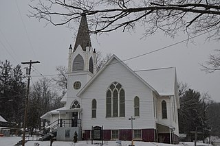
Macksburg is a village in Washington County, Ohio, United States, along the West Fork of Duck Creek. The population was 120 at the 2020 census. The village is about 28 miles (45 km) south of Cambridge, Ohio.
Beech Bottom is a village in Brooke County, West Virginia, United States, situated along the Ohio River. The population was 523 at the 2010 census. It is part of the Weirton–Steubenville metropolitan area.
Buchtel is a village in Athens and Hocking counties in the U.S. state of Ohio, just northeast of Nelsonville. Located in the Hocking Valley, it was a center of coal mining in the late 19th and early 20th centuries. The population was 518 at the 2020 census. A former name for the village is Bessemer.
Yorkville is a village in Belmont and Jefferson counties in the U.S. state of Ohio. The population was 968 at the 2020 census. Yorkville lies within two Metropolitan Statistical Areas; the Belmont County portion is part of the Wheeling metropolitan area, while the Jefferson County portion is part of the Weirton–Steubenville metropolitan area.
Canal Winchester is a city in Fairfield and Franklin counties in the U.S. state of Ohio. The city is a suburb of Columbus. The population was 9,107 at the 2020 census.
Delafield is a city in Waukesha County, Wisconsin, United States, along the Bark River. The population was 7,185 at the 2020 census. It is part of the Milwaukee metropolitan area.
Millersburg is a village and the county seat of Holmes County, Ohio, United States. Located 66 miles (106 km) south of Cleveland, it is in the heart of Ohio's Amish Country and is part of a large regional tourism industry. The population was 3,151 at the 2020 census. Holmes County Airport, located two miles southwest of Millersburg, serves the county.