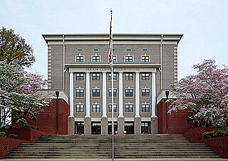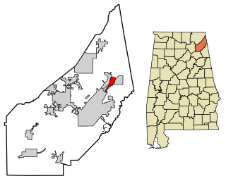
Cherokee County, Alabama is a county located in the northeastern part of the U.S. state of Alabama. As of the 2010 census, the population was 25,989. Its county seat is Centre. The county is named for the Cherokee tribe.

Etowah County is a county located in the northeastern part of the U.S. state of Alabama. As of the 2010 census the population was 104,430. Its county seat is Gadsden. Its name is from a Cherokee word meaning "edible tree". In total area, it is the smallest county in Alabama, but one of the most densely populated. Etowah County comprises the Gadsden Metropolitan Statistical Area.

DeKalb County is a county located in the northeastern part of the U.S. state of Alabama. As of the 2010 census, the population was 71,109. Its county seat is Fort Payne, and it is named after Major General Baron Johan DeKalb. DeKalb County is part of the Huntsville-Decatur-Albertville, AL Combined Statistical Area.

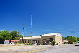
Crossville is a town in DeKalb County, Alabama, United States. At the 2010 census the population was 1,862, up from 1,431 in 2000. Crossville is located atop Sand Mountain, a southern extension of the Cumberland Plateau.

Geraldine is a town in DeKalb County, Alabama, United States. It was incorporated in February 1957. At the 2010 census the population was 896.

Mentone is a town in DeKalb County, Alabama, United States. Mentone, located atop Lookout Mountain, has the highest elevation of any incorporated town in Alabama, and narrowly higher than Hytop.

Powell is a town in DeKalb County, Alabama, United States. At the 2010 census the population was 955. Powell is located atop Sand Mountain.

Shiloh is a town in DeKalb County, Alabama, United States. It incorporated in 1962. At the 2010 census the population was 274. Shiloh is located atop Sand Mountain.

Sylvania is a town in DeKalb County, Alabama, United States. It incorporated in October 1967. At the 2010 census the population was 1,837, up from 1,186 in 2000. Sylvania is located atop Sand Mountain.

Valley Head is a town in DeKalb County, Alabama, United States. Although the town incorporated in 1921, it was also listed as being incorporated on the 1890 U.S. Census. At the 2010 census the population was 558.

Grove Oak is a small unincorporated community in DeKalb County, Alabama, United States. It is located atop Sand Mountain in northeastern Alabama.

North Alabama is a region of the U.S. state of Alabama, generally considered to include 16 counties: Blount, Cherokee, Colbert, Cullman, DeKalb, Etowah, Franklin, Jackson, Lauderdale, Lawrence, Limestone, Madison, Marion, Marshall, Morgan, and Winston, with a combined population of 1,000,985, or 20.94% of the state's population as of 2010 Census.

Alabama's 4th congressional district is a U.S. congressional district in Alabama, which elects a representative to the United States House of Representatives. It encompasses the counties of Franklin, Colbert, Marion, Lamar, Fayette, Walker, Winston, Cullman, Lawrence, Marshall, Etowah, and DeKalb. It also includes parts of Jackson, Tuscaloosa, and Cherokee counties, as well as parts of the Decatur Metropolitan Area and the Huntsville-Decatur Combined Statistical Area.

Dawson is a small unincorporated community located in DeKalb County, Alabama, United States. It is located atop Sand Mountain, approximately 4 miles (6 km) northeast of the town of Crossville.
The DeKalb County School System (Alabama) controls the schools that serve DeKalb County, Alabama, United States except for the schools located within the county seat of Fort Payne, Alabama which has its own school system. The administrative offices of the system are located in Rainsville.

Hopewell is an unincorporated community in Jackson Township, DeKalb County, Indiana.

Adamsburg is an unincorporated community located on Lookout Mountain in eastern DeKalb County, Alabama, United States, southeast of the county seat of Fort Payne, and just west of Little River Canyon.

Aroney is an unincorporated community located on Sand Mountain in far southwestern DeKalb County, Alabama, United States, approximately five miles east of the city of Boaz.

Beaty Crossroads is an unincorporated community on Sand Mountain in northern DeKalb County, Alabama, United States. It is located within the town limits of Ider at the intersection of Alabama Highway 75 and Alabama Highway 117.

Bootsville is a ghost town in the Sand Valley area of central DeKalb County, Alabama, United States. It was located roughly five miles west-southwest of Fort Payne. This would place it near the present-day intersection of County Road 458 and County Road 461.


