Valley Head, Alabama

Last updated

Valley Head, Alabama
USPS - Valley Head, AL - 35989.jpg
Post office in Valley Head
DeKalb County Alabama Incorporated and Unincorporated areas Valley Head Highlighted 0178240.svg
Location of Valley Head in DeKalb County, Alabama.
Coordinates: 34°33′55″N85°36′59″W / 34.56528°N 85.61639°W / 34.56528; -85.61639
CountryUnited States
State Alabama
County DeKalb
Area
[1]
  Total
3.78 sq mi (9.80 km2)
  Land3.77 sq mi (9.78 km2)
  Water0.01 sq mi (0.02 km2)
Elevation
[2]
1,063 ft (324 m)
Population
 (2020)
  Total
577
  Density152.85/sq mi (59.01/km2)
Time zone UTC−6 (Central (CST))
  Summer (DST) UTC−5 (CDT)
ZIP code
35989
Area code 256
FIPS code 01-78240
GNIS feature ID2406785 [2]
Website valleyheadalabama.com

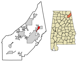
Valley Head is a town in DeKalb County, Alabama, United States. Although the town incorporated in 1921, it was also listed as being incorporated on the 1890 U.S. Census. This town is part of the Lookout Mountain region. At the 2020 census, the population was 577.

Contents

Geography

Valley Head is located at 34°33′55″N85°36′59″W / 34.56528°N 85.61639°W / 34.56528; -85.61639 (34.565301, -85.616426). [3]

According to the U.S. Census Bureau, the town has a total area of 3.5 square miles (9.1 km2), all land.

Climate

Valley Head has a humid subtropical climate (Köppen Cfa), although it is the coolest place in the state with winter temperatures about 18 °F (10 °C) cooler than on the Gulf Coast, and 56 mornings during the three-month winter falling below freezing. While holding many monthly record lows for Alabama, [4] it falls short of the all-time record low of −27 °F (−33 °C) held by New Market. [5]

Climate data for Valley Head, Alabama (19912020 normals, extremes 1893present)
MonthJanFebMarAprMayJunJulAugSepOctNovDecYear
Record high °F (°C)79
(26)
80
(27)
90
(32)
92
(33)
100
(38)
104
(40)
106
(41)
105
(41)
104
(40)
98
(37)
90
(32)
78
(26)
106
(41)
Mean maximum °F (°C)67.2
(19.6)
71.0
(21.7)
78.0
(25.6)
82.9
(28.3)
86.7
(30.4)
91.2
(32.9)
93.0
(33.9)
93.8
(34.3)
90.7
(32.6)
83.8
(28.8)
76.0
(24.4)
68.5
(20.3)
94.9
(34.9)
Mean daily maximum °F (°C)48.8
(9.3)
53.0
(11.7)
61.3
(16.3)
70.1
(21.2)
77.1
(25.1)
83.5
(28.6)
86.3
(30.2)
86.0
(30.0)
81.3
(27.4)
71.5
(21.9)
60.3
(15.7)
51.6
(10.9)
69.2
(20.7)
Daily mean °F (°C)39.3
(4.1)
42.7
(5.9)
49.9
(9.9)
57.8
(14.3)
66.1
(18.9)
73.5
(23.1)
76.8
(24.9)
76.2
(24.6)
70.7
(21.5)
59.8
(15.4)
49.0
(9.4)
42.1
(5.6)
58.7
(14.8)
Mean daily minimum °F (°C)29.8
(−1.2)
32.4
(0.2)
38.6
(3.7)
45.6
(7.6)
55.0
(12.8)
63.4
(17.4)
67.0
(19.4)
66.4
(19.1)
60.1
(15.6)
48.1
(8.9)
37.7
(3.2)
32.5
(0.3)
48.1
(8.9)
Mean minimum °F (°C)10.1
(−12.2)
14.7
(−9.6)
19.8
(−6.8)
28.2
(−2.1)
38.5
(3.6)
51.4
(10.8)
57.7
(14.3)
56.3
(13.5)
44.4
(6.9)
30.3
(−0.9)
20.8
(−6.2)
16.3
(−8.7)
8.0
(−13.3)
Record low °F (°C)−15
(−26)
−18
(−28)
2
(−17)
19
(−7)
29
(−2)
35
(2)
45
(7)
45
(7)
29
(−2)
19
(−7)
−2
(−19)
−8
(−22)
−18
(−28)
Average precipitation inches (mm)5.51
(140)
5.36
(136)
5.31
(135)
5.17
(131)
4.70
(119)
4.47
(114)
5.22
(133)
3.32
(84)
4.69
(119)
3.69
(94)
4.72
(120)
5.70
(145)
57.86
(1,470)
Average snowfall inches (cm)1.0
(2.5)
1.3
(3.3)
1.4
(3.6)
0.0
(0.0)
0.0
(0.0)
0.0
(0.0)
0.0
(0.0)
0.0
(0.0)
0.0
(0.0)
0.0
(0.0)
0.3
(0.76)
1.0
(2.5)
5.0
(13)
Average precipitation days (≥ 0.01 in)11.612.112.010.510.311.311.79.48.37.58.811.4124.9
Average snowy days (≥ 0.1 in)1.21.10.60.00.00.00.00.00.00.00.00.73.6
Source: NOAA [6] [7]

Demographics

Historical population
CensusPop.Note
1890 233
1930 430
1940 4392.1%
1950 418−4.8%
1960 4241.4%
1970 47010.8%
1980 60929.6%
1990 577−5.3%
2000 6115.9%
2010 558−8.7%
2020 5773.4%
U.S. Decennial Census [8]
2013 Estimate [9]

As of the census [10] of 2000, there were 611 people, 244 households, and 175 families residing in the town. The population density was 175.3 inhabitants per square mile (67.7/km2). There were 269 housing units at an average density of 77.2 per square mile (29.8/km2). The racial makeup of the town was 92.47% White, 2.29% Black or African American, 0.65% Native American, 0.16% Asian, 0.16% Pacific Islander, and 4.26% from two or more races. 2.29% of the population were Hispanic or Latino of any race.

There were 244 households, out of which 28.7% had children under the age of 18 living with them, 54.5% were married couples living together, 14.8% had a female householder with no husband present, and 27.9% were non-families. 25.0% of all households were made up of individuals, and 11.9% had someone living alone who was 65 years of age or older. The average household size was 2.50 and the average family size was 2.98.

In the town, the population was spread out, with 24.2% under the age of 18, 9.3% from 18 to 24, 24.7% from 25 to 44, 25.2% from 45 to 64, and 16.5% who were 65 years of age or older. The median age was 38 years. For every 100 females, there were 85.2 males. For every 100 females age 18 and over, there were 86.7 males.

The median income for a household in the town was $29,013, and the median income for a family was $36,250. Males had a median income of $28,558 versus $17,222 for females. The per capita income for the town was $13,582. About 12.2% of families and 15.9% of the population were below the poverty line, including 21.4% of those under age 18 and 21.5% of those age 65 or over.

Education

Valley Head School, home of the "Tigers", is a member of the DeKalb County School System.

Notable people

References

  1. "2020 U.S. Gazetteer Files". United States Census Bureau. Retrieved October 29, 2021.
  2. 1 2 U.S. Geological Survey Geographic Names Information System: Valley Head, Alabama
  3. "US Gazetteer files: 2010, 2000, and 1990". United States Census Bureau. February 12, 2011. Retrieved April 23, 2011.
  4. "Alabama Temperature Extremes". Infoplease. Sandbox Networks Inc.
  5. Shaw, Gabbi (January 9, 2025). "The coldest temperature recorded in every state". Business Insider.
  6. "NowData – NOAA Online Weather Data". National Oceanic and Atmospheric Administration. Retrieved June 7, 2021.
  7. "Station: Valley Head, AL". U.S. Climate Normals 2020: U.S. Monthly Climate Normals (1991–2020). National Oceanic and Atmospheric Administration. Retrieved June 7, 2021.
  8. "U.S. Decennial Census". Census.gov. Retrieved June 6, 2013.
  9. "Annual Estimates of the Resident Population: April 1, 2010 to July 1, 2013". Archived from the original on May 22, 2014. Retrieved June 3, 2014.
  10. "U.S. Census website". United States Census Bureau . Retrieved January 31, 2008.