Pine Ridge, Alabama

Last updated

Pine Ridge, Alabama
DeKalb County Alabama Incorporated and Unincorporated areas Pine Ridge Highlighted 0160372.svg
Location of Pine Ridge in DeKalb County, Alabama.
Coordinates: 34°26′45″N85°46′45″W / 34.44583°N 85.77917°W / 34.44583; -85.77917
Country United States
State Alabama
County DeKalb
Area
[1]
  Total1.33 sq mi (3.45 km2)
  Land1.33 sq mi (3.45 km2)
  Water0.00 sq mi (0.00 km2)
Elevation
[2]
955 ft (291 m)
Population
 (2020)
  Total263
  Density197.45/sq mi (76.24/km2)
Time zone UTC-6 (Central (CST))
  Summer (DST) UTC-5 (CDT)
ZIP code
35968 [3]
Area code(s) 256 and 938
FIPS code 01-60372
GNIS feature ID2407119 [2]

Pine Ridge is a town in DeKalb County, Alabama, United States. It incorporated in 1982. At the 2020 census, the population was 263.

Contents

Geography

Pine Ridge is located near the geographic center of DeKalb County at 34°26′45″N85°46′45″W / 34.44583°N 85.77917°W / 34.44583; -85.77917 (34.445939, -85.779069). [4] It is bordered to the east by the city of Fort Payne, the county seat, and to the northwest by the city of Rainsville.

Pine Ridge is in the Ridge and Valley portion of the Appalachian Mountains and occupies a series of low ridges and valleys. From east to west, they are Middle Ridge, Dugout Valley, Shinbone Ridge, and Sand Valley, with the northwestern part of the town climbing the eastern edge of Sand Mountain, a southern extension of the Cumberland Plateau.

Alabama State Route 35 passes through the town, connecting Fort Payne and Rainsville. Exit 218 on Interstate 59 is 2 miles (3 km) east of Pine Ridge via AL 35.

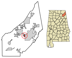
According to the U.S. Census Bureau, the town has a total area of 1.3 square miles (3.4 km2), all land. [5]

Demographics

Historical population
CensusPop.Note
1990 227
2000 2437.0%
2010 28216.0%
2020 263−6.7%
U.S. Decennial Census [6]
2013 Estimate [7]

As of the 2010 Census Pine Ridge had a population of 282. There were 104 households. The racial composition of the population was 76.2% non-Hispanic white, 1.8% black or African American, 0.4% Pacific Islander, 1.4% from two or more races and 20.9% Hispanic or Latino. [8]

As of the census [9] of 2000, there were 243 people, 100 households, and 70 families residing in the town. The population density was 192.2 inhabitants per square mile (74.2/km2). There were 112 housing units at an average density of 88.6 per square mile (34.2/km2). The racial makeup of the town was 96.30% White, and 3.70% from two or more races. 0.41% of the population were Hispanic or Latino of any race.

There were 100 households, out of which 33.0% had children under the age of 18 living with them, 58.0% were married couples living together, 7.0% had a female householder with no husband present, and 30.0% were non-families. 29.0% of all households were made up of individuals, and 12.0% had someone living alone who was 65 years of age or older. The average household size was 2.43 and the average family size was 3.01.

In the town, the population was spread out, with 24.3% under the age of 18, 11.1% from 18 to 24, 30.5% from 25 to 44, 22.2% from 45 to 64, and 11.9% who were 65 years of age or older. The median age was 37 years. For every 100 females, there were 89.8 males. For every 100 females age 18 and over, there were 89.7 males.

The median income for a household in the town was $28,250, and the median income for a family was $30,833. Males had a median income of $22,404 versus $13,250 for females. The per capita income for the town was $14,237. About 15.3% of families and 14.9% of the population were below the poverty line, including 16.4% of those under the age of eighteen and 20.0% of those 65 or over.

Related Research Articles

<span class="mw-page-title-main">Cherokee County, Alabama</span> County in Alabama, United States

Cherokee County, Alabama is a county located in the northeastern part of the U.S. state of Alabama. As of the 2020 census, the population was 24,971. Its county seat is Centre. The county is named for the Cherokee tribe.

<span class="mw-page-title-main">DeKalb County, Alabama</span> County in Alabama, United States

DeKalb County is a county located in the northeastern part of the U.S. state of Alabama. As of the 2020 census, the population was 71,608. Its county seat is Fort Payne, and it is named after Major General Baron Johan DeKalb. DeKalb County is part of the Huntsville-Decatur-Albertville, AL Combined Statistical Area.

<span class="mw-page-title-main">Marshall County, Alabama</span> County in Alabama, United States

Marshall County is a county of the state of Alabama, United States. As of the 2020 census the population was 97,612. Its county seat is Guntersville. A second courthouse is in Albertville. Its name is in honor of John Marshall, famous Chief Justice of the United States. Marshall County is a dry county, with the exception of the five cities of Albertville, Arab, Grant, Guntersville, and Boaz. Marshall County comprises the Albertville, AL Micropolitan Statistical Area, which is also included in the Huntsville-Decatur-Albertville, AL Combined Statistical Area.

<span class="mw-page-title-main">Midway, Alabama</span> Town in Alabama, United States

Midway is a town located in eastern Bullock County, Alabama, United States. At the 2020 census, the population was 421.

<span class="mw-page-title-main">Collinsville, Alabama</span> Town in Alabama, United States

Collinsville is a town in DeKalb and Cherokee counties in the U.S. state of Alabama. It was incorporated in 1887. As of the 2010 census, the population was 1,983.

<span class="mw-page-title-main">Crossville, Alabama</span> Town in Alabama, United States

Crossville is a town in DeKalb County, Alabama, United States. At the 2010 census the population was 1,862, up from 1,431 in 2000. Crossville is located atop Sand Mountain, a southern extension of the Cumberland Plateau.

<span class="mw-page-title-main">Fyffe, Alabama</span> Town in Alabama, United States

Fyffe is a town in DeKalb County, Alabama, United States. It was incorporated in 1956. At the 2020 census, the population was 967. Fyffe is located atop Sand Mountain.

<span class="mw-page-title-main">Geraldine, Alabama</span> Town in Alabama, United States

Geraldine is a town in DeKalb County, Alabama, United States. It was incorporated in February 1957. At the 2020 census, the population was 910.

<span class="mw-page-title-main">Hammondville, Alabama</span> Town in Alabama, United States

Hammondville is a town in DeKalb County, Alabama, United States. It was incorporated in 1937. As of the 2010 census, the population of the town is 488.

<span class="mw-page-title-main">Henagar, Alabama</span> City in Alabama, United States

Henagar is a city in DeKalb County, Alabama, United States. At the 2020 census, the population was 2,292.

<span class="mw-page-title-main">Ider, Alabama</span> Town in Alabama, United States

Ider is a town in DeKalb County, Alabama, United States. At the 2020 census, the population was 735. It incorporated in October 1973.

<span class="mw-page-title-main">Lakeview, Alabama</span> Town in Alabama, United States

Lakeview is a town in DeKalb County, Alabama, United States. At the 2020 census, the population was 161. Lakeview is located atop Sand Mountain.

<span class="mw-page-title-main">Mentone, Alabama</span> Town in Alabama, United States

Mentone is a town in DeKalb County, Alabama, United States. It is located atop Lookout Mountain.

<span class="mw-page-title-main">Powell, Alabama</span> Town in Alabama, United States

Powell is a town in DeKalb County, Alabama, United States. At the 2020 census, the population was 901. Powell is located atop Sand Mountain.

<span class="mw-page-title-main">Rainsville, Alabama</span> City in Alabama, United States

Rainsville is a city in DeKalb County, Alabama, United States. At the 2010 census the population was 4,948, up from 4,499 in 2000. Rainsville is located on top of Sand Mountain, a southern extension of the Cumberland Plateau.

<span class="mw-page-title-main">Shiloh, DeKalb County, Alabama</span> Town in Alabama, United States

Shiloh is a town in DeKalb County, Alabama, United States. It incorporated in 1962. At the 2020 census, the population was 321. Shiloh is located atop Sand Mountain.

<span class="mw-page-title-main">Sylvania, Alabama</span> Town in Alabama, United States

Sylvania is a town in DeKalb County, Alabama, United States. It incorporated in October 1967. At the 2010 census the population was 1,837, up from 1,186 in 2000. Sylvania is located atop Sand Mountain. Sylvania was incorporated in 1967. The post office /town hall was built in 1977.

<span class="mw-page-title-main">Valley Head, Alabama</span> Town in Alabama, United States

Valley Head is a town in DeKalb County, Alabama, United States. Although the town incorporated in 1921, it was also listed as being incorporated on the 1890 U.S. Census. At the 2020 census, the population was 577.

<span class="mw-page-title-main">Section, Alabama</span> Town in Alabama, United States

Section is a town in Jackson County, Alabama, United States and is included in the Chattanooga-Cleveland-Dalton, TN-GA-AL Combined Statistical Area. As of the 2010 census, the population of the town was 770, an increase of one person (769) from 2000. Section is located on top of Sand Mountain.

<span class="mw-page-title-main">Pine Hill, Alabama</span> Town in Alabama, United States

Pine Hill is a town in Wilcox County, Alabama, United States. It incorporated in 1895. Per the 2020 census, the population was 758.

References

  1. "2020 U.S. Gazetteer Files". United States Census Bureau. Retrieved October 29, 2021.
  2. 1 2 U.S. Geological Survey Geographic Names Information System: Pine Ridge, Alabama
  3. "Pine Ridge AL ZIP Code". zipdatamaps.com. 2023. Retrieved February 17, 2023.
  4. "US Gazetteer files: 2010, 2000, and 1990". United States Census Bureau. February 12, 2011. Retrieved April 23, 2011.
  5. "Geographic Identifiers: 2010 Demographic Profile Data (G001): Pine Ridge town, Alabama". U.S. Census Bureau, American Factfinder. Retrieved October 7, 2015.[ dead link ]
  6. "U.S. Decennial Census". Census.gov. Retrieved June 6, 2013.
  7. "Annual Estimates of the Resident Population: April 1, 2010 to July 1, 2013" . Retrieved June 3, 2014.
  8. 2010 general profile of population and housing characteristics for Pine Ridge, Alabama from the US Census
  9. "U.S. Census website". United States Census Bureau . Retrieved January 31, 2008.