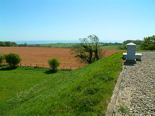
Folkestone to Etchinghill Escarpment is a 263.2-hectare (650-acre) biological and geological Site of Special Scientific Interest on the northern outskirts of Folkestone in Kent. It is a Special Area of Conservation. An area of 205 hectares is a Nature Conservation Review grassland site, Grade 2, and the 70-hectare (170-acre) Asholt Wood at its western end is a Grade 1 woodland site. The reserve has a Geological Conservation Review site.

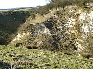
Mole Gap to Reigate Escarpment is a 1,016.4-hectare (2,512-acre) biological and geological Site of Special Scientific Interest west of Reigate in Surrey. It is a Geological Conservation Review site and a Special Area of Conservation. Part of it is a Nature Conservation Review site, Grade I. Two small private nature reserves in the site are managed by the Surrey Wildlife Trust, Dawcombe and Fraser Down.

Sheepleas is a 99.9-hectare (247-acre) biological and geological Site of Special Scientific Interest east of Guildford in Surrey. It is a Geological Conservation Review site and a Local Nature Reserve. It is owned by Surrey County Council and managed by the Surrey Wildlife Trust.

Allington Quarry is a 0.8-hectare (2.0-acre) geological Site of Special Scientific Interest north of Maidstone in Kent. It is a Geological Conservation Review site.

Rusthall Common is a 2.7-hectare (6.7-acre) geological Site of Special Scientific Interest in Rusthall, a suburb of Tunbridge Wells in Kent. It is a Geological Conservation Review site. It is owned by the Manor of Rusthall and managed by Tunbridge Wells Commons Conservators.

Little Heath Pit is a 0.3-hectare (0.74-acre) geological Site of Special Scientific Interest at Little Heath near Potten End in Hertfordshire. It is part of the Ashridge Estate, owned by the National Trust, and the local planning authority is Dacorum Borough Council. It is listed in the Geological Conservation Review.

Sturry Pit is a 0.7 hectares geological Site of Special Scientific Interest north-east of Canterbury in Kent. It is a Geological Conservation Review site.

Hart Hill is a 1.4-hectare (3.5-acre) geological Site of Special Scientific Interest north-west of Charing Kent. It is a Geological Conservation Review site.
Lenham Quarry is a 4-hectare (9.9-acre) geological Site of Special Scientific Interest east of Lenham in Kent. It is a Geological Conservation Review site.

Oaken Wood is a 18.7-hectare (46-acre) geological Site of Special Scientific Interest west of Maidstone in Kent. It is a Geological Conservation Review site.
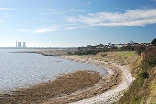
Sandwich Bay to Hacklinge Marshes is a 1,790.1-hectare (4,423-acre) biological and geological Site of Special Scientific Interest which stretches between Deal and Sandwich in Kent. It includes two Geological Conservation Review sites, and most of it is a Nature Conservation Review site, Grade I. Part of it is a Ramsar site, a Special Area of Conservation, a Special Protection Area and a National Nature Reserve, It also includes a Kent Wildlife Trust nature reserve and a Local Nature Reserve,

Spot Lane Quarry is a 0.1-hectare (0.25-acre) geological Site of Special Scientific Interest on the eastern outskirts of Maidstone in Kent. It is a Geological Conservation Review site.
Wateringbury SSSI is a 0.2-hectare (0.49-acre) geological Site of Special Scientific Interest in Wateringburym west of Maidstone in Kent. It is a Geological Conservation Review site.

Houlder and Monarch Hill Pits is a 0.7-hectare (1.7-acre) geological Site of Special Scientific Interest in Upper Halling in Kent. It is a Geological Conservation Review site.

Aylesford Pit is a 1.5-hectare (3.7-acre) geological Site of Special Scientific Interest north of Maidstone in Kent. It is a Geological Conservation Review site.

Wiggenhall St Germans SSSI is a 5.2-hectare (13-acre) geological Site of Special Scientific Interest south of King's Lynn in Norfolk. It is a Geological Conservation Review site.
Sugworth is a 0.6-hectare (1.5-acre) geological Site of Special Scientific Interest north of Abingdon-on-Thames in Oxfordshire. It is a Geological Conservation Review site.
