
Northern Areas Council is a local government area in the Yorke and Mid North region of South Australia. The council seat and main council offices are at Jamestown, while the council also maintains district offices at Gladstone and Spalding.

Curramulka is a town in the Australian state of South Australia on the Yorke Peninsula. Curramulka is within easy driving distance of the coastal resort towns of Port Victoria and Port Vincent and is 15 kilometres (9.3 mi) north-east of Minlaton. At the 2016 census, Curramulka had a population of 305.
Nangwarry is a town and a locality in the Australian state of South Australia located about 352 kilometres (219 mi) south-east of the state capital of Adelaide and about 32 kilometres (20 mi) north-west of the regional centre of Mount Gambier.
Glenburnie is an eastern suburb of Mount Gambier.

The District Council of Belalie was a local government area in South Australia. It was proclaimed on 11 November 1875, and initially comprised most of the cadastral Hundred of Belalie, including its central town of Jamestown. Jamestown itself had originally been planned to be named Belalie when surveyed; while the town had been renamed, the Belalie name was retained for the council. It was divided into five wards at its inception with one councillor each, the first councillors for each being appointed by proclamation. The South-East and South-West wards had been replaced by the Yarcowie and Yongala wards by 1893.

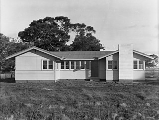
Belalie East is a rural locality in the Mid North region of South Australia. It is situated in the Northern Areas Council. The boundaries were formally established in April 2001 for the long established local name, relating to the cadastral Hundred of Belalie; however, the modern locality is divided between Belalie and the adjacent Hundred of Whyte.
Canowie is a sparsely populated farming and grazing locality in the Mid North region of South Australia in the Hundred of Anne, County of Victoria. It is mainly sited on a relatively featureless plain, with the north-south trending Browne Hill Range to the west.
Brownlow is a locality in the Australian state of South Australia about 98 kilometres north-east of the Adelaide city centre
Baroota is a locality in the Australian state of South Australia located on the east coast of Spencer Gulf about 230 kilometres north of the state capital of Adelaide and about 29 kilometres (18 mi) north-east of the city of Port Pirie.
The County of Bosanquet is a cadastral unit in the Australian state of South Australia that covers land both in the north of the Eyre Peninsula and to the peninsula's north. It was proclaimed on 23 October 1913 and was named after Sir Day Hort Bosanquet, the Governor of South Australia from 1909 to 1914.
Caroline is a locality in the Australian state of South Australia located about 389 kilometres (242 mi) south-east of the state capital of Adelaide and about 12 kilometres (7.5 mi) southeast of the municipal seat of Mount Gambier adjoining the border with the state of Victoria.
Mingbool is a locality in the Australian state of South Australia located about 372 kilometres (231 mi) south-east of the state capital of Adelaide adjoining the border with the state of Victoria and about 16 kilometres (9.9 mi) north-west of the municipal seat of Mount Gambier.
The County of Victoria is one of the 49 cadastral counties of South Australia. It was proclaimed by Governor Richard MacDonnell in 1857 and probably named for Queen Victoria. It covers an area of the Spencer Gulf coast and hinterland in the Mid North of the state from Port Pirie in the northwest to near Mount Bryan in the southeast, including most of the Broughton River watershed.
The Hundred of Caltowie is a cadastral unit of hundred in South Australia centred on the township of Caltowie. It is one of the 14 hundreds of the County of Victoria and was proclaimed by Governor James Fergusson in July 1871.

Saltia is a locality in the Australian state of South Australia located on the western side of the Flinders Ranges about 279 kilometres (173 mi) north of the state capital of Adelaide and about 19 kilometres (12 mi) east of the city of Port Augusta.
Fisher is a locality in the Australian state of South Australia located about 96 kilometres (60 mi) north-east of the state capital of Adelaide and about 47 kilometres (29 mi) north-east of the municipal seat in Mannum.

County of Herbert is a cadastral unit located in the Australian state of South Australia that covers land to the east of the Flinders Ranges about 55 kilometres (34 mi) north-east of the town of Peterborough. It was proclaimed in 1877 and named after a prominent man of the time with either a title or a surname containing the name ‘Herbert’. It has been partially divided in the following sub-units of hundreds – Cavenagh, Coglin, Minburra, Nackara, Paratoo and Waroonee.
Moockra is a locality in the Australian state of South Australia located on the eastern side of the Flinders Ranges about 274 kilometres (170 mi) north of the state capital of Adelaide and about 47 kilometres (29 mi) north-east and 36 kilometres (22 mi) south-east respectively of the municipal seats of Melrose and Quorn.
Brooker is a locality in the Australian state of South Australia located in the state’s west on Eyre Peninsula about 266 kilometres (165 mi) west of the state capital of Adelaide and about 38 kilometres (24 mi) north-west of the municipal seat in Tumby Bay.

County of Kimberley is a cadastral unit located in the Australian state of South Australia that covers land to the east of the Flinders Ranges about 45 kilometres (28 mi) east of the town of Peterborough. It was proclaimed in 1871 and named after John Wodehouse, 1st Earl of Kimberley, a British Secretary of State for the Colonies. It has been partially divided in the following sub-units of hundreds – Gumbowie, Hardy, Ketchowla, Parnaroo, Terowie and Wonna.

