
Northern Areas Council is a local government area in the Yorke and Mid North region of South Australia. The council seat and main council offices are at Jamestown, while the council also maintains district offices at Gladstone and Spalding.

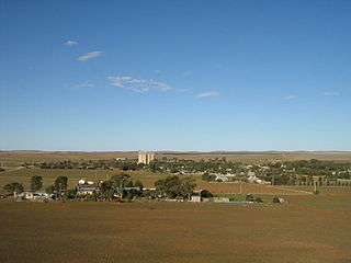
Jamestown is a town in the Mid North region of South Australia 207 kilometres (129 mi) north of Adelaide. It lies on the banks of the Belalie Creek and on the Crystal Brook-Broken Hill railway line between Gladstone and Peterborough, and ultimately on the main line linking Adelaide and Perth to Sydney. At the 2016 census, Jamestown had a population of 1,561, and is the thriving centre of a prosperous area. Jamestown is the council seat of its local municipality, Northern Areas Council. Jamestown is in the South Australian Legislative Assembly electoral district of Stuart and the federal Division of Grey.
Tarcowie is a town in South Australia. Tarcowie is an aboriginal word meaning "torrential waters". It was named by Governor Musgrave on 20 May 1875. At the 2011 census, Tarcowie had a population of 205, 10 fewer than the 2006 census. The dominant industry in Tarcowie is sheep farming, however in recent times wind farming may be taking over as the main industry for the town. The Tarcowie Landcare Group, an environmental organisation, is based in this town.
The Northern Areas Football Association is an Australian rules football competition based in the Mid North region of South Australia, Australia. It is an affiliated member of the South Australian National Football League.

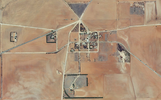
Yatina is a town and locality in the Australian state of South Australia located on the RM Williams Way about 222 kilometres (138 mi) north of the state capital of Adelaide and about 31 kilometres (19 mi) and 21 kilometres (13 mi) respectively from the municipal seats of Jamestown and Orroroo.
Caltowie is a town in the Mid North region of South Australia. It is on the Wilkins Highway and the Crystal Brook-Broken Hill railway line between Gladstone and Jamestown.
Appila is a locality in the Mid North of South Australia east of the lower Flinders Ranges. It occupies much of the eastern half of the Hundred of Appila and a strip on the western side of the adjacent Hundred of Tarcowie.
The District Council of Jamestown was a local government area in South Australia, centred on the region surrounding the town of Jamestown. The District Council came into existence on 21 March 1935 following the amalgamation of 95% of the District Council of Belalie with the District Council of Caltowie and the Hundred of Mannanarie, which had been in the abolished District Council of Yongala. For almost all of its history, it surrounded but did not include the town of Jamestown itself; the Jamestown township had separated from Belalie as the Corporate Town of Jamestown in 1878, and would not merge back into the broader municipality until 1991.
The District Council of Caltowie was a local government area in South Australia, centred on the town of Caltowie and surrounding cadastral Hundred of Caltowie. It came into operation on 28 February 1878, with the first five councillors appointed by proclamation. The town and hundred had both been laid out in 1872. The council initially met in local hotels, leased private offices for a period, and met at Hornsdale Station for a year, before constructing purpose-built council offices in Charles Street, Caltowie, in 1896.

The District Council of Belalie was a local government area in South Australia. It was proclaimed on 11 November 1875, and initially comprised most of the cadastral Hundred of Belalie, including its central town of Jamestown. Jamestown itself had originally been planned to be named Belalie when surveyed; while the town had been renamed, the Belalie name was retained for the council. It was divided into five wards at its inception with one councillor each, the first councillors for each being appointed by proclamation. The South-East and South-West wards had been replaced by the Yarcowie and Yongala wards by 1893.
The District Council of Laura was a local government area in South Australia. It was created on 1 May 1932 with the amalgamation of the Corporate Town of Laura and the District Council of Booyoolie. It reunited the whole cadastral Hundred of Booyoolie within the same district council, as had previously been the case when the Booyoolie council was first proclaimed in 1876. The Laura merger had occurred after a much broader 1931 merger proposal, which would have seen the Corporate Town of Laura, District Council of Gladstone, Corporate Town of Gladstone and District Council of Caltowie merge into a drastically enlarged District Council of Booyoolie, was abandoned after meeting strong opposition from both the Laura and Gladstone communities.
Mannanarie is a rural locality in the Mid North region of South Australia, situated in the Northern Areas Council. It was established in April 2001, when boundaries were formalised for the "long established local name". It comprises most of the cadastral Hundred of Mannanarie, apart from a northern section which lies in Tarcowie and Yatina. The name stems from an Aboriginal word, "manangari", meaning "good string or cord", stemming from a local native plant useful for string making.
The Hornsdale Wind Farm is an electricity generator in the locality of Hornsdale in the south-west of the Narien Range, north of Jamestown, South Australia. It consists of 99 wind turbines with a generation capacity of 315 megawatts (422,000 hp). The plant is owned and operated by Neoen, a French renewable energy company.
The County of Dalhousie is one of the 49 cadastral counties of South Australia in straddling the Mid North and Flinders Ranges regions. It was proclaimed in 1871 by Governor James Fergusson and was named for Fergusson's father-in-law James Broun-Ramsay, 1st Marquess of Dalhousie.
Hornsdale is a locality in the Mid North region of South Australia 226 kilometres (140 mi) north of Adelaide.
The Narien Range is a range of hills in South Australia's Mid North. The range stretches from a point north of Jamestown northwards to Orroroo.
The Hundred of Caltowie is a cadastral unit of hundred in South Australia centred on the township of Caltowie. It is one of the 14 hundreds of the County of Victoria and was proclaimed by Governor James Fergusson in July 1871.

The Hundred of Kulpara is a cadastral unit of hundred located on the northern Yorke Peninsula in South Australia and centred on the township of Kulpara. It is one of the 16 hundreds of the County of Daly and was proclaimed by Governor Dominick Daly on 12 June 1862.

The Hundred of Talunga is a cadastral hundred of the County of Adelaide, South Australia, spanning the Torrens Valley in the Adelaide Hills. It was proclaimed by Governor Frederick Robe in 1846 and named for an indigenous term thought to mean 'waterhole'.

The Hundred of Yackamoorundie is a cadastral unit of hundred in the County of Stanley, South Australia.

