Huntley, Montana

Last updated

Huntley, Montana
CDP
Yellowstone County Montana Incorporated and Unincorporated areas Huntley Highlighted.svg
Location of Huntley, Montana
Coordinates: 45°53′59″N108°18′16″W / 45.89972°N 108.30444°W / 45.89972; -108.30444
Country United States
State Montana
County Yellowstone
Area
[1]
  Total1.60 sq mi (4.15 km2)
  Land1.52 sq mi (3.94 km2)
  Water0.08 sq mi (0.21 km2)
Elevation
[2]
3,019 ft (920 m)
Population
 (2020)
  Total442
  Density290.79/sq mi (112.30/km2)
Time zone UTC-7 (Mountain (MST))
  Summer (DST) UTC-6 (MDT)
ZIP code
59037
Area code 406
FIPS code 30-38200
GNIS feature ID2408411 [2]

Huntley is a census-designated place (CDP) in Yellowstone County, Montana, United States. The population was 411 at the 2000 census. Huntley lent its name to the Huntley Project, a federal irrigation project that began delivering water to the arid district in 1907. Today, Huntley is an eastern suburb of Billings and is located east of Shepherd and west of Worden.

Contents

History

George N. Smith and family at the Yellowstone River, Huntley, Montana, 1881 GeorgeSmithHuntleyMontana-Haynes1881.jpg
George N. Smith and family at the Yellowstone River, Huntley, Montana, 1881

This settlement in arid Crow Indian country was named for S.O. Huntley, a partner in the stagecoach firm of Clark & Huntley. It was located at the head of navigation on the Yellowstone River. The first steamboat, the packet Josephine, arrived June 6, 1875, but river trade was infrequent. A U.S. post office was established in March 1878. The 1880 Census found only 37 people living in Huntley.

Surveying for a railroad led to the so-called "Baker Battle" between Sioux Indians and Army engineers in 1872. The Northern Pacific Railroad arrived in 1882, connecting the town to the new city of Billings. Three years later the town called "Huntley Station" had two stores, a hotel, and a blacksmith. German immigrants were prominent among the new settlers, who established Lutheran and German Methodist churches.

In 1905 the United States Bureau of Reclamation began an irrigation project, called the Huntley Project, on lands that had been part of the Crow Indian Reservation until 1904. The town of Huntley was incorporated into the project along with the new railroad towns of Ballantine, Worden, and Pompey's Pillar, all founded in 1907. [3]

During the Yellowstone Flood of 1937, the damage to Huntley was more extensive, percentage-wise, than in any other community in the region. Much of the original town of Huntley was destroyed and significant portions of the land it occupied was claimed or compromised by the Yellowstone River. The flood damage included washing away the suspension bridge that allowed adjacent Highway 312 to cross the river. After the flood, the site of the town was relocated from the north side of the river to the higher elevation on the south bank.
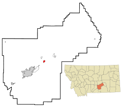
Geography

Huntley is located at 45°53′59″N108°18′16″W / 45.89972°N 108.30444°W / 45.89972; -108.30444 (45.899722, -108.304491). [4]

According to the United States Census Bureau, the CDP has a total area of 1.3 square miles (3.4 km2), all land.

Climate

According to the Köppen Climate Classification system, Huntley has a cold semi-arid climate, abbreviated "BSk" on climate maps.

Climate data for Huntley Experimental Station, Montana, 19912020 normals, extremes 1911present
MonthJanFebMarAprMayJunJulAugSepOctNovDecYear
Record high °F (°C)69
(21)
74
(23)
82
(28)
92
(33)
99
(37)
107
(42)
109
(43)
106
(41)
102
(39)
94
(34)
81
(27)
76
(24)
109
(43)
Mean maximum °F (°C)56.7
(13.7)
61.9
(16.6)
72.1
(22.3)
81.8
(27.7)
87.3
(30.7)
94.6
(34.8)
100.1
(37.8)
99.2
(37.3)
95.2
(35.1)
84.1
(28.9)
70.2
(21.2)
58.1
(14.5)
100.8
(38.2)
Mean daily maximum °F (°C)34.9
(1.6)
39.2
(4.0)
49.8
(9.9)
58.5
(14.7)
67.5
(19.7)
77.1
(25.1)
87.1
(30.6)
86.1
(30.1)
75.3
(24.1)
60.3
(15.7)
46.7
(8.2)
36.4
(2.4)
59.9
(15.5)
Daily mean °F (°C)23.4
(−4.8)
26.7
(−2.9)
35.9
(2.2)
45.2
(7.3)
54.5
(12.5)
63.3
(17.4)
71.0
(21.7)
69.3
(20.7)
59.2
(15.1)
45.7
(7.6)
33.9
(1.1)
24.6
(−4.1)
46.1
(7.8)
Mean daily minimum °F (°C)11.8
(−11.2)
14.3
(−9.8)
22.1
(−5.5)
31.9
(−0.1)
41.1
(5.1)
49.5
(9.7)
54.9
(12.7)
52.5
(11.4)
43.2
(6.2)
31.1
(−0.5)
21.0
(−6.1)
12.9
(−10.6)
32.2
(0.1)
Mean minimum °F (°C)−15.7
(−26.5)
−9.6
(−23.1)
−0.8
(−18.2)
17.8
(−7.9)
26.7
(−2.9)
36.5
(2.5)
44.7
(7.1)
41.5
(5.3)
29.6
(−1.3)
14.0
(−10.0)
−2.2
(−19.0)
−10.9
(−23.8)
−24.1
(−31.2)
Record low °F (°C)−52
(−47)
−53
(−47)
−37
(−38)
−7
(−22)
9
(−13)
27
(−3)
36
(2)
29
(−2)
16
(−9)
−15
(−26)
−33
(−36)
−47
(−44)
−53
(−47)
Average precipitation inches (mm)0.45
(11)
0.50
(13)
0.80
(20)
1.70
(43)
2.61
(66)
2.26
(57)
1.53
(39)
0.85
(22)
1.35
(34)
1.35
(34)
0.58
(15)
0.46
(12)
14.44
(366)
Average snowfall inches (cm)6.7
(17)
7.1
(18)
4.7
(12)
1.8
(4.6)
0.2
(0.51)
0.0
(0.0)
0.0
(0.0)
0.0
(0.0)
0.2
(0.51)
2.7
(6.9)
4.4
(11)
6.6
(17)
34.4
(87.52)
Average precipitation days (≥ 0.01 in)5.05.36.09.011.711.27.45.96.77.05.15.185.4
Average snowy days (≥ 0.1 in)4.55.03.41.30.20.00.00.00.11.22.84.422.9
Source 1: NOAA [5]
Source 2: National Weather Service [6]

Demographics

Historical population
CensusPop.Note
2020 442
U.S. Decennial Census [7]

As of the census [8] of 2000, there were 411 people, 160 households, and 108 families residing in the CDP. The population density was 319.2 inhabitants per square mile (123.2/km2). There were 164 housing units at an average density of 127.4 per square mile (49.2/km2). The racial makeup of the CDP was 97.32% White, 0.24% Native American, 0.24% Asian, 2.19% from other races. Hispanic or Latino of any race were 3.16% of the population.

There were 160 households, out of which 39.4% had children under the age of 18 living with them, 53.8% were married couples living together, 9.4% had a female householder with no husband present, and 31.9% were non-families. 26.9% of all households were made up of individuals, and 11.3% had someone living alone who was 65 years of age or older. The average household size was 2.57 and the average family size was 3.13.

In the CDP, the population was spread out, with 32.1% under the age of 18, 3.4% from 18 to 24, 29.4% from 25 to 44, 22.4% from 45 to 64, and 12.7% who were 65 years of age or older. The median age was 38 years. For every 100 females, there were 99.5 males. For every 100 females age 18 and over, there were 97.9 males.

The median income for a household in the CDP was $36,125, and the median income for a family was $36,750. Males had a median income of $31,250 versus $21,875 for females. The per capita income for the CDP was $13,913. About 12.9% of families and 11.5% of the population were below the poverty line, including 15.4% of those under age 18 and none of those age 65 or over.

Mural in Huntley Mural in Huntley, Montana.jpg
Mural in Huntley

Economy

Huntley's economy is based primarily on agriculture, including yam farming, sugar beets, corn, wheat, and barley.[ citation needed ]

Media

Huntley is part of the Billings media area.

The Yellowstone County News is a weekly newspaper based in Huntley. [9] It covers news for the wider Billings area.

Education

The school district is Huntley Project K-12 Schools, a K-12 unified school district. [10]

Notable people

Related Research Articles

<span class="mw-page-title-main">Yellowstone County, Montana</span> County in Montana, United States

Yellowstone County is the most populous county in the U.S. state of Montana. As of the 2020 census, the population was 164,731. Its county seat is Billings, the state's most populous city. Like the nearby park, Yellowstone County is named after the Yellowstone River which roughly bisects the county, flowing southwest to northeast. The river, in turn, was named for the yellow sandstone cliffs in what is now Yellowstone County.

<span class="mw-page-title-main">Crow Agency, Montana</span> Census designated place in Montana, United States

Crow Agency is a census-designated place (CDP) in Big Horn County, Montana, United States and is near the actual location for the Little Bighorn National Monument and re-enactment produced by the Real Bird family known as Battle of the Little Bighorn Reenactment. The population was 1,616 at the 2010 census. It is the governmental headquarters of the Crow Native Americans. It is also the location of the "agency offices" where the federal Superintendent of the Crow Indian Reservation and his staff interacts with the Crow Tribe, pursuant to federal treaties and statutes.

<span class="mw-page-title-main">Belfry, Montana</span> Census-designated place in Montana, United States

Belfry is a census-designated place (CDP) in Carbon County, Montana, United States. It is part of the Billings, Montana Metropolitan Statistical Area. The population was 218 at the 2010 census. It is located approximately 11 miles (18 km) from the Wyoming border, roughly halfway between Billings, Montana and Cody, Wyoming.

<span class="mw-page-title-main">Bridger, Montana</span> Town in Montana, United States

Bridger is a town in Carbon County, Montana, United States. It is part of the Billings, Montana Metropolitan Statistical Area. The population was 662 at the 2020 census.

<span class="mw-page-title-main">Fromberg, Montana</span> Town in Carbon County, Montana, United States

Fromberg is a town in Carbon County, Montana, United States. As of the 2020 census, the population of the town was 392.

<span class="mw-page-title-main">Simms, Montana</span> CDP in Montana, United States

Simms is a census-designated place (CDP) in Cascade County, Montana, United States. The population was 354 at the 2010 census. It is part of the Great Falls, Montana Metropolitan Statistical Area.

<span class="mw-page-title-main">Gardiner, Montana</span> Unincorporated community in Park County, Montana, United States

Gardiner is a census-designated place (CDP) in Park County, Montana, United States, along the 45th parallel. As of the 2020 census, the population of the community and nearby areas was 833.

<span class="mw-page-title-main">Sidney, Montana</span> City in Montana, United States

Sidney is a city in and the county seat of Richland County, Montana, United States, less than 10 mi (16 km) west of the North Dakota border. The population was 6,346 at the 2020 census. The city lies along the Yellowstone River and is in proximity to the badlands of the Dakotas. Sidney is approximately midway between Glendive, Montana and Williston, North Dakota.

<span class="mw-page-title-main">Birney, Montana</span> Census-designated place in Montana, United States

Birney is a census-designated place (CDP) in Rosebud County, Montana, United States. The population was 108 at the 2000 census.

<span class="mw-page-title-main">Park City, Montana</span> CDP in Montana, United States

Park City is a census-designated place (CDP) in Stillwater County, Montana, United States. The population was 870 at the 2000 census.

<span class="mw-page-title-main">Reed Point, Montana</span> CDP in Montana, United States

Reed Point is a census-designated place (CDP) in Stillwater County, Montana, United States. The population was 247 at the 2020 census.

<span class="mw-page-title-main">Ballantine, Montana</span> CDP in Montana, United States

Ballantine is a census-designated place (CDP) in Yellowstone County, Montana, United States. It lies approximately nine miles (14 km) northeast of Billings on Interstate 94. The population was 346 at the 2000 census. Ballantine, along with the communities of Pompey's Pillar, Worden, and Huntley, is part of the Huntley Project, an irrigation district created by the United States Bureau of Reclamation. The majority of Ballantine's population lives on scattered farms and ranches surrounding the actual townsite.

<span class="mw-page-title-main">Custer, Montana</span> Village in Montana, United States

Custer is a village in Yellowstone County, Montana, United States. The population was 145 at the 2000 census.

<span class="mw-page-title-main">Laurel, Montana</span> City in Montana, United States

Laurel is a city in Yellowstone County, Montana, United States. It is the third largest community in the Billings Metropolitan Statistical Area, and is located in the Yellowstone Valley, as an east–west terminal division point of the BNSF Railway. The population was 7,222 at the 2020 census.

<span class="mw-page-title-main">Lockwood, Montana</span> CDP in Montana, United States

Lockwood is a census-designated place (CDP) in Yellowstone County, Montana, United States. It is not an organized city or town. The population was 7,195 at the 2020 census.The population was 7,222 at the 2020 census. Lockwood is a suburb of Billings and is the second largest community in the Billings Metropolitan Statistical Area. Annexation of Lockwood to Billings has been studied; however, the June 2009 Billings City Council Annexation Plan states that the city has no plans to annex Lockwood in the foreseeable future. Lockwood is the site of a major Exxon refinery.

<span class="mw-page-title-main">Shepherd, Montana</span> CDP in Montana, United States

Shepherd is a census-designated place (CDP) in Yellowstone County, Montana, United States. The population was 193 at the 2000 census. Shepherd is a Billings suburb located to the northeast. The unincorporated town was named after R.E. Shepherd, a prominent early settler and owner of the Billings Land and Irrigation Company and the Merchants National Bank. The post office opened in 1915.

<span class="mw-page-title-main">Worden, Montana</span> CDP in Montana, United States

Worden is a census-designated place (CDP) in Yellowstone County, Montana, United States. The population was 582 at the 506 at the 2020 census. Worden, along with Ballantine, Huntley, and Pompey's Pillar, is part of the Huntley Project, an irrigation district established by the United States Bureau of Reclamation in 1907.

<span class="mw-page-title-main">Cardwell, Montana</span> Census-designated place in Montana, United States

Cardwell is a census-designated place (CDP) in Jefferson County, Montana, United States. The population was 62 at the 2020 census. It is part of the Helena Micropolitan Statistical Area.

<span class="mw-page-title-main">Billings Metropolitan Statistical Area</span>

The Billings Metropolitan Statistical Area is the largest metropolitan area in the U.S. state of Montana. Located in the south central portion of the state, its population is 184,167 as of 2020.

The Huntley Project is an irrigation project in southern Montana that was established by the United States Bureau of Reclamation in 1907. The district includes the towns of Huntley, Worden, Ballantine, and Pompeys Pillar.

References

  1. "ArcGIS REST Services Directory". United States Census Bureau. Retrieved September 5, 2022.
  2. 1 2 U.S. Geological Survey Geographic Names Information System: Huntley, Montana
  3. "Huntley". Montana Place Names Companion. Montana Historical Society. Retrieved April 5, 2021.
  4. "US Gazetteer files: 2010, 2000, and 1990". United States Census Bureau. February 12, 2011. Retrieved April 23, 2011.
  5. "U.S. Climate Normals Quick Access". National Oceanic and Atmospheric Administration. Retrieved August 5, 2022.
  6. "NOAA Online Weather Data". National Weather Service. Retrieved August 5, 2022.
  7. "Census of Population and Housing". Census.gov. Retrieved June 4, 2016.
  8. "U.S. Census website". United States Census Bureau . Retrieved January 31, 2008.
  9. "About". Yellowstone County News. Retrieved January 3, 2024.
  10. "2020 CENSUS - SCHOOL DISTRICT REFERENCE MAP: Yellowstone County, MT" (PDF). U.S. Census Bureau . Retrieved March 15, 2024. - Text list